The Creation and Adoption of Gunpowder

Image

The ancient Chinese accidently invented one of the most widely used weapons.  Alchemists in ancient China spend centuries trying to concoct an elixir of life with no success.  During the Tang Dynasty, an alchemist mixed 75 parts saltpetre with 14 parts charcoal and 11 parts sulfur, which exploded when it was exposed to an open flame.  

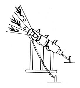
At first, China used gunpowder simply to scare or surprise their enemies.  When the Chinese realized the significance of what they had invented, they started to use gunpowder to kill instead.  The military forces of the Song Dynasty started using gunpowder devices against the Mongols as early as 904 A.D. The first of these devices was “flying fire”: an arrow with a burning tube of gunpowder attached to the shaft, primitive hand grenades, poisonous gas shells, flamethrowers and landmines.  By the 11th century, the Chinese were filling bombs with gunpowder and firing them from catapults. These fire cannons needed two people to carry them and were fired from moving platforms placed near the wall of the enemy city.


The Song government realized the extreme advantage they had in warfare and tried to keep gunpowder a secret from other countries.  In 1076, they even banned the sale of saltpeter to foreigners. Despite all their efforts, knowledge of this new substance was carried along the Silk Road to India, the Middle East, and Europe.  By 1280, recipes for gunpowder had been published in the west.

Gunpowder is just another example of how when a new technology is created, the rest of the world must either adapt or become obsolete.  This is extremely relevant when it comes to weapons and tools of warfare. If one civilization has better weapons, they will be able to conquer everyone else unless other civilizations learn the technology.  This is a constant cycle as civilizations create new technology while also trying to keep up with the new technology of others.

Additional Content:

http://www.monkeytree.org/silkroad/gunpowder/europe.html

Work Cited:

“Flying-cloud Thunderclap Eruptor.” depts.washington.edu/chinaciv/miltech/firearms.htm.

“Flying Fire.” ffden2.phys.uaf.edu/211.fall2000.web.projects/I.%20Brewster/History.html.

“Gun and Gunpowder.” Silk-Road, www.silk-road.com/artl/gun.shtml.

Ross, Cody. “Middle Age Technologies Gunpowder.” Four Rivers Charter, fourriverscharter.org/projects/Inventions/pages/china_gunpowder.htm.

Szczepanski, Kallie. “The Invention of Gunpowder: A History.” ThoughtCo, 23 Apr. 2018, www.thoughtco.com/invention-of-gunpowder-195160.

The Editors of Encyclopaedia Britannica. “Gunpowder Explosive.” Encyclopedia Britannica,www.britannica.com/technology/gunpowder.

Viking-Age Burials, Beads and Gender Views

Usually when asked to imagine what a Viking may have looked like, many people think of the strong male viking warrior, while the women in their society is confined to being servile and dutiful wives. This sentiment has continued throughout the years, even in a Time article in 2000, described them as meek house workers, reinforcing our view that theirs was a strictly male dominated society. (Lemonick et. al. 2000)  However, studies about Gender in Viking societies completed as early as almost a century ago has shown that gender roles were not as clearly defined as preceding archaeologists and historians may have thought (O’Sullivan, 2016). Specifically, by looking at the graves for Viking age Scandinavians, and the objects found in associated with them, archeologists are able to discover new perspectives and ways of thinking about gender for these people which can help us in understanding modern day culture as well.

It has been found that stereotypically “feminine” designated items such as beads or brooches, that have been considered simple adornments based on our modern concepts of jewelry, are actually very helpful in learning about the Viking culture and helping to do away with previous notions that there was a conclusive division of male and female in Scandinavian society, and how these concepts carry over to modern day Scandinavian society (O’Sullivan, 2016). One such way this is supported is by finding beads in association with burials displaying otherwise “male” attributes or bodies determined to be biologically male. Examples of these male designated graves that have the presence of beads include findings from Norway, Dublin, England, and Iceland. In the cemetery at Ire on the Baltic island of Gotland, ten individuals that were determined to be male were buried with glass beads, and also were buried in association with weaponry (Fig. 2). Some male graves are also found without weapons but still with beads in their graves, which indicates that the inclusion of beads would not confirm nor negate the determination of a grave being named male (O’Sullivan).

In many female determined grave sited, oval or tortoise brooches, and box brooches were found, usually on the chest of the body or below the chin, meaning that they were likely affixed to a dress or used to keep a cape closed. These brooches also reflect the rank and status of the woman, as well as tasks they may have carried out in their lives (Jesch, 1991). These brooches could designate their positioning within social classes. In the Viking social hierarchy, there was three classes; upper, middle, and lower, all of which, women were able to be a part of, as well as had considerable social mobility (Larson, 2012). In fact, the Oseberg ship burial, one of the most famous burials that many do not realize was for a woman (Fig. 1). The remains of two women, one a slave, and the other likelely a noblewoman or völva, a religious shaman of the norse religion. Inside the ship, tapestries, a four wheeled cart, wood works, spades, and a staff were found. In the same area was the Gokstad Ship burial which held the remains of a Viking chieftain, showing that it was possible for women to hold a position as high as a male or higher with in the Viking culture (Larson, 2012).

By looking at the archeological remains of the Vikings and others like it we see that many times there is evidence for less strict divisions of gender, that gender was likely only one small part of what defined their place in culture and that it is important to question previously unchallenged and undisputed assumptions about cultures, both past and present.


Fig 2. Beads typically found in male burials, these are specifically from those found in Cumwhitton Cemetery (https://cola.unh.edu/anthropology/women-traders-viking)


Further Reading:

http://www.academia.edu/23101978/Manifestations_of_identity_in_burial_Evidence_from_Viking-Age_graves_in_the_North_Atlantic_diaspora

https://www.ancient.eu/article/1251/women-in-the-viking-age/


References:

Jesch, Judith.

1991. Women in the Viking Age. Woodbridge, Suffolk: Boydell. https://www.jstor.org/stable/27710925?seq=1#metadata_info_tab_contents


Joanne O’Sullivan.

   2015. Strung Along: Re-evaluating Gendered Views of Viking-Age Beads, Medieval Archaeology,59:1, 73-86. https://www.tandfonline.com/doi/full/10.1080/00766097.2015.1119384


Larson, Caitlin.

2012. VIKING SOCIAL STRUCTURE AND GENDER ROLES IN SCANDINAVIA BASED ON BURIALS AND GRAVE GOODS. The Archaeological Studies Program Department of Sociology and Archaeology. https://core.ac.uk/download/pdf/10597635.pdf


Lemonick, Michael D., and Andrea Dorfman.

2000. “The Amazing Vikings.” Timehttp://content.time.com/time/magazine/article/0,9171,44020,00.html


Warfare in the Late Stone Age: Nataruk, Kenya

The origin point and reasoning for human warfare is widely debated. Yet, an answer would provide valuable information that could help humans cease or prevent wars. Warfare is said to be common after state societies emerged 5,000 years ago. This does not mean that there aren’t accounts outside of those descriptors, though. At one sight in Kenya, evidence of warfare was dated to 10,000 years ago. This site combats the generalization of warfare’s origin story.

(Figure 1. The Nataruk site during excavation, Photo from Wikipedia)

In 2012, at a site in Nataruk, west of Kenya’s lake Turkana, researchers discovered a large number of battered skeletons. The skeletons were widely spread out. The remains seem to be of a small hunter-gatherer band who lived approximately 9,500 to 10,500 years ago. The remains and surrounding sources were dated using radiocarbon dating, optically stimulated luminescence, and uranium series.

There were 27 skeletons at a minimum. All 27 of them were not buried. The remains comprised of six children and 21 adults. Trauma was found on the crania, cheekbones, hands, knees, ribs, and neck, to name a few (Handwerk 2016). There is also evidence of bound wrists on four skeletons. These locations of trauma are the most commonly targeted in violence cases. The weapons used to create all of these lesions were projectile points, a club-like weapon, and another weapon to be held at close proximity. This knowledge implies that the people had undergone violent deaths.

(Figure 2. Distribution of finds at Nataruk. Graphic by Esri, DigitalGlobe, GeoEye, i-cubed, USDA, USGS, AEX, Getmapping, Aerogrid, IGN, IGP, swisstopo, and the GIS User Community)

Usually conflict arises in sedentary societies. Since sedentary societies control land and resources, is believed that the “root causes for most warfare was control of resources… Including food, labor, and raw materials” (Sabloff 67). This, however, is not true at the site in Nataruk. The projectile points show inter-group conflict (Lahr 2016) and the rest of the weapons show that the hunter-gatherer group was victim to a premeditated attack. This shows that the group had valuable resources, even though it wasn’t a state society.

This begs the question, “what valuable resources did they have?” Evidence shows that West Turkana was a fertile landscape. The hunter-gatherer group found could have been raided for this fertile territory. They also could have raided for their women or children (Lahr 2016). There was some political complexity between the attackers and the attacked that led to this act of aggression. This exemplifies that raiding for resources is not only inherent in state societies, but foraging societies as well.

Since the Nataruk site shows us that warfare was evident in prehistory, we can conclude that warfare has existed for much longer than we assumed. Warfare seems to be a recurring phenomenon in human history and prehistory. If we study the past examples of warfare like the one at Nataruk, we may gain knowledge helpful in preventing or stopping war.


Further Reading:

http://www.pnas.org/content/112/36/11217 (Another study showing prehistoric warfare, in Central Europe)


http://science.sciencemag.org/content/341/6143/270 (Warfare in mobile hunter-gatherer bands and the implications on warfare origins)


Reference List:

Handwerk, Brian

2016, An Ancient, Brutal Massacre May Be the Earliest Evidence of War. Smithsonian.com. D.C., Washington. Accessed 10 November 2018.


Lahr, Mirazon M.

2016, Inter-group violence among early Holocene hunter-gatherers of West Turkana, Kenya. Nature, International Journal of Science. 529, pages 394–398. Accessed 10 November 2018.


Sabloff, Jeremy A.

2008 Archaeology Matters: Action Archaeology in the Modern World. Left Coast Press. Walnut Creek, California.


Images:

https://www.nature.com/articles/nature16477/figures/4

https://en.wikipedia.org/wiki/Nataruk#/media/File:2._Excavations_at_NATARUK.jpg

The Political Impact of ISIS’ Destruction of Antiques

While notorious for public beheadings, ISIS also attacks Syrian and Iraqi artifacts and ancient sites. ISIS follows a strict Salafi interpretation of Islam that prohibits worship of shrines, tombs, and idols, and this interpretation leads ISIS to destroy churches, mosques, and even artifacts and antiquities deemed idolatrous. In 2015, ISIS territories were situated next to several world heritage sites (Figure 1), many of which they destroyed. Irina Bokova, the head of the United Nations Education, Scientific and Cultural Organization, refers to the destruction of antiques as “cultural cleansing”, and says that destroying artifacts “adds to the systematic destruction of heritage and the persecution of minorities that seeks to wipe out the cultural diversity that is the soul of the Iraqi people” (Hartmann 2015).

ISIS employs the brutal war tactic of publically destroying the culture of those who disagree with their ideals, including posting a photo showcasing the destruction of a religious site (Figure 2). ISIS is attempting to erase history. They are symbolically trying to disconnect their enemies from the past and the land, and they are trying to pave the way for a future in which the only history of Syria and Iraq is the history of ISIS.

ISIS’ attacks are demoralizing, horrific, and profitable. Selling and looting antiquities is ISIS’ second highest source of funding after oil, making the destruction of culture both a profitable escapade and a form of cultural warfare. In light of this news, in 2014 the U.S. sought to implement a bipartisan cultural protection czar to reduce the amount of smuggled antiques into the U.S. in order to curtail ISIS funding (Muñoz-Alonso 2014). Both the U.S. and Germany have started imposing laws that would catch smuggled artifacts at their respective borders.

In recent years, ISIS has lost 96% of its territories (Bendaoudi 2018). Still, the sites and antiques ISIS destroyed can never be truly rebuilt, which is why the impact of cultural warfare is so tragic. If the past is forgotten, those in the future can never look back to where they came from, and the connection to the land, the culture, and the people of the past could be lost. Governments and the UN must defend antiques and world historical sites from terror, and their importance must never be forgotten. For this reason, archaeology and the study of the past remain relevant and important subjects today.

Figure 1. ISIS territories in proximity to world heritage sites. Graphic by New York Times. United Nations Educational, Scientific and Cultural Organization (Nimrud is on the Tentative World Heritage List); Institute for the Study of War (control areas); Satellite image by Landsat via Google Earth

Figure 2. A photo by ISIS showcasing the destruction of a religious site. Photo by Hyperallergic

Works Cited:


Muñoz-Alonso, Lorena

2014  Could US Cultural Protection Czar Stop Rampant ISIS Looting? Electronic document, https://news.artnet.com/art-world/could-us-cultural-protection-czar-stop-rampant-isis-looting-173972, accessed November 9, 2018.


Hartmann, Margaret

2015  ISIS is Destroying Ancient Art in Iraq and Syria. Electronic document, http://nymag.com/intelligencer/2015/03/isis-destroys-ancient-art.html, accessed November 9, 2018.


Bendaoudi , Abdelillah

2018    After the “almost 100 percent” Defeat of ISIS, What about its Ideology? Electronic document, http://studies.aljazeera.net/en/reports/2018/05/100-percent-defeat-isis-ideology-180508042421376.html, accessed November 9, 2018.


Additional Content:

“How Antiques Have Been Weaponized in the Struggle to Preserve Culture”

How Antiquities Have Been Weaponized in the Struggle to Preserve Culture

“The Race to Save Syria’s Archaeological Treasures”

https://www.smithsonianmag.com/history/race-save-syrias-archaeological-treasures-180958097/

The Effects of Volcanic Activity on Societies in the Jama River Valley

Volcanoes can be destructive, but they can also lead to beneficial changes in societies. The Jama-Coaque I peoples lived to the west of the Ecuadorian Andes, which includes more than 30 active volcanoes. After the eruption of Pichincha (Figure 1), one of these volcanoes, the Jama-Coaque I peoples left the Jama River Valley (Coutros 2018). However, the destructive volcanoes did not keep people away from the Jama River Valley forever. The Jama-Coaque II peoples, descendents of Jama-Coaque I, resettled the valley hundreds of years later (Coutros 2018). This cycle of settlement and abandonment of the Jama River Valley began long before the Jama-Coaque I peoples left the valley. Around 1880 B.C., Pichincha erupted and the Valdivian peoples were forced to abandon their thriving farms, and around 467 B.C., the eruption of Pululahua, another volcano in the region, led to the Chorrera peoples leaving the Jama River Valley (Coutros 2018).

Figure 1. Ecuador’s Pichincha volcano.

The volcanic activity of the Ecuadorian Andes led to changes in the Jama-Coaque II peoples who returned to the valley. Previous inhabitants of the Jama River Valley, like the Valdivia and Chorrera cultures, relied on floodplain agriculture, which involves growing crops on river banks. When the river system was clogged by volcanic ash, their crops died. By diversifying their nutrient sources and agricultural techniques, the Jama-Coaque II peoples did not have to rely on floodplain agriculture to survive (Coutros 2018). This illustrates the importance of a society’s ability and willingness to change in order to adapt to a changing environment (O’Donnell 2017). The changes made by the Jama-Coaque II peoples led to their success in surviving in the Jama River Valley (Figure 2).

Figure 2. A map of the Jama River Valley and the Ecuadorian Andes.

Communal storage pits, which were used to store food for more than one household, and increased warfare and raiding suggest the rise of a centralized authority in the Jama-Coaque II communities (Coutros 2018). Communal storage and increased warfare allows the Jama-Coaque II peoples to maintain and protect food reserves. While volcanic activity may have pushed communities out of the Jama River Valley for hundreds of years, it also led to the Jama-Coaque II peoples developing practices that allowed them to thrive in the valley.

Volcanic activity has importance in archaeology beyond studying how it affects various cultures. A dating method used in archaeology involves studying layers of volcanic ash deposits. Tephrochronology is the study of volcanic ash, or tephra, deposits (U.S. Geological Survey 2016). Tephrochronology is a helpful tool in areas like Iceland, where tephrochronology was utilized in a study of human impact on the environment (McGovern et al. 2007). In these situations, the layers of ash deposited by volcano eruptions can help archaeologists date artifacts.

Additional Content

This page explains how the Jama-Coaque culture is known for its ceramic creations and describes a Jama-Coaque sculpture: https://www.metmuseum.org/art/collection/search/314183

An article about how early humans may have survived the eruption of a volcano named Toba: https://www.sciencemag.org/news/2018/03/how-ancient-humans-survived-global-volcanic-winter-massive-eruption

References Cited

Coutros, Peter

2018 How Volcanoes Destroy and Nurture Societies. Electronic document, https://www.sapiens.org/column/off-the-map/volcanic-archaeology-pichincha-volcano/, accessed November 8, 2018.


McGovern, Thomas H., Orri Vésteinsson, Adolf Fridriksson, Mike Church, Ian Lawson, Ian A. Simpson, Arni Einarsson, Andy Dugmore, Gordon Cook, Sophia Perdikaris, Kevin J. Edwards, Amanda M. Thomson, W. Paul Adderley, Anthony Newton, Gavin Lucas, Ragnar Edvardsson, Oscar Aldred, and Elaine Dunbar

2007 Landscapes of Settlement in Northern Iceland: Historical Ecology of Human Impact and Climate Fluctuation on the Millennial Scale. American Anthropologist 109(1):27-51. DOI: 10.1525/AA.2007.109.1.27, accessed November 9, 2018.


O’Donnell, Jim

2017 How Vulnerable Are We to Collapse? Electronic document, https://www.sapiens.org/archaeology/hohokam-mimbres-collapse/?utm_content=buffer75cc7&utm_medium=social&utm_source=twitter.com&utm_campaign=buffer, accessed November 9, 2018.


U.S. Geological Survey

2016 USGS Tephrochronology (Tephra) Project. Electronic document, https://geomaps.wr.usgs.gov/tephra/index.htm, accessed November 9, 2018.


Image Sources

Coutros, Peter

2018 How Volcanoes Destroy and Nurture Societies. Electronic document, https://www.sapiens.org/column/off-the-map/volcanic-archaeology-pichincha-volcano/, accessed November 9, 2018.

Archaeology and the Ethical Dilemma

When most people think of an archaeological monument, the Great Pyramid of Giza, Stonehenge, and Machu Picchu are usually the most popular to come to mind. However, a new name should be added to the list. In Kenya’s Lake Turkana, archaeologists have recently been examining several pillar sites, including the Lothagam North Pillar Site. At the Lothagam site, the archaeological team have learned that the platform and pit below the pillared site had been built by a community for the use of a communal grave site. In excavating the grave site, the team found an estimated 580 people, spanning across multiple ages and generations. The site has awed the field of archaeology for it seems that community that built the monument constructed it as a means of uniting the people and an example of an egalitarian society, whereas in the past, it has been suggested that the construction of monuments was a way by upper class rulers to emphasize the hierarchy. (Daley) Yet, perhaps more importantly, it raises the question about the relevance of ethics in archaeology, specifically with the uncovering of human remains.

This ethical predicament stems from whether it is acceptable to exhume the dead from their burials when excavating a site and the implications surrounding the cultural context. In the past, archaeologists would commonly disrespect sites of human remains when searching for artifacts, and along the way, collected the skeletons and put them in museums. Because they were no sources of power actively trying to protect their history, many of these skeletons were taken from Native American burials during plundering, and the removal of a body from their places of burial ignorantly disregards the importance of the final resting place in many Native American  communities. (Alex) Now, more archaeologists are aware of the gravity of their actions, but the issue still arises for many teams whether it is ok to disturb if it is for the benefit of an scientific discovery. The American Anthropological Association has sought to mediate this problem by emphasizing “People and groups have a generic right to realize their capacity for culture, and to produce, reproduce and change the conditions and forms of their physical, personal and social existence, so long as such activities do not diminish the same capacities of others.” This response to the ethical dilemma puts clear stress on how while they do encourage the research into learning cultural past, they condemn it begins to affects the values and wishes of other cultures.


In some ways, we have taken this declaration to heart. The establishment of the Native American Graves Protection and Repatriation Act in 1990 requires the permission of the local community in order for scientists to excavated remains on federal or tribal land. This is a big step in the right direction for achieving the respect Native Americans have been demanding regarding the treatment of their burials, but unfortunately, the law is not regularly enforced and many remains are still taken to museums or reburied.


So, how do we begin to further approach an ethical and safe solution for archaeologists? First, by adhering to the demands of Native American groups and other misrepresented cultures around the world when addressing their burial grounds. This also includes respecting their wishes in all research, including online, by not posting images of human bones in case it does belong to one of their people. (Class) Next, we encourage scientific development in excavation tools that will allow archaeologists to investigates, but disturb as little as possible.


In the Lothagam site, archaeologists have already found through the study of some the remains that the drying of Lake Turkana forced diverse groups of people to unite and work together. (Alex) This is important for outlining more of the area’s history, but again, it can only truly be successful should it be done responsibly and ethically. Thankfully, that is the case.


Further Readings:

Killgrove, Kristina.

2018 International Experts Refute ‘Alien’ Mummy Analysis, Question Ethics and Legality. Forbes, July 18, 2018. https://www.forbes.com/sites/kristinakillgrove/2018/07/18/international-experts-refute-alien-mummy-analysis-question-ethics-and-legality/#32327dc93722

Strauss, Mark.

2016 When Is It Okay To Dig Up The Dead? National Geographic, April 7, 2016. https://news.nationalgeographic.com/2016/04/160407-archaeology-religion-repatriation-bones-skeletons/


Reference List:

Daley, Jason.

2018 Their World Was Crumbling But These Ancient People Built a Lasting Memorial
Read. Smithsonian Magazine, August 22, 2018. https://www.smithsonianmag.com/science-nature/when-their-world-was-chaos-these-ancient-people-coped-building-monument-180970087/, accessed November 4, 2018.

Alex, Bridget

2018 When Is It Ok For Archaeologists To Dig Up the Dead? Discover Magazine Blog, September 7, 2018. http://blogs.discovermagazine.com/crux/2018/09/07/when-is-it-ok-for-archaeologists-to-dig-up-the-dead/#.W9-pXS2ZP-Y, accessed November 4, 2018.

Image Sources:

Daley, Jason.

2018 Their World Was Crumbling But These Ancient People Built a Lasting Memorial
Read. Smithsonian Magazine, August 22, 2018. https://www.smithsonianmag.com/science-nature/when-their-world-was-chaos-these-ancient-people-coped-building-monument-180970087/, accessed November 4, 2018.

How We Can Learn from the Fall of the Mayan Civilization


The fall of the Mayan civilization has puzzled scholars for years. At the Mayan’s peak, the civilization was made up by more than 19 million people. However, during the 8thor 9thcentury the Mayan civilization suddenly collapsed. In his book “Collapse,” Jared Diamond puts forth a theory about the sudden demise of the Mayan civilization. Diamond believes that a prolonged drought which was intensified by rapid deforestation led to the collapse of the once great Mayan civilization (Stromberg).Studying the collapse of the Mayan civilization can be beneficial for a multitude of reasons. We can determine the ways in which the Mayans exacerbated deforestation along with the effects which it had. In the book, “American Anthropologist,” Fisher and Feinman link past human activity to a range of environmental changes. Analysis of past human activity and its effects on the environmental are critical to evaluating contemporary environmental debates and policies. As seen in Figure 1, the decline of the Mayan population was closely tied to rapid deforestation coupled with the soil erosion. The Mayans burned and chopped down their forests in order to clear land for agriculture and also to acquire wood for the elaborate construction of their cities (Stromberg). Deforestation in Central American still remains extremely problematic today. In Honduras, it is estimated that up to 85% of timber which is cut down is done so illegally (Charlotte). Deforestation is a great threat to biodiversity, leading birds, animals and plants to lose their natural habitats. The world’s forests are one big carbon sink, storing and locking away carbon dioxide avoiding its immediate release into the atmosphere. When a tree dies all of the carbon that has been stored away is released back into the atmosphere. If the tree is cut down prematurely, the process is accelerated. Currently global loss of forests is contributing 12-15% of total greenhouse gas emissions (Charlotte). This information about the fall of the Mayan civilization becomes increasingly alarming when we look into what is currently going on in Brazil. Recently, a new President was elected in Brazil, Jair Bolsonar. Bolsonar’s environmental policies can be perceived as being a threat to human existence all together. As seen in Figure 2, deforestation of the Brazilian Amazon has been on a general downtrend. However, this may soon change. Bolsonar’s policies favor business over biodiversity and calls for pro-market ways of exploiting Brazil’s natural resources. Bolsonar also has promised to weaken the enforcement of environmental laws. It is extremely important to learn from the failures of past human societies and civilizations. It is thought that we have 12 years to prevent the dangerous destabilization of the Earth’s climate (The Guardian).  We have seen how deforestation led to the demise of the once great Mayan civilization. Hopefully we will use the information we have learned from the past to solve the deforestation problems which are still extremely prevalent today.


Additional Readings:

www.cropcycle.org/2011/07/25/deforestation-in-central-america/.

https://www.theguardian.com/commentisfree/2018/oct/31/the-guardian-view-on-brazils-new-president-a-global-danger

Figure 1. Population density, Deforestation and Soil Erosion for the Mayan Civilization

Source: https://ourworldindata.org/forests

Figure 2: Deforestation in Brazil

Source: https://rainforests.mongabay.com/amazon/deforestation_calculations.htm

Works Cited   

Charlotte. “Deforestation in Central America.” Crop Cycle,   www.cropcycle.org/2011/07/25/deforestation-in-central-america/.

Fisher, Christopher T, and Gary M Feinman. American Anthropologist .

Stromberg, Joseph. “Why Did the Mayan Civilization Collapse? A New Study Points to .   Deforestation and Climate Change.” Smithsonian.com, Smithsonian Institution, 23 Aug.        2012,www.smithsonianmag.com/science-nature/why-did-the-mayan-civilization-    collapse-a-new-study-points-to-deforestation-and-climate-change-30863026/?no-ist.

“The Guardian View on Brazil’s New President: a Global Danger | Editorial.” The Guardian,          Guardian News and Media, 31 Oct. 2018, .            www.theguardian.com/commentisfree/2018/oct/31/the-guardian-view-on-brazils-new-        president-a-global-danger.

What Soil Conveys About Maya Culture and How It Informs the Present World

Soil used to be cast aside: important only for the provenience of artifacts that were found. With modern technology; however, the matrix itself can provide valuable archaeological evidence. In the case of Tikal, an ancient Maya city in northern Guatemala, chemical analysis of soil has provided conclusive evidence of Maya agriculture (American Society of Agronomy 2012). Corn uses a different photosynthetic pathway than most of the vegetation native to Tikal and produces a higher ration of carbon-13 to carbon-12 in the soil (Eberl 2016). Richard Terry, a soil scientist at Brigham Young University, conducted research on 185 soil cores taken from around Tikal (Figure 1) which have been used to map where the Maya did and did not plant maize (Hollingshead 2013). With the model his team created of long-term corn production in Tikal, it is possible to determine the number of people the city could support (Hollingshead 2013). With this technique, it is then possible to look at modern soil and determine the population limit our agriculture can support before environmental collapse.

Figure 1. Soil scientists from Brigham Young University taking soil samples near Tikal, Gautemala (Gannon 2013).

Soil also provides direct evidence to overexploitation of resources, a problem that persists to this day. The Maya achieved widespread maize production but with this came invisible degenerative soil processes like erosion and fertility depletion (Olson 1981). Soil analysis in Tikal indicated that corn-production occurred mostly in low-lying wetlands called bajos, but erosion was discovered in upslope soils which suggested that farming had spread to hills (American Society of Agronomy 2012). It is likely that the spread of farming was due to increased demand because of population growth, but the larger production drastically affected soil viability and inevitably would have undercut the food source (American Society of Agronomy 2012). Again in Tikal, soil use was mapped based on the color: soil used for agricultural production was lighter than the mineral-rich soil which had been left undisturbed (Olson 1981) (Figure 2). The fact that the soil in Tikal has retained the nutrient character the Maya left it with for thousands of years is a sobering thought. Not only does overexploitation lead to decreased production in the relatively short-term but also affects the ability of future civilizations to survive in the far long-term. We not only need to consider the effects of our agriculture on how much food we can create for the present population, but also whether our supposed sustainability means future civilizations will be unable to survive. In order to maintain an ability for agricultural production the current rate of farming needs to decrease or needs to increase in variation (through consultation with experts on the nutrient use of each specific plant) so as to reduce mineral depletion.

Figure 2. An example of soil color being recorded with a Munsell Color Chart— to be recorded the soils must all be in the same conditions such as sunlight or shade and wet or dry (Maya Research Program).

Reference List:

American Society of Agronomy

  2012  Researchers Unlock Ancient Maya Secrets with Modern Soil Science. Electronic document, https://www.sciencedaily.com/releases/2012/11/121112090732.htm, accessed November 2, 2018.

Eberl, Markus.

  2016  Ancient Maya Agriculture at Tamarindito, Guatemala. Electronic document,  https://my.vanderbilt.edu/universityfundingprograms/2016/11/ancient-maya-agriculture-at-tamarindito-guatemala/, accessed November 2, 2018.

Gannon, Megan.

  2013  How Many Mayans Were There. Electronic document,  https://www.livescience.com/37773-ancient-maya-farms-population.html, accessed November 2, 2018.

Hollingshead, Todd.

  2013  Newly Revealed Maya Farming Hotspots Hold Key to Ancient Culture. Electronic document,  https://news.byu.edu/news/newly-revealed-maya-farming-hotspots-hold-key-ancient-culture, accessed November 2, 2018.

Maya Research Program

  2016  Soil Excavations with the Maya Research Program. Electronic document, https://munsell.com/color-blog/soil-excavation-maya-research-program/, accessed November 2, 2018.

Olson, Gerald W.

  1981  Archaeology: Lessons On Future Soil Use. Electronic document,  http://www.ciesin.columbia.edu/docs/002-225/002-225.html, accessed November 2, 2018.


Additional Content for Interested Readers:

Ballantyne, Marissa.

  2007  BYU Research Team’s Special Methods Find Ancient Maya Marketplace. Electronic document,  https://news.byu.edu/news/byu-research-teams-special-methods-find-ancient-maya-marketplace, accessed November 2, 2018.

Burnett, Richard L., Richard E. Terry, Ryan V. Sweetwood, David Webster, Tim Murtha, and Jay Silverstein

  2012  Upland and Lowland Soil Resources of the Ancient Maya at Tikal, Guatemala. Electronic document,  https://dl.sciencesocieties.org/publications/sssaj/abstracts/76/6/2083, accessed November 2, 2018.

Muhs, Daniel R., Robert R. Kautz, and J. Jefferson MacKinnon

  1985  Soils and the Location of Cacao Orchards at a Maya site in Western Belize. Electronic document,  https://www.sciencedirect.com/science/article/pii/0305440385900573, accessed November 2, 2018.

Parallels in History, the Bronze Age to the Rust Belt

Cities are simply destined to fail. They face the same problems over and over again throughout history. Yet today, many rarely tend to think or believe that our system of cities is at any risk of collapse. However, studying history can give rare insights into both what has already happened in the past and what will inevitably happen in the future.

The Bronze Age Collapse of the 12th century BC can be compared to the decline of the Rust Belt today. The Rust Belt of the United States’s Midwest and Great Lakes regions faces severe depopulation, deindustrialization, and de-urbanization. As the industrial heartland saw its manufacturing jobs moved overseas, steel and coal industries declined, and automation increased, the region has spiraled into severe decline.

The Bronze Age Collapse was a regional breakdown of societal order and depopulation of the Aegean, Anatolia, the Levant, Mesopotamia, and Egypt. Many theories and arguments have been put forth for the cause of the Bronze Age Collapse. From natural disasters such as volcanoes and earthquakes to droughts to invading armies, there is not a definite reason for the collapse. Regardless, the Bronze Age featured several parallels to our modern world.

The map above shows the multiple invasions that rocked the Eastern Mediterranean during the late Bronze Age. However, despite the immense destruction of the cities, note the cities that were able to survive the collapse.

The civilizations of the Mycenaean, Hittites, and Egyptians featured interdependent trade among each other. For example, the Uluburun shipwreck of the late 14th century BC showed the transport of goods as it circled the eastern Mediterranean, especially copper and tin ingots, precursors to bronze. Likewise, today’s world is reliant on a system of global trade. In addition, each civilization depended too heavily on bronze for their armies and warrior aristocracy, and as a means to trade for other goods. The very same bronze, as important as crude oil today, whose need of tin, required imports from as far as modern-day Great Britain. This compares to the Rust Belt whose overreliance on manufacturing and its industry to power its economy. The importance of bronze and industry respectively in their systems meant that even a minor disruption can have enormous impacts.

A side-view replica of the Uluburun shipwreck details the exhaustive collection of goods held by the ship as its voyage circled the Eastern Mediterranean.

However, both histories show that collapse is not inescapable. Several Rust Belt cities have found success by shifting away from manufacturing and diversifying their economies with service industries, higher education, and more specialized industries. Similarly, not all cities met their end during the end of the Bronze Age. Several cities adapted to the changing times either by giving up their overreliance on bronze or simply moving away from the torrent of disasters, droughts, and invaders.

The inability of the systems to adapt to new problems is what led to the collapse of the Bronze Age. And likewise, should the Rust Belt cities continue to believe that manufacturing can make a comeback, they will repeat history. The lessons of the Bronze Age Collapse teach us that although we can handle better our problems, we cannot afford to be reliant on a single form of living or to be afraid to adapt.

Works Cited:

Austin, John C. 2017  A tale of two Rust Belts. The Avenue (blog), December 5, 2017.  http://www.brookings.edu/blog/the-avenue/2017/12/05/a-tale-of-two-rust-belts, accessed November 4, 2018.

Porter, Eduardo 2018  Lessons from Rust-Belt Cities That Kept Their Sheen. New York Times 1 May. New York.

The Human Journey. Ideas that Shaped our Modern World: Connecting with the Gods, The Bronze Age Collapse. http://www.humanjourney.us/ accessed November 4, 2018.  

Image Sources:

Historical Atlas of the Mediterranean. The Bronze Age Collapse (1250-1150 BC) http://explorethemed.com/ accessed November 4, 2018.

The Human Journey. Ideas that Shaped our Modern World: Connecting with the Gods, The Bronze Age Collapse. http://www.humanjourney.us/ accessed November 4, 2018.

Further Reading:

Cline, Eric H 2014  1177 B.C.: The Year Civilization Collapsed. Princeton University Press, Princeton.

Millsap, Adam 2017 The Rust Belt Didn’t Adapt And It Paid The Price. Forbes 19 Jan. Jersey City.

LIDAR Survey Reveals New Information About the Maya Lowlands

For years, archaeologists have been using LIDAR to study ancient Maya sites. Recently, an analysis was released of a 2016 survey of the Maya lowlands. The survey, the largest ever done in the region, covered 2,144 square kilometers of land and uncovered a total of 61,480 ancient man-made structures (Canuto et. al 2018). Although the population density was clearly not homogenous – some areas were very rural while others were were far more urban – the researchers estimate an average population density of about 120 people per square kilometer, or about 7 to 11 million people total (Canuto et. al 2018).  According to Dr. Thomas Garrison, one of the archaeologists involved with analyzing the data, this discovery is revolutionary because it places population estimates in this region at several times more than was previously thought and reveals new information about the politics, economics, and agricultural practices of the area (St. Fleur 2018).

A map of the surveyed regions.

As one might expect, a significant amount of farmland was needed to produce food for such a large population, and this could be found right there in the lowlands (Canuto et. al 2018). According to archaeologist Francisco Estrada-Belli, “All of these hundreds of square kilometers of what we thought were unusable swamp were actually some of the most productive farmland” (St. Fleur 2018). The urban areas would have relied on the rural ones for importing food, since the LIDAR scans show that there was not enough farmland immediately surrounding most of them to support their populations. In fact, the many kilometers of roadways imply a high level of interconnectedness between much of the surveyed area, while the infrastructure layout and connectivity more generally reveals that there was likely large-scale planning done by a centralized power (Canuto et. al 2018).

Some of the LIDAR rendering, showing several houses and other structures.

This LIDAR survey reveals important information about the farming practices of the Maya as well as about the extensive infrastructure and organization of their societies. The intensive farming itself is not an isolated thing, since it is known that Mayan agricultural practices and urban expansion had significant impacts on the land (Stromberg 2012). But what is surprising is the location and extent of the land modification. This study will help archaeologists and historians better understand the Maya lowlands, and develop a better image of what their societies look like, and possibly even why they fell. Since our modern societies are facing increasing environmental crises (also partially from unsustainable farming practices) it is more important than ever to learn from the past to change the future.


Works Cited:

Canuto, Marcello et al.

 2018  Ancient Maya Lowland Complexity as Revealed by Airborne Laser Scanning of Northern Guatemala. Science Magazine, accessed 1 November 2018.

St. Fleur, Nicholas.

 2018  Hidden Kingdoms of the Ancient Maya Revealed in a 3D Laser Map. The New York Times, accessed 1 November 2018.

Stromberg, Joseph.

 2012  Why did the Mayan Civilization Collapse? A New Study Points to Deforestation and Climate Change. Smithsonian Magazine, accessed 3 November 2018.

Image Sources:

Estrada-Belli, Francisco.

 2018  The New York Times, September 27, 2018, https://static01.nyt.com/images/2018/10/02/science/28TB-MAYA/28TB-MAYA-jumbo-v2.jpg?quality=90&auto=webp , accessed 3 November 2018.

Canuto, Marcello et. al

 2018  Science Magazine, September 2018, http://science.sciencemag.org/content/sci/361/6409/eaau0137/F4.large.jpg , accessed 3 November 2018.

Further Reading:

“Drought and the Ancient Maya Civilization.” https://www.ncdc.noaa.gov/abrupt-climate-change/Drought%20and%20the%20Ancient%20Maya%20Civilization

“Mayans Converted Wetland to Farmland.” https://www.nature.com/news/2010/101105/full/news.2010.587.html