In class we have been discussing the many different ways in which an archaeological site can be displayed as an exhibit. Although it may not exactly be an archaeological site, Monet’s Gardens in Giverny is a great example of how some exhibits, like the St. Mary’s exhibit in Maryland, take the approach of recreating the site as it was in the past.
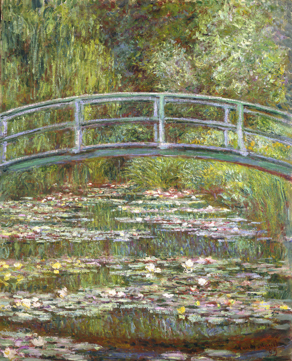
Monet’s gardens and house in Giverny was the home of the French impressionist painter, Claude Monet and his family. The gardens were inspiration for many of Monet’s famous works including Bridge over a Pond of Water Lilies (1899). Many years after Monet had passed and the property remained neglected by the family, it was finally in 1977 that Gérald van der Kemp was appointed curator at Giverny by the Academie des Beaux-Arts. After about 10 years of restoration the property was well suited for visitors. The idea behind the restoration process was to make the property look very similar to its original form.
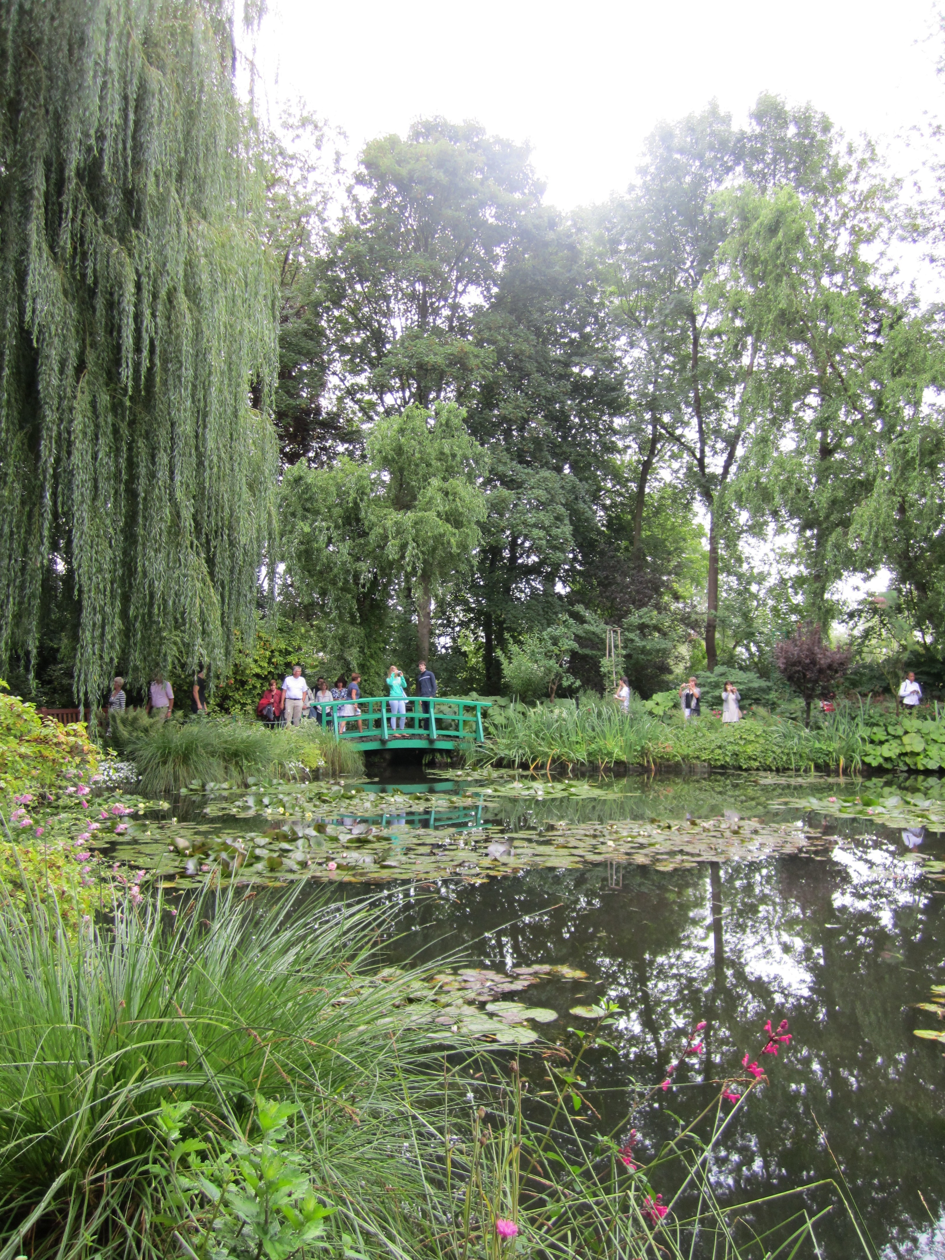
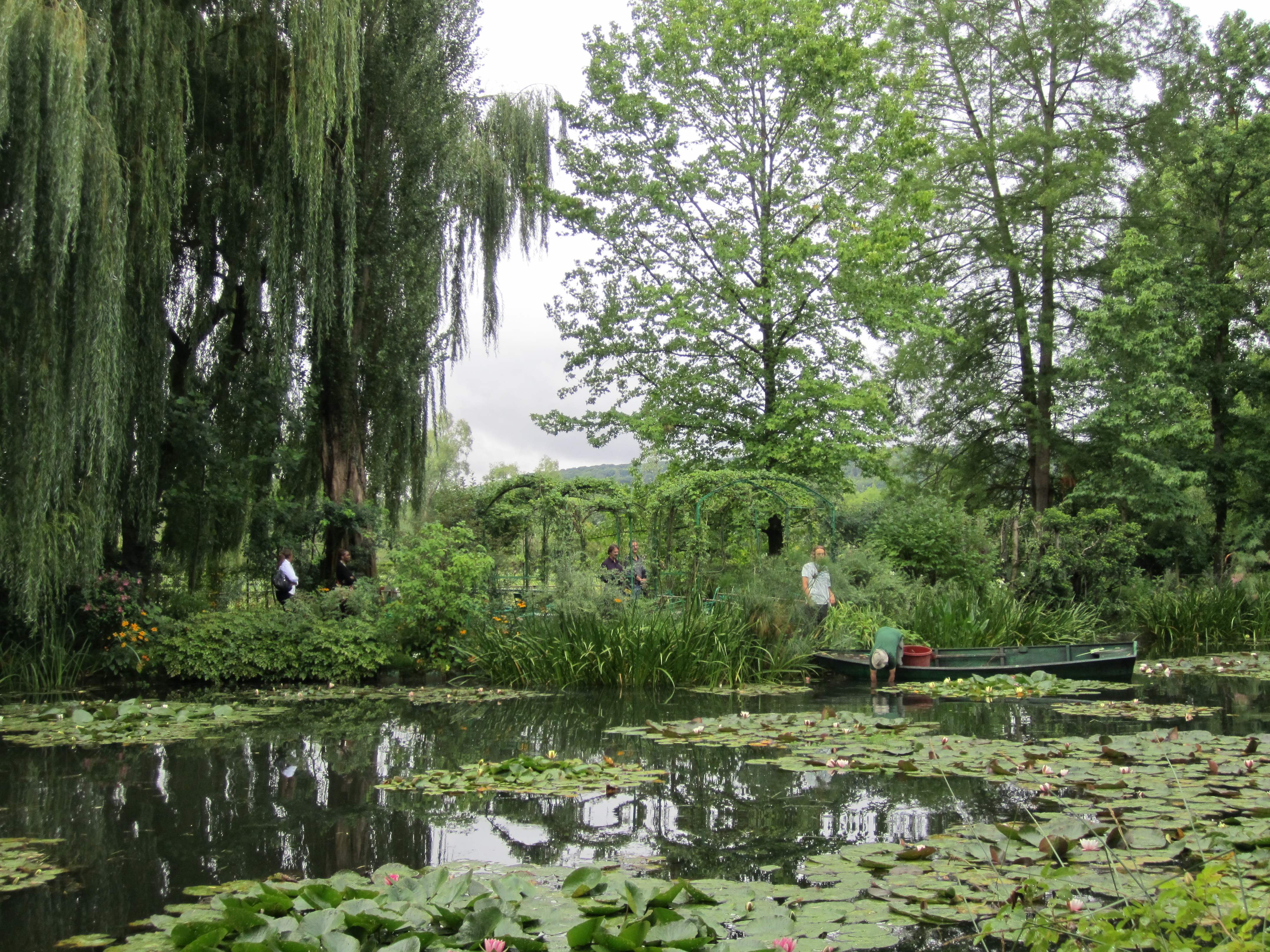
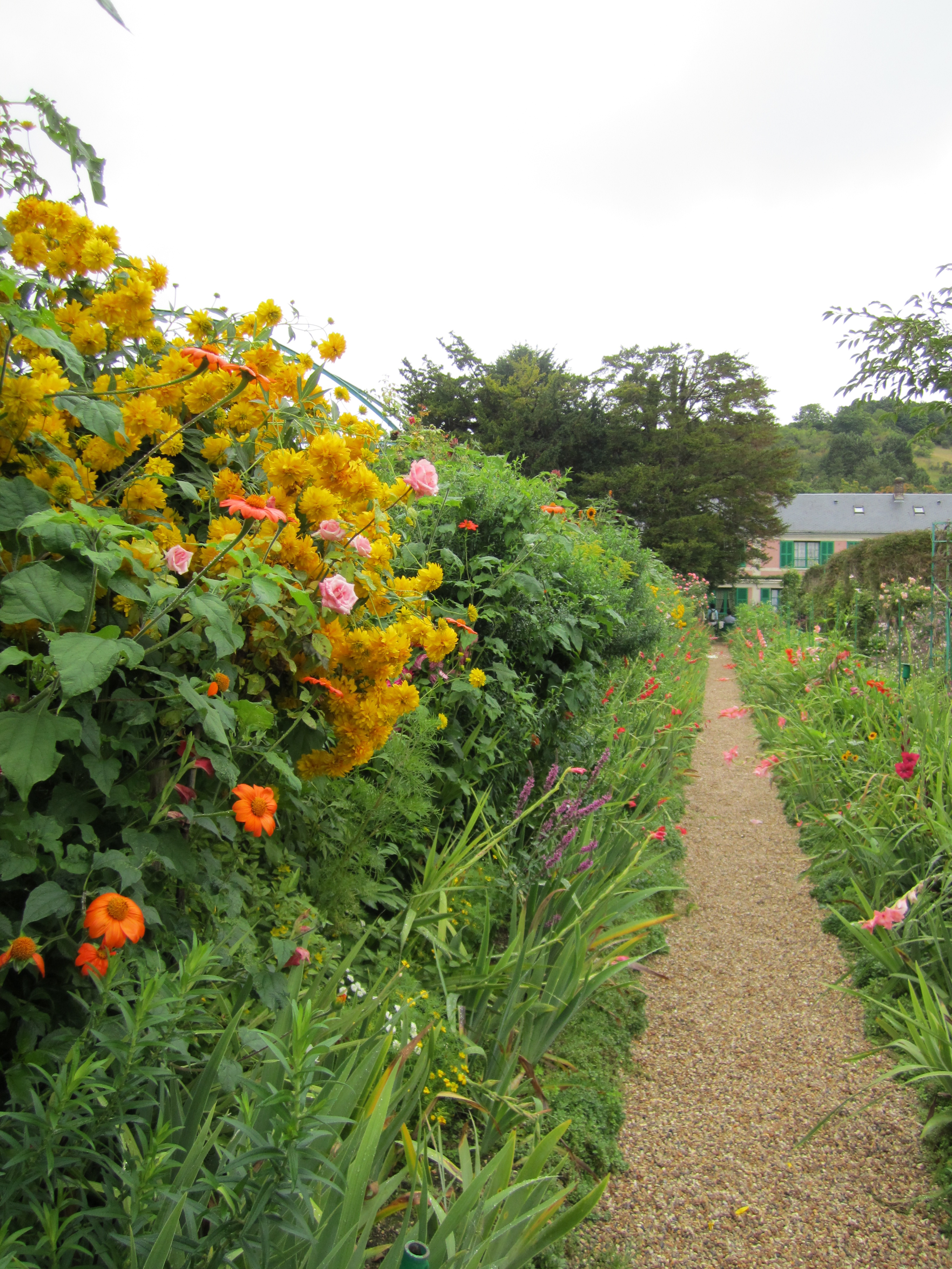
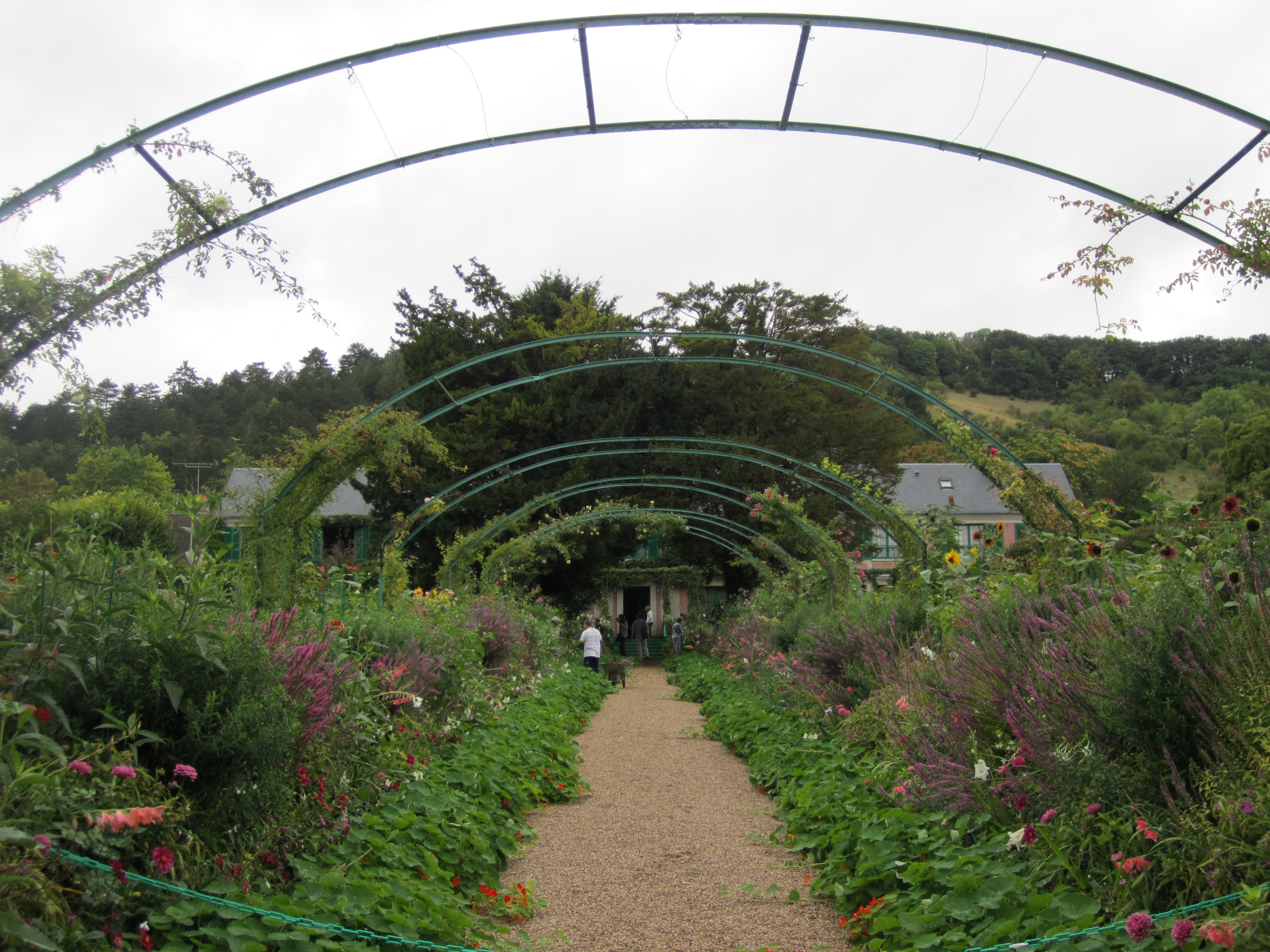
There are currently many gardeners staffed to keep up the appearance of the garden throughout the year. When I visited, everything was green because it was the summertime, so the gardens were not nearly as colorful as the gardens in Monet’s paintings, however still incredibly beautiful. There were simple paths leading around the pond that Monet had painted. Visitors could also stand on the bridge that Monet painted and take pictures. The lilies, which are essentially to recreating Monet’s scene of the pond, were also being tended to by a gardener in a green boat (as seen in the picture). In front of the house there were many thick gardens full of a variety of multicolored flowers and thin dirts paths among the plots leading to the modest yet brightly colored ivy covered house.
 The house was clearly restored and polished, however maintained the essence of the French countryside. Some of the furniture I believe was actually used by Monet and his family and underwent restoration. Visitors could walk through the house and see a completely furnished sun-filled bedroom, a bright yellow kitchen, and living room. The living room walls were lined with Monet’s paintings from ceiling to floor, left to right. A painting resting on an easel was located in the corner of the room giving the room a sense of life and a relationship to the painter who once lived there. For me, it gave the space an emotive quality. When exiting the property visitors were first led into a large gift shop with a very high ceiling that sold jewelry, prints of Monet’s paintings, art books, etc… I visited with a bus tour (because that’s how my family rolls) and the gardens themselves were not crowded but within the house and gift shop it was pretty packed.
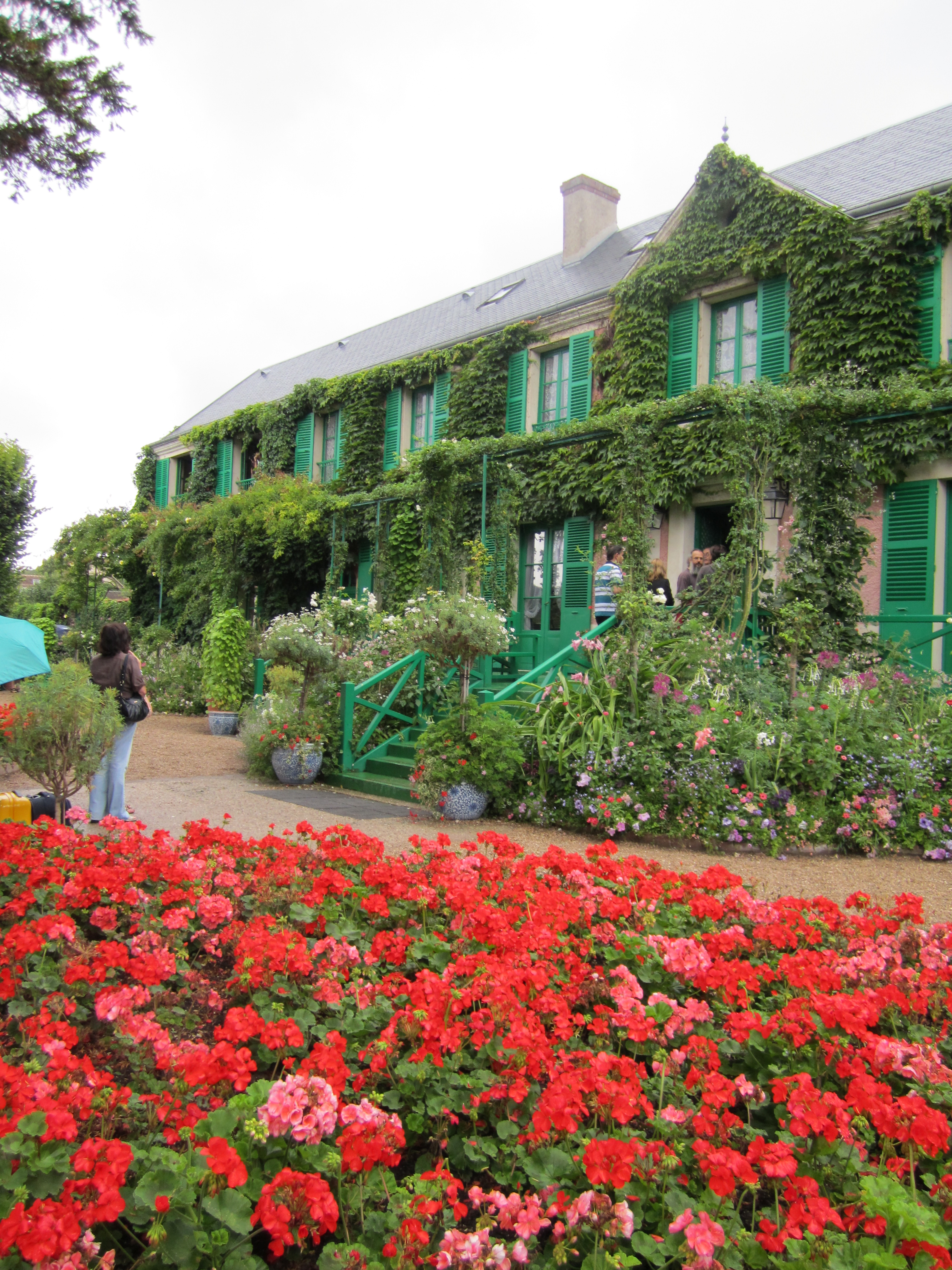 Overall it was an amazing visit. I really enjoyed the recreation of the property – it was definitely an effective way of showing the site to the public. It is also obviously a very popular museum. According to the website, <giverny.org>, approximately 500,000 guests visit this museum annually! The pictures here are from my visit they depict the pond, the gardens, and the house.
(First image is from <http://0.tqn.com/d/arthistory/1/0/r/S/mfp_mma_17.jpg> )