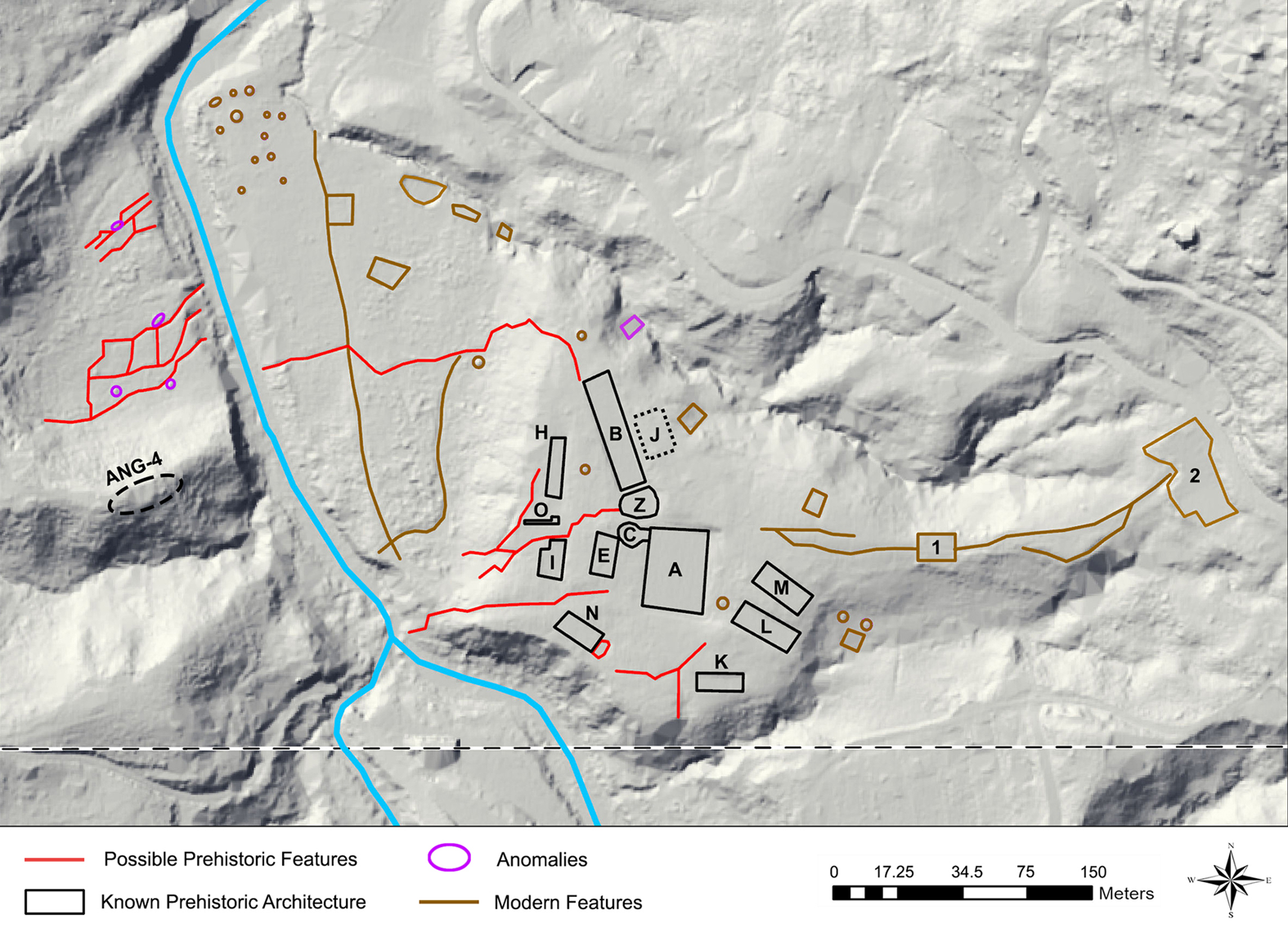
In response to a variety of factors including a changing climate, lack of traditional food availability, and relations with neighbors, several indigenous groups in North America migrated to the great plains in the late prehistoric period and changed their way of life to revolve around a new primary food source; bison. Indigenous people living in the central plains previously did not subsist primarily off of the bison or have a mobile lifestyle – archaeological evidence shows remnants of permanent dwellings and commonly found animal bones from small game in a food context, while bison bones were found much less frequently, and those that were appeared to be artifacts from tools, not necessarily food. (Ritterbush 2002). In contrast, two groups entered the plains area in the late prehistoric period; the Algonquians (also called the Illinois) and the Oneota. Both of these groups came from an area east of the plains where they primarily subsisted on different sources of food like agriculture and small game.
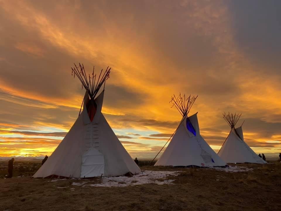
Figure 1: Many Native American stereotypes come from the common image of indigenous people from the great plains – teepees specifically are an iconic stereotype of the Native American, when in fact they are only typical of groups living mobile lifestyles in the Great Plains (“Lighting of the Teepees: Illuminating Indigenous Peoples’ Day” n.d.).
The Algonquians left their previous lands near the great lakes due to climate change that made agriculture much more difficult, as well as a lower human population on the plains. They did not move with the goal of continuing their agricultural traditions, instead, they changed tactics and became pedestrian bison hunters (Morrissey 2015). This change had a massive effect on their social organization – whereas before there would be small hunting parties for small game, buffalo required large teams, entire villages devoted to following, trapping, and killing these animals. This caused a shift in Illinois group dynamics – groups became much larger and more mobile, permanent villages were uncommon (Morrissey 2015).
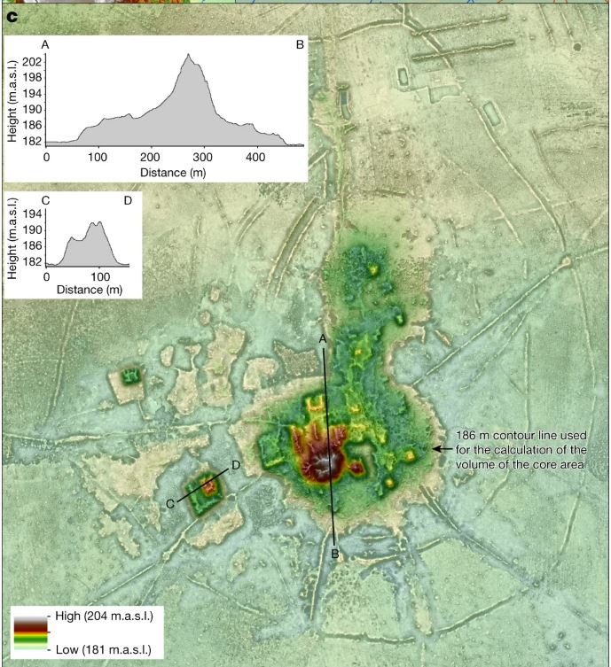
The Oneota had a similar trajectory – they came from sites near the Great Lakes to the Central Plains, possibly driven by intra-group fissions and the promise of endless bison herds (Ritterbush 2002). Once in the central plains they dominated the pre-existing groups, who lived in mostly small family groups, whereas the Oneonta had the large groups (300 or more members) that were necessary for bison hunting. They were attracted by the lack of population in the plains, and possibly driven by an overpopulation and lack of resources around the Great Lakes. Archaeological evidence of bison remains supports the idea that these groups migrated to exploit this food niche. An abundance of specific types of bones used for tools suggested long-distance trade with more western groups, and findings of those bones in more eastern areas signifies that the trade network may have continued further to the east (Ritterbush 2002). The new resource of bison and the larger social networks that the hunt for bison requires enabled growth of long-distance trade in the Midwest and more complex social groups.
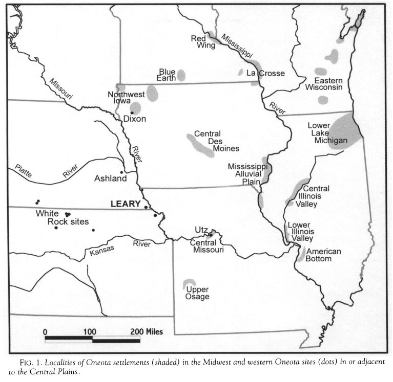
Figure 2: A map of the locations of Oneota settlements from further east, near the Great Lakes, and the sites they moved to further west in the Great Plains (Ritterbush 2002).
Both of these groups, the Illinois and the Oneota, followed the bison from the Great Lakes to the Central Plains. This movement and the social changes it required created larger, more interconnected and mobile social groups that dominated the region and facilitated long-distance trade.
Further Reading:
The importance of bison, and their history in North America: https://www.nps.gov/articles/bison_badl.htm
The history of bison in the United States and how the US government endangered them: https://www.flatcreekinn.com/bison-americas-mammal/
Bibliography
“Bison, Buffalo, Tatanka: Bovids of the Badlands (U.S. National Park Service).” n.d. Www.nps.gov. https://www.nps.gov/articles/bison_badl.htm.
Bozell, John R. 1995. “CULTURE, ENVIRONMENT, and BISON POPULATIONS on the LATE PREHISTORIC and EARLY HISTORIC CENTRAL PLAINS.” Plains Anthropologist 40 (152): 145–63. https://www.jstor.org/stable/25669333.
“Lighting of the Teepees: Illuminating Indigenous Peoples’ Day.” n.d. Mountain Time Arts. Accessed October 31, 2022. https://mountaintimearts.org/illuminating-indigenous-peoples-day.
Morrissey, Robert Michael. 2015. “Bison Algonquians: Cycles of Violence and Exploitation in the Mississippi Valley Borderlands.” Early American Studies 13 (2): 309–40. https://www.jstor.org/stable/pdf/24474892.pdf?refreqid=excelsior%3A88995ba3607a08358c35a5c2741f2b01&ab_segments=0%2Fbasic_search_gsv2%2Fcontrol&origin=&acceptTC=1.
Ritterbush, Lauren W. 2002. “DRAWN by the BISON: LATE PREHISTORIC NATIVE MIGRATION into the CENTRAL PLAINS.” Great Plains Quarterly 22 (4): 259–70. https://www.jstor.org/stable/pdf/23533248.pdf?refreqid=excelsior%3A6f5a7cf147082fce969e1747d149dd42&ab_segments=0%2Fbasic_search_gsv2%2Fcontrol&origin=&acceptTC=1.
The Bison: from 30 million to 325 (1884) to 500,000 (today. 2018. “The Bison: From 30 Million to 325 (1884) to 500,000 (Today) – Flat Creek Inn.” Flat Creek Inn. February 10, 2018. https://www.flatcreekinn.com/bison-americas-mammal/.
Zedeño, Maria Nieves, Jesse A. M. Ballenger, and John R. Murray. 2014. “Landscape Engineering and Organizational Complexity among Late Prehistoric Bison Hunters of the Northwestern Plains.” Current Anthropology 55 (1): 23–58. https://doi.org/10.1086/674535.