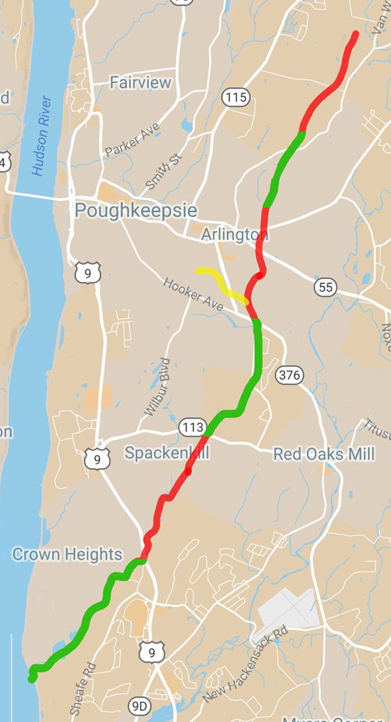
In support of the Environmental Studies focus on the Casperkill Watershed, we recorded a flight above the Casperkill Creek, from its source to its mouth in the Hudson River, a distance of about 10 miles. The course was covered by 6 separate flights, as shown below. We also flew a course over the Casperkill’s biggest tributary, the Fonteyn Kill.
Click on a red or green line segment to see a drone video of the corresponding section of the Casperkill Creek, flown north to south, or click here to see all 6 segments in succession. (Click on the yellow line segment to see a drone video of the Fonteyn Kill.)


