The Landsat Program and Archaeological Imaging

Satellites, from an archaeological perspective, can be viewed as much more than just a future (or present-day) artifact. With the launch of Landsat, NASA revolutionized imaging on earth, and has allowed for the discovery of new archaeological sites, allowing archaeologists to preserve more of the past. The idea of imaging earth from space came about after the launch of Surveyor 1 and the Lunar Orbital platforms. These satellites took extremely details pictures of the surface of the moon and other planets, but they were not made for looking at earth. (Aldenderfer, 2019). Soon after, imaging of earth from space became popular, starting with the United States Department of Defense, who kept most of the images classified. With the launch of the Landsat Program, advance images of earth are now in public domain, able to be used by Archaeologists eager to study the hidden sites of the earth. (Giardino, 2010)

Figure 1: Landsat satellite in orbit. Retrieved from https://www.nasa.gov/mission_pages/landsat/overview/index.html

            In the 1980s, Archaeology saw an increased use of these satellites for learning about sites on earth. In 1984, Boston University sponsored a conference on satellite imaging and archaeology as a response to the growth in usage of these satellite images. (Sever and Wiseman, 1989). The conclusions of the conference were widely agreed upon, and stipulated that these images should be used in learning about the relationship between environment and society, ancient and present, and should be focused especially in places with endangered resources. (Giardino, 2010).

One example of the use of the Landsat program occurred in Guatemala, which aimed to understand the Ancient Maya relationship to the rainforests of Northern Guatemala. The satellite images revealed that swamps made up to 40% of the land space in the rainforest, and they changed with the seasons. It also revealed different vegetation, as well as other small changes that occurred that could elucidate the mystery of what wiped out the Maya. Through the satellites, not only is environmental information found, but archaeological sites can be discovered. Through this project, 70 new Archaeological sites were discovered. (Sever and Irwin, 2003)

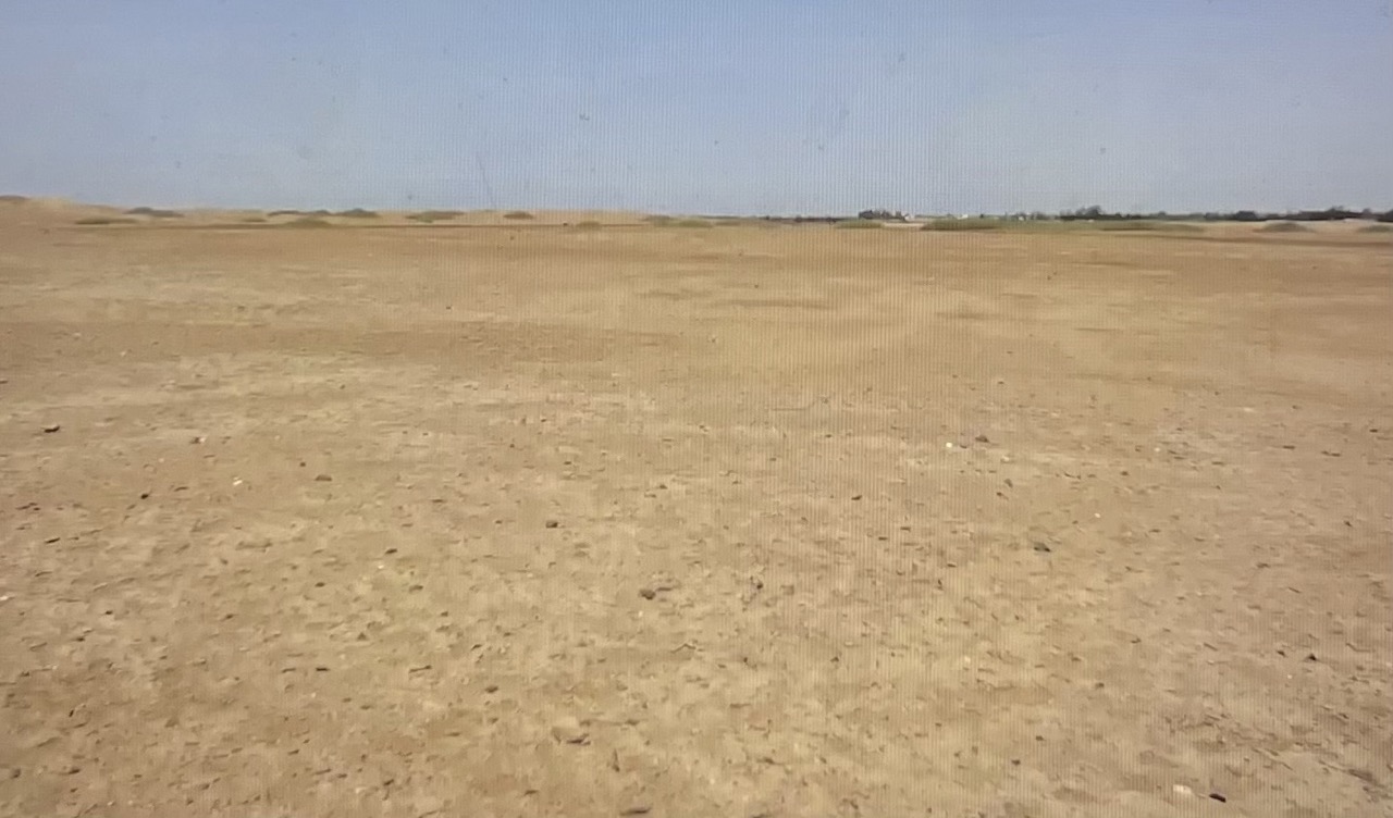
.         Figure 2: Satelite image of Maya ruins. Retrieved from https://earthobservatory.nasa.gov/images/6293/maya-ruins

           The rainforest is incredibly dense, an area that is hard to study without some form of aerial imaging, though the use of these satellites, so much more can be discovered. Satellite images reveal vegetational change, differing elevations on which sites are located, and the courses of water features. The use of satellites has made imaging much more cost-efficient and accessible. (Sever and Irwin, 2003)


Works Referenced

Sever, Thomas L., and Daniel E. Irwin. “LANDSCAPE ARCHAEOLOGY: Remote-Sensing Investigation of the Ancient Maya in the Peten Rainforest of Northern Guatemala.” Ancient Mesoamerica 14, no. 1 (2003): 113–22. doi:10.1017/S0956536103141041.

Wiseman, James R. “Archaeology Today: From the Classroom to the Field and Elsewhere.” American Journal of Archaeology 93, no. 3 (1989): 437–44. https://doi.org/10.2307/505593.

Giardino, Marco J. “A History of NASA Remote Sensing Contributions to Archaeology.” Journal of Archaeological Science 38, no. 9 (September 2011): 2003–9. https://doi.org/10.1016/j.jas.2010.09.017.

Aldenderfer, Mark S. 2019. “What Did the Moon Landing Do for Archaeology?” Anthropology News 60 (5). https://doi.org/10.1111/an.1276.


Further Reading:

https://www.nasa.gov/mission_pages/landsat/overview/index.html

https://researchoutreach.org/articles/archaeology-space-using-earth-observation-data-unearth-past/


The Importance of Aboriginal Archaeology

Image

In class this week, we learned about Alice Gorman’s work with space archaeology, but also her earlier career as a cultural heritage consultant for Aboriginal archaeology. This field of archaeology is important for understanding the majority of past human activity on the continent. It is also incredibly important to protect Aboriginal artifacts and heritage to preserve Aboriginal heritage in the face of colonial destruction.

Australia’s oldest known archaeological site is the Madjedbebe rock shelter. The site is so old that radiocarbon dating is unreliable for many of the artifacts, which include stone tools, seashells, and supplies for making rock art. The tools include stone spear tips and axes. (Britannica). In 2012, researchers applied the technique of optically stimulated luminescence to date some artifacts as 65,000 years old (Odyssey Traveller). In 2017, further application of the technique found that they could even be up to 80,000 years old (Britannica). This discovery shows that humans were on the Australian continent much earlier than Archaeologists had thought.

Some of the rock art at Madjedbebe possibly depicting European colonization.

However, the Madjedbebe rock shelter isn’t just important for its oldest artifacts. The site’s use spans a long time. Rock art in the shelter also seems to depict European colonization (Odyssey Traveller). This makes the site important for the study of many different time periods, and it is a prominent site in Australian archaeology for this reason.

The rock art depicting European colonizers also serves as a reminder that archaeology is never separate from the violent colonization that it may study. The capitalism and extractivism of colonial occupation is often directly destructive to Aboriginal archaeology and heritage. In 2020, the Rio Tinto mining company destroyed the Juukan 1 and Juukan 2 rock shelter sites, all for the expansion of its iron mine (Dvorsky 2020). Protections for important sites like this are often weak, and many of them are not even officially designated as heritage sites. Mining companies like Rio Tinto have the power to commit this destruction completely legally (Dvorsky 2020). If Aboriginal heritage is to be protected, Australian laws must change to favor these sites over the interests of the mining industry.

Protestors rebuke Rio Tinto’s destruction of the two Aboriginal rock shelters.

This injustice is concerning to archaeologists, but archaeology has its own problems regarding the treatment of Aboriginal heritage. While archaeology can be a powerful tool for preserving and elevating the importance of this heritage, archaeologists also have a problematic historical tendency to take control over artifacts, remains, and sites. This is not usually destructive, but it is still harming the heritage of people who are alive and have to be included in archaeology. Without working in collaboration with Aboriginal interests, archaeologists risk contributing to these same colonial systems. Indigenous people have historically been used as informants in Australian archaeology since the 1930s (Wilson 2014), but consulting them for information and sharing in the benefit of the work are two different things. It is imperative that Australian archaeologists emphasize ethics and repatriation, and always use their skills to benefit indigenous people rather than harm them.


REFERENCES

Dvorsky, George. “Mining Company Blows Up 46,000-Year-Old Aboriginal Site, Expresses No Regrets.” Gizmodo, May 28, 2020. https://www.odysseytraveller.com/articles/madjedbebe-archaeological-site-northern-territory/.

“Madjedbebe Archaeological Site, Northern Territory.” Odyssey Traveller, March 4, 2021. https://www.odysseytraveller.com/articles/madjedbebe-archaeological-site-northern-territory/.

“Madjedbebe.” Britannica, accessed December 4, 2022. https://www.odysseytraveller.com/articles/madjedbebe-archaeological-site-northern-territory/.

Wilson, Christopher. “Indigenous Archaeologies: Australian Perspective.” Encyclopedia of Global Archaeology. Springer, New York, NY. 2014. https://link.springer.com/referenceworkentry/10.1007/978-1-4419-0465-2_1012/.


FURTHER READING

https://www.theguardian.com/australia-news/2021/dec/05/original-archaeologists-arnhem-land-traditional-owners-take-charge-of-priceless-rock-art

Code of Ethics

Ancient Footprints: Could Human Life Existed in North America Far Before we Thought?

Image

In the past couple of years, a team of scientists have found what is now the oldest known set of human footprints in North America within White Sands National Park. These footprints are from 21,000 to 23,000 years old. In order to date this, scientists used radio carbon dating on seeds found embedded in the prints. 

Based on the stratigraphy of the land, the scientists were able to tell what was happening around and during the time the prints were made. They have found multiple different “tracks” which each house a unique set of prints. Based on their studies, they have found that the area had been under the surface of a lake for the majority of the last 30,000 years, ending with the lake drying up around 10,000 years ago. The footprints were made during a time of drought, when the waterline receded. When the drought ended, the lake level rose and began covering the footprints with layers of silt which preserved them. Footprints there are now revealed through natural means, such as sand blowing and revealing them. Others are specifically searched for by scientists and meticulously excavated.

This site shows the stratigraphy of the land and multiple sets of footprints made thousands of years apart, with the oldest being the furthest down.

When studying the tracks, the scientists sought to determine the age of the individuals who had made them. Most of them turned out to be the footprints of teenagers and children. From the relative lack of adult footprints, the scientists think that it was likely due to the adults doing the skilled work, while teens did brunt work and children played.

Here is a National Geographic artist’s depiction of what the scene by the lake would have looked like, with playing children taking the forefront.

Beyond what we can learn about the lives of the people who made the prints, these footprints predate when scientists believed humans arrived in North America. This site gives more evidence to the argument that there was human life in North America far earlier than the estimated 13,000 years ago.

White Sands is a place that multiple surrounding Native tribes feel a connection to. These footprints have now become a beautiful way for them to connect with their ancestors. These tribes are currently working to preserve the footprints so humans far in the future can continue to see the marks of humans far in the past.

References:

Bennett, Sukee. “Human Tracks May Be Earliest Evidence of People in North America.” PBS. Public Broadcasting Service, June 8, 2022. https://www.pbs.org/wgbh/nova/article/human-ice-age-footprints-white-sands-national-park/.

“The Discovery of Ancient Human Footprints in White Sands National Park and Their Link to Abrupt Climate Change: U.S. Geological Survey.” The discovery of ancient human footprints in White Sands National Park and their link to abrupt climate change | U.S. Geological Survey. Accessed December 4, 2022. https://www.usgs.gov/programs/climate-research-and-development-program/news/discovery-ancient-human-footprints-white.

Wei-Haas, Maya. “Stunning Footprints Push Back Human Arrival in Americas by Thousands of Years.” History. National Geographic, September 24, 2021. https://www.nationalgeographic.com/history/article/fossil-footprints-challenge-theory-when-people-first-arrived-americas.

Further Links:

Oldest European footprints:
https://www.nhm.ac.uk/discover/the-oldest-human-footprints-in-europe.html
What Scientists can learn from a set of footprints:
https://humanorigins.si.edu/evidence/behavior/footprints

The Influence of Space Archaeology and Satellites on Our Understanding of the Past

There are currently more than 40,000 detected objects in space, and 5,000 of those objects are satellites. Archaeologists rely on satellites, which help to communicate the positions of sites with historical or cultural relevance. This is especially clear in the case of Sarah Parcak, space archeologist and Egyptologist, who defines space archaeology as using “any form of air or space-based data” to look for ancient features or sites (Marchant 2019). 

Through the use of satellite imagery, Parcak and her team have discovered “more than 3,000 ancient settlements, more than a dozen pyramids and over a thousand lost tombs” in Egypt (Tucker 2016). One of these discoveries was the ancient city of Tanis, the former capital of Egypt. After centuries, Tanis was eventually lost under a large build up of silt and mostly forgotten. This did not stop Parcak from trying to find it, however. Because the city is still mostly buried under the desert (Figure 1), it would take hundreds of years to excavate the site using conventional practices. Instead, Parcak combined two satellite images to unveil (Figure 2) the “layout of the largest, most continuously occupied capital city in ancient Egypt” with visible suburbs, streets, and houses (Marchant 2019). 

Figure 1: Tanis, Egypt from ground level. Photograph by Sarah Parcak.

Figure 2: Satellite image of the archaeological site in Tanis, Egypt. Photograph by DigitalGlobe/Maxar via Getty Images.

Space archaeology and satellite imagery have not only helped uncover different ancient cities like Tanis, they have helped deepen our understanding of things that have already been revealed and studied in the archaeological record. Archaeologists, for example, have argued whether ancient Egypt’s Old Kingdom ended largely for social, political, and economic reasons or because of a severe drought. Parcak used satellite images of ground survey work and the Nile Delta to show a decrease in the number of the Old Kingdom’s settlements from that time period to the following one. Smaller settlements were more abandoned than larger settlements, which were generally maintained. Parcak concluded that the images provided more evidence of there having been a “a serious drought that lasted for a lengthy period of time and played a more major role in the decline than previously assumed” (Corbyn 2019). Therefore, satellites also help to advance existing perceptions of archaeological findings. 

According to Parcak, space archaeology allows people to see “a world without borders, full of possibility, past, present and future” (Marchant 2019). It allows people to analyze and understand features that relate to the history of humanity that are not visible from the ground. With satellite imagery, archaeologists are able to uncover truths about the past that have never been considered or fully understood, shining a light on the ever changing nature of history and our understanding of it. 


Further Reading:

https://www.rotary.org/en/sarah-parcak-and-secrets-of-satellites 

https://www.nytimes.com/2019/07/08/science/sarah-parcak-space-archaeology.html 

References:

Corbyn, Zoe. July 27, 2019. “Sarah Parcak: ‘Imagine being able to zoom in from space to see a pottery shard!’” The Guardian. https://www.theguardian.com/science/2019/jul/27/sarah-parcak-interview-arcaeology-from-space-satellite-imaging-globalxplorer-project-ancient-egypt

Marchant, Jo. June 26, 2019. “Adventures of a space archaeologist.” Nature. https://www.nature.com/articles/d41586-019-01972-3.

Tucker, Abigail. December 2016. “Space Archaeologist Sarah Parcak Uses Satellites to Uncover Ancient Egyptian Ruins.” Smithsonian Magazine. https://www.smithsonianmag.com/innovation/space-archaeologist-sarah-parcak-winner-smithsonians-history-ingenuity-award-180961120/. 

Beyond Space and Defense: The Indigenous Archaeology of the Woomera Range

The Woomera Range Complex located in the northwest region of southern Australia was a hub of space and defense testing and development for the nation of Australia beginning in the late 1940s. The Complex, consisting of the Woomera Prohibited area and the Woomera Restricted Airspace, remains an area of defense related development for the Australian government, and serves as a location for weapons testing, the mining and development of explosive and hazardous materials, and special forces preparation (Royal Australian Air Force). However, the range itself was the location of significant human development before it was utilized by the commonwealth. The range served as a home for countless Indigenous Australian people of different groups, and contains sites of significance to many that still exist in Australia to this day. The history of the Woomera range goes back thousands of years, and the presence of Indigenous Australians on its grounds cannot be ignored. 

Figure 1. Footprint of the Woomera Prohibited Area. Retrieved from Bush Heritage Australia.

The land of the Woomera Protected area includes the lands of six Indigenous Australian groups. A majority of this land (30%) belonged to the Maralinga Tjarutja and the Anangu Pitjantjatjara Yunkunytjatjara, and the remainder was spread between the Antakirinja Matu-Yankunytjatjara, Arabana, Gawler Ranges, and Kokatha people (Department of Defence). The land of the Kokatha Native Title is home to a number of Indigenous archaeological sites, including multiple in the Lake Hart region. Archaeologists discovered a series of fourteen stone structures which were likely used for housing or hunting by the Kokatha people. A nearby site known as Wild Dog Creek is home to a series of rock carvings produced in the Panaramitee style, which involved breaking away smaller pieces of the rock with sharp man-made tools. These carvings depict life for the Kokatha people and include images of human footprints, shelters, kangaroos, and many species of birds (Trask, 2022). Some of these portrayals match the recreations of a species known as Genyornis newtoni – a giant bird species ranging from two to two and a half meters tall that went extinct approximately 50,000 years ago (Musser, 2022). While the dating of features and artifacts within the Woomera rage can be difficult due to the harsh weather and wide open nature of the climate, these depictions have added weight to estimates that the Kokatha people inhabited the lands of the range as far back as 50,000 years ago (Trask, 2022). 

Figure 2. Depiction of Panaramitee carvings at Wild Dog Creek. Retrieved from SBS News.

The deep ties that Indigenous people have to the Woomera Range are represented in the name of the complex itself. The word Woomera pays homage to an Indigenous Australian spear thrower called the Woomera (Royal Australian Air Force). The weapon itself displayed extreme accuracy and was one of the most prominent technological advancements of the time period. The research and development in space and defense technologies completed by the Australian Commonwealth within the Woomera Range Complex are mirrored in the advancements of the Indigenous Australian peoples that inhabited the lands previously, and ignoring their accomplishments when discussing the Woomera range discounts a significant portion of the region’s history.

Figure 3. Woomera (Spear-Thrower). Retrieved from Museum of New Zealand – Te Papa Tongarewa.


REFERENCES

Department of Defense, Commonwealth of Australia. “History of the Woomera Prohibited Area: Sectors.” Defence. Commonwealth of Australia, Department of Defence. Accessed December 4, 2022. https://www.defence.gov.au/bases-locations/sa/woomera/about.  

Royal Australian Air Force. “Woomera Range Complex.” Woomera Range Complex | Air Force. Accessed December 4, 2022. https://www.airforce.gov.au/about-us/bases/woomera-range-complex. 

Unknown. Woomera (Spear-Thrower). n.d. Hardwood, grass tree resin, fibre, Overall: 155mm (width), 650mm (length), 25mm (depth). <a href=”https://www.tepapa.govt.nz”>Museum of New Zealand – Te Papa Tongarewa</a>; Collection: History; Gift of Alexander Turnbull, 1913. https://jstor.org/stable/community.27031922.

Trask, Steven. “The Significance of These Very Rare Aboriginal Shelters Has Been Revealed.” SBS News, June 23, 2022. https://www.sbs.com.au/news/article/the-significance-of-these-very-rare-aboriginal-shelters-has-been-revealed/634tt22qt. 

Musser, Anne. “Genyornis Newtoni.” The Australian Museum, April 4, 2022. https://australian.museum/learn/australia-over-time/extinct-animals/genyornis-newtoni/. 

Taylor, Kate. “Life in the Woomera Prohibited Area.” Bush Heritage Australia, December 3, 2020. https://www.bushheritage.org.au/blog/when-weird-becomes-normal.

FURTHER READING

https://www.abc.net.au/science/articles/2007/07/18/1980913.htm

https://www.jstor.org/stable/25734735

The ISSAP: Archaeology in Outer Space

Typically, an archaeologist’s job is to uncover the narratives of past civilizations through the items they left behind to gather a better glimpse of our past and how various cultures lived. Recently, however, humans have ventured beyond Earth to other places like the Moon and Mars, so how does this change the meaning of archaeology? To help answer this question, the term “space archaeology” was coined to describe human activity in space, or human activity with the goal of exploring space (Woodall, 2022). Furthermore, to investigate space archeology, archaeologists have looked to the International Space Station (ISS). This is one of the first experiments where archaeological research focused on a society that exists in the present, rather than the past.

Full image of the ISS, the largest satellite in orbit.

In particular, researchers led by archaeologists Alice Gorman (author of Dr. Space Junk vs the Universe) and Justin Walsh have begun to explore the “unique micro-society in a mini world” by examining the culture of living on the ISS (“Boldly Going”, 2022). These researchers studied a grid comprised of photographs taken by crew members, hoping to address several overarching questions that have not previously been inquired by other earthbound archaeologists. These questions include how crew members interact with one another as well as the equipment and limited space, how space artifacts reflect culture through hierarchical lenses, how crew members altered the station to suit their needs, and what is the effect of microgravity on this miniature society (Romo, 2022). The ISS is the next step in investigating the development of humanity living in space.

The dotted yellow line outlines a sample location of the analyzed artifacts.

An additional reason this research is occurring is because the ISS will intentionally fall to Earth in January 2031 (Strickland, 2022). Therefore, it is highly important to research this aspect of human culture before it is too late.

Moreover, Walsh remarks, “If this were a site on Earth, we would do everything we could to preserve it. But that isn’t technically feasible, so the next thing archaeologists do, like when sites are going to be [destroyed], is document everything we can about the site, and preserve that documentation and any samples” (Strickland, 2022).

The International Space Station Archaeological Project (ISSAP) is the first large-scale space archaeology project. The first phase of the experiment lasted 60 days from January to March 2022, and updates are currently posted on the ISSAP’s website (“Boldly Going”, 2022). These updates included photos of artifacts, explanations of technology used by the archaeologists, and analyses of assemblages of items. Now that Phase One is complete, what will Phase Two look like? Is this the future of archaeology?

Reference List:
“Boldly Going Where No Archaeologists Have Gone Before.” ISS Archaeology, April 12, 2022. https://issarchaeology.org/.

Romo, Vanessa. “Archaeologists Launch First-Ever ‘Dig’ into Life on the International Space Station.” NPR. NPR, January 20, 2022. https://www.npr.org/2022/01/20/1074216381/archeologists-launch-first-ever-dig-into-life-on-the-international-space-station.

Strickland, Ashley. “Capturing the Heritage of the International Space Station before It Crashes into the Ocean.” CNN. Cable News Network, March 11, 2022. https://www.cnn.com/2022/03/11/world/space-station-archaeology-cultural-heritage-scn/index.html.

Woodall, Tatyana. “What an Extraterrestrial Archaeological Dig Could Tell Us about Space Culture.” Popular Science, March 29, 2022. https://www.popsci.com/space/archaeology-international-space-station/.

Further Reading:
Ali, Rao Hamza, Amir Kanan Kashefi, Alice C. Gorman, Justin St. P. Walsh, and Erik J. Linstead. “Automated Identification of Astronauts on Board the International Space Station: A Case Study in Space Archaeology.” Acta Astronautica. Pergamon, August 12, 2022. https://www.sciencedirect.com/science/article/pii/S0094576522004210.

Metzger, Cerise Valenzuela, Cerise Valenzuela Metzger View all posts, and View all posts. “Chapman University’s Study Aboard the International Space Station Wins a Prestigious Digital Archaeology Award.” Chapman Newsroom, November 18, 2022. https://news.chapman.edu/2022/11/14/chapman-universitys-study-aboard-the-international-space-station-wins-a-prestigious-digital-archaeology-award/.

Namibian Apollo 11 Cave Site – Sequent Occupancy Shows Evidence of Changing Modes of Subsistence

At the time of its discovery, the Apollo 11 Cave site in Southwest Namibia was of particular significance in dating the emergence of modern human cognition. During the first few excavations starting in 1969 by Dr. Wolfgang Erich Wendt, seven painted stone slabs were found. These slabs were found to be associated with charcoal radiocarbon dated to between 27,500 to 25,500 years BP, making them the oldest rock art recorded in southern Africa at the time. Most notable of these painted slabs is what many describe as a “therianthrope,” which could have been of religious significance to its original painter (see image 2). Also found in the cave were geometric figures, such as zig-zag lines, dots, and circular “wagon wheels,” which were originally attributed to San hunter-gatherer shamanistic practices (Masson 2006). However, it is now thought to be more likely that such geometric forms (see image 2) were instead made by incoming Khoekhoe herders, or at least an adoption of Khoekhoe traditions by San hunter-gatherers, due to their association with similar engravings (Smith and Ouzman 2004).

(1) Image of what has widely been referred to as a therianthrope for its strange figure, namely its human-like hind legs

Herder arts of Africa - Wits University

(2) Example of Khoekhoe geometric rock engraving

The stone slabs, as well as some of the representational depictions found on the Apollo 11 cave wall, are almost universally agreed to have been made by San hunter-gatherers. These images, and other evidence of San occupation such as blades and flake tips, were left in and around the cave from approximately 49,000 BP until at least 1,700 BP. From 1,700 BP onward evidence of Khoekhoe occupation – pottery fragments and geometric art – is found. Such evidence also roughly coincides with sheep remains found throughout southern Africa, perhaps brought by Khoekhoe sheep herders or given to San hunter-gatherers by Khoekhoe herders through trade (Masson 2006).

Khoekhoe migration into southern Africa is indicative of a larger cultural shift in the region, as it signifies a shift in subsistence practices. What would have incentivized such a change within the wider cultural landscape of southern Africa? Perhaps the shift occurred due to an environmental change which made hunting a less stable mode of subsistence? Or maybe the shift occurred simply because herding allowed groups to sustain greater populations, and thus herders out-competed or absorbed hunter-gatherers into their cultures? Further research would be helpful in clearing up ambiguity surrounding these questions, which would provide invaluable insight into pre-historic motivations for societal change. Such insight could help us better understand the ways people adapt to change, which could grant us with more efficient tools for solving modern problems.

Additional Links

Pigment analysis of painted stone slabs:

https://reader.elsevier.com/reader/sd/pii/S2352409X1530198X?token=626E933C7D8847608D77B78CCF68B8D3EF966CAF1E526A4012EE30202BEE4DECFA04DB3886FCBEF3BE3E83ECE1919622&originRegion=us-east-1&originCreation=20221203195907

New evidence of domesticated sheep in southern Africa over 2,000 years ago:

https://science.uct.ac.za/articles/2021-03-26-domesticated-sheep-reached-southern-africa-over-2000-years-ago-new-finding

Image Links:

1:

https://www.jstor.org/stable/24643613?seq=4#metadata_info_tab_contents

2:

https://www.wits.ac.za/media/wits-university/faculties-and-schools/science/research-entities/rari/images/2020/Engraving%20Beaufort%20West%20South%20Africa-400×259

Works Cited:

Masson, John. 2006. “Apollo 11 Cave in Southwest Namibia: Some Observations on            the Site and Its Rock Art.” The South African Archaeological Bulletin
Vol. 61, No. 183 (Jun., 2006): 76-89. Cape Town: South African Archaeological                Society.

Smith, B.W. and Ouzman, S. 2004. “Taking stock: identifying Khoekhoen herder rock            art in southern Africa.” Current Anthropology 45(4): 499-526. Chicago: University of        Chicago Press.

Man Camps: An Oil Industry Business that Affects Native American Women

Who owns the land controls who can prosecute crimes committed on the land, as per the law in the United States. The United States federal government holds most Native American land in trust, so even on Native American land, oil extraction companies can extract resources with permission from the United States government (Natural Resources Revenue Data). These resource extraction projects lead to man camps, housing areas provided to the people who work at the extraction project, usually men, and almost always non-Native. However, many Native American women are murdered yearly or go missing at these man camps (Mitchell 2022). Since the beginning of these camps, the rate of missing and murdered indigenous women (MMIW) has increased by 75% (Stern 2021). 

Figure 1. Man Camps near resource extraction projects in North Dakota (Wikipedia 2022)

Native American women close to these camps live under the terror of being the next victim. Women are easy prey, many of whom have gone missing or murdered at rates higher than their non-Native American counterparts since the oil boom (Stern 2021). Where is the law that supports these Native American women? The court states that Native Nations cannot punish or prosecute non-Native Americans (Mitchell 2022), and the US government cannot prosecute Native Americans (Liptak 2022). However, The United States has ignored the law and has prosecuted native Americans anyway, while tribal police departments cannot do anything to protect Native women (Mitchell 2022). For example, Nathan Sanchez, from the Fort Berthold reservation, was working when a girl with her wet jeans emerged. He asked her what had happened, and she told him that she had been raped. He noticed she was a non-Native American and asked her immediately if the raper was Native American. She said yes, but after she got to the police station, she confessed that she had been living on the reservation. The night before Nathan found her; she said an oil worker offered her some drinks and took her to his camper, where he committed the act. Nathan could not do anything because she confessed that the man was not Indian (Crane-Murdoch 2013). Even though this girl was white, she was raped because she lived on the reservations. Nathan wanted to help her, but he could not do anything else to help her only because the rapist was non-Native American.

Figure 2. The Tiny House Warriors hold up a red dress — a symbol in remembrance of MMIW (Grable 2021).

What is left for these victims is to find comfort in themselves and their community. Most of these women do not get any mental health assistance, and the victims’ families are left alone with their trauma (Mitchell 2022). Native Americans have the highest rate of suicide (Suicide resource prevention center 2020). No wonder most of these girls are left alone confronting these traumas because not even their tribal police can do anything to help them. Also, because of these oil projects all around Native American communities, these people are raised in violence, homelessness, poverty, and depression, which puts women and children at risk of trafficking (Stern 2021). Oil industries expose Native Americans to these predators, while the government does not take any accountability for solving these problems.

References:

“Native American Lands | Ownership and Governance.” Natural Resources Revenue Data, revenuedata.doi.gov/how-revenue-works/native-american-ownership-governance.

Mitchell, Kimberly N. “MAN Camps, Oil Pipelines, and MMIW: How United States v. Cooley Is a False Victory for Indigenous Tribes.” Vermont Journal of Environmental Law, 2022. https://vjel.vermontlaw.edu/man-camps-oil-pipelines-and-mmiw-how-united-states-v-cooley-is-a-false-victory-for-indigenous-tribes.

Stern, Julia. “Pipeline of Violence: The Oil Industry and Missing and Murdered Indigenous Women: Immigration and Human Rights Law Review.” Immigration and Human Rights Law Review | The Blog, May 24, 2022. https://lawblogs.uc.edu/ihrlr/2021/05/28/pipeline-of-violence-the-oil-industry-and-missing-and-murdered-indigenous-women/.

Wikipedia. 2022. “Man camp.” Wikimedia Foundation. Last modified November 21, 2022. https://en.wikipedia.org/wiki/Man_camp.

Liptak, Adam. “Supreme Court Narrows Ruling for Tribes in Oklahoma.” The New York Times. The New York Times, June 29, 2022. https://www.nytimes.com/2022/06/29/us/politics/supreme-court-ruling-oklahoma-tribes.html#:~:text=Oklahoma%2C%20which%20was%20decided%20by,in%20tribal%20or%20federal%20courts.

Crane-Murdoch, Sierra. “On Indian Land, Criminals Can Get Away with Almost Anything.” The Atlantic. Atlantic Media Company, February 27, 2013. https://www.theatlantic.com/national/archive/2013/02/on-indian-land-criminals-can-get-away-with-almost-anything/273391/.

Grable, Kaitlin. “Big Oil Is Fueling the Crisis of Missing and Murdered Indigenous Women.” Greenpeace USA, May 5, 2021. https://www.greenpeace.org/usa/justice-for-missing-and-murdered-indigenous-women-will-move-us-closer-to-climate-justice/.

“Racial and Ethnic Disparities.” Racial and Ethnic Disparities | Suicide Prevention Resource Center, 2020. https://sprc.org/scope/racial-ethnic-disparities#:~:text=American%20Indian%20and%20Alaska%20Native%20adults%20are%20at%20highest%20risk,adults%20and%20then%20White%20adults.

Further reading: 

Simons, Jane. “As Native American Women Go Missing and Are Murdered, Who Is Keeping Track?” Southwest Michigan’s Second Wave, August 18, 2021. https://www.secondwavemedia.com/southwest-michigan/features/As-Native-American-women-go-missing-and-are-murdered-who-is-keeping-track-081821.aspx.

Bartley, Felicia, and Isleta Pueblo . “MMIW.” Native Womens Wilderness. Accessed December 3, 2022. https://www.nativewomenswilderness.org/mmiw.


The Cerutti Mastodon and the Arrival of Early Hominins to the North American Continent

During a freeway expansion project in 1992, the bones of the Cerutti Mastodon were found. This site has been being studied over several decades, and throughout that time scientists have discovered evidence that implies that humans have been on the North American continent for much longer than previously thought. (SDNHM) The remains of the mastodon date back 130,000 years old, and humans were thought to have crossed over a land bridge into the Americas around 13,500 years ago. (Mayor, 2014) But how do we know that humans were present while the mastodon was alive? Well, certain artifacts found at the site can tell us that humans were there. These artifacts were found in situ, which means they were found where they were originally deposited. The way that the bones and stones were fractured showed that Humans were present during the burial of the mastodon. The presence of hammerstones and stone anvils also alongside the mastodon. These prove that some species of Homo were on the North American continent nearly ten times earlier than previously thought. (Holen et al. 2017)

Figure 1: Diagram showing what bones of the mastodon were found. (Holen et al. 2017)

There are those, however, that challenge the assertion that this site is legitimate. In a paper written by Gary Haynes in the journal PaleoAmerica, he writes that the mastodon assemblage is “not adequately supported.” (Haynes, 2017) He questions the validity of the stratigraphy of the CM site since it was discovered while construction workers were trying to build a highway, claiming that the machinery could have moved where the bones and artifacts were located which would make the dating of the site inaccurate. Another paper published in the journal Nature written by S. R. Holen et al. also claims that the dating of the site is not evidence of early hominid activity in the Americas in the late Pleistocene. (Ferraro, 2018)

Figure 2: Figure from the original paper on the CM site showing the position of the tusk. (Holen et al. 2017)

Holen et al., who published the original paper on the Cerutti Mastodon site, responded to the criticisms in his paper he published in the journal of PaleoAmerica. In response to the claim that the assemblage was moved by the machinery, Holen points to the mastodon tusk that was implanted through several layers as seen in figure 2 above. In response to the criticisms that the rocks weren’t used by hominins by restating the presence of flakes and bulbs of percussion, commonly seen as wear in stone tools. And in response to the claim that the artifacts were moved there from natural processes, Holen looked to the fact that large hammerstones and tusks were moved, however the molars and bone fragments and smaller rocks were not moved far away. These artifacts were found closely consolidated, so they couldn’t have been previously moved from natural processes. (Holen et al. 2017)


Seeing the evidence provided, we know that a hominin was present in the Americas 130,000 years ago. Whether those hominins were Homo Sapien or another hominin could be debated. But the absence of evidence shouldn’t overrule the evidence that we do have of hominins being present that far back.


More articles to read:

https://www.pbs.org/newshour/tag/cerutti-mastodon-site


https://www.thearchaeologist.org/blog/new-evidence-for-human-activity-in-north-america-130000-years-ago


References:

The cerutti mastodon discovery. The Nat


The Cerutti Mastodon Site: One year later. The Nat


Ferraro, Joseph V., Katie M. Binetti, Logan A. Wiest, Donald Esker, Lori E. Baker, and Steven L. Forman

2018 Contesting early archaeology in California. Nature 554(7691)


Haynes, Gary

2017 The cerutti mastodon. PaleoAmerica 3(3): 196–199


Holen, Steven R., Thomas A. Deméré, Daniel C. Fisher, Richard Fullagar, James B. Paces, George T. Jefferson, Jared M. Beeton, Adam N. Rountrey, and Kathleen A. Holen

2017 Broken bones and hammerstones at the Cerutti Mastodon site: A reply to Haynes. PaleoAmerica 4(1): 8–11


Holen, Steven R., Thomas A. Deméré, Daniel C. Fisher, Richard Fullagar, James B. Paces, George T. Jefferson, Jared M. Beeton, Richard A. Cerutti, Adam N. Rountrey, Lawrence Vescera, and Kathleen A. Holen

2017 A 130,000-year-old archaeological site in Southern California, USA. Nature 544(7651): 479–483


Moyer, Steve, Mark Athitakis, Erica Machulak, Jennifer Smart, and James Williford

The first Americans. The National Endowment for the Humanities

Whoops, I Lost My Nuclear Missile: The Archaeological Rediscovery of a Forgotten Ballistic Missile Crash

On September 15, 1959, the US Army launched a test missile with the potential to travel nearly 4,000 miles.  This so-called Jupiter missile took off from Cape Canaveral almost exactly 10 years before Apollo 11 lifted off at the same site (Wade 2019, 13).  But unlike the rocket that put the first humans on the moon, the Jupiter missile (Figure 1) had an ill-fated launch.  The failure of a connection joint 13 seconds after takeoff meant that the rocket’s final resting place was in a crater that formed just a few hundred feet from the launchpad inside of a Western Florida beach (Penders 2012, 235).  

Figure 1:
The ill-fated Jupiter AM-23 missile shortly before takeoff in September 1959. Source: US Army Website, http://www.redstone.army.mil/history/archives/jupiter/jupiter_am23_16sep59_01.jpg

The physical impact and the potential cultural ramifications of the failed missile launch were largely ignored at the time.  More than 80% of the rockets launched at Cape Canaveral failed during the 1950s, and the government simply continued its launches, with more than 30 missiles launched in 1957 alone (Wade 2019, 13).  The Jupiter AM-23’s fragments were quickly cleared from the crater site, and apart from an environmental investigation in the 1990s, the crater has been largely ignored ever since (Penders 2012, 235-237).  However, in 2012, archaeologist Thomas Penders undertook a surface survey of the crash site, determining which missile caused the crash and offering further insight into the less-documented legacies of the space race.  

Penders’ initial goal was to rediscover the crater, a structure that had not likely maintained its original form due to its proximity to the Florida coastline.  He used an aerial image from 1960 as a reference for the crater’s position (Figure 2) and loaded the image into a GIS that helped his team locate the crater without needing to use a grid-based surface survey (Penders 2012, 234).  

Figure 2: Aerial photograph from 1960 showing missile impact crater. Source: US Air Force (cited in Penders: Aerospace Archaeology, p. 233).

The area around the crater contained 412 artifacts from several different launches, including debris from the explosion of a Delta II rocket (in addition to the Jupiter missile Penders was interested in).  But typological analysis allowed Penders’ team to distinguish between the two rockets; the Delta II artifacts consisted mainly of carbon-fiber sheets or foam, whereas the Jupiter AM-23 fragments were made of aluminum or steel (Penders 2012, 236).  Penders’ team also documented the crater’s structure, allowing him to classify it as a vertical-impact crater and rule out several of the rocket launches with more haphazard flight paths that could have formed the crater.  

Penders’ rediscovery of the Jupiter missile crater is an important and necessary step towards telling the full picture of the history of the space race.  For every successful rocket that launched humans closer to the moon, there were another seven that crashed and burned, leaving holes in the landscape and wildlife of the area.  While the US government may keep its records of failed launches largely hidden from the public, the mark they made on the American landscape and history will remain, left in the hands of archaeologists to uncover what has been left out of our historical narratives.  

References

Penders, Thomas. Aerospace Archaeology and the Study of Missile Crash Sites: An Example From the Jupiter Crash Site (8BR2087), Cape Canaveral Air Force Station, Brevard County, Florida. 2012. DOI.org (Datacite), https://doi.org/10.48512/XCV8458233.

Wade, Mark. “Jupiter IRBM,” 2019. http://www.astronautix.com/j/jupiterirbm.html.

Further reading

Jupiter Missile (May 31, 1957). Accessed December 2, 2022. https://www.youtube.com/watch?v=eZmJGSpelMQ.

Darrin, M. Ann Garrison., and O’Leary, Beth Laura. On the Nature of the Cultural Heritage Values of Spacecraft Crash Sites in Handbook of Space Engineering, Archaeology, and Heritage / Edited by Ann Garrison Darrin, Beth Laura O’Leary. Advances in Engineering (Boca Raton, Fla.). Boca Raton: CRC Press, 2009.