
Less than three kilometers from the well-known site of Stonehenge lies the Durrington Wall site; while it was long known as a location of interest, with features including timber circles and a recently discovered Neolithic settlement, new information showing that the site also once included as many as ninety stones, now buried beneath the surface, was released in early September 2015.
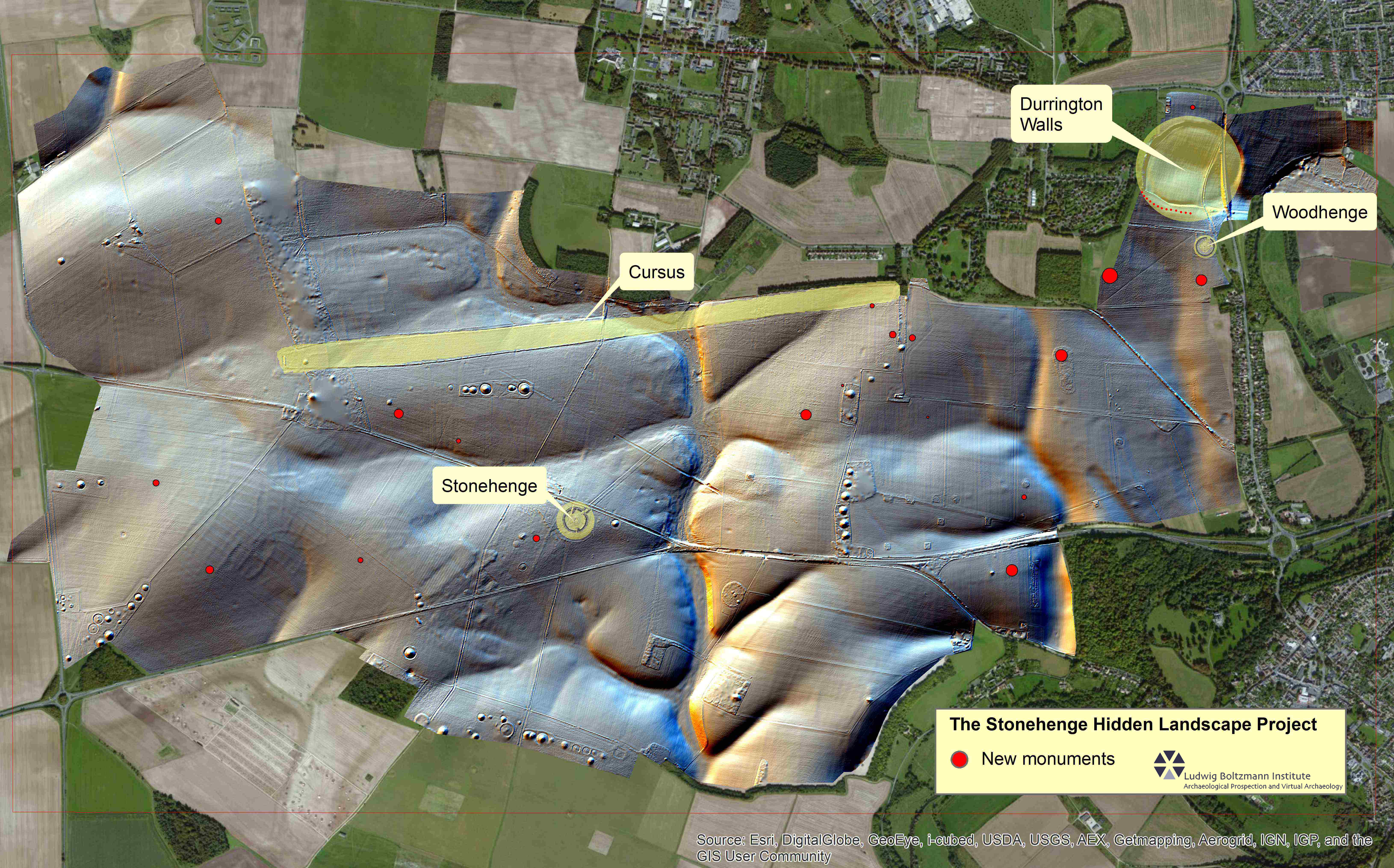
Preliminary ‘invisible’ map of region with data from project. Durrington Wall marked at top left in yellow, stones marked there in red.
Through the Hidden Landscapes Project, researchers were able to survey the land with sophisticated magnetometers, as well as laser and radar arrays, which produced high quality images that showed many features including these new ones at the Durrington Wall site. The data collected from this five year project will be merged to form a detailed map of the so-called ‘invisible’ landscape, which the researchers hope will be useful in tying together the full scale of Stonehenge and the surrounding areas.

A magnetometer in use during the Hidden Landscapes Project.
But the researchers are still most excited about the radar and magnetometer data from the Durrington Wall site. The data revealed foundations where stones had stood and stone fragments, as well as full sized stones, some around fifteen feet in height. While radar works by bouncing a signal off of a subsurface object, a magnetometer measures small fluctuations in the Earth’s magnetic that can be caused by artifacts or features; a magnetometer can be attached to a tractor, to facilitate movement and data gathering. In the digital images, the stones clearly form a row along one part of the Durrington Wall site.
This new discovery is particularly significant, as it has led the researchers on the project to rethink assumptions held about Stonehenge and the great area. Until the discovery of the stones at Durrington Wall, Stonehenge was believed to be the only major site to include stone structures of this magnitude. The new information that there was another large stone site at the same time as Stonehenge (or possibly even earlier), has lead researchers to question preconceived notions regarding the builders, their relationship with the land around Stonehenge, and the presence of great monuments of this scale and type.
Without the top of the line geophysical and remote sensing technologies that the Hidden Landscapes Project made use of during this survey, the stones beneath Durrington Wall that have led to these new questions might not have even been found. Through technological advances and the funding to use them, the archaeological community has the opportunity to reexamine some widely held assumptions, revise some of its theories, and continue to expand its understanding of the past.
Further Information
Virtual film representation of stone structures at Durrington Wall: https://youtu.be/zIfOGFA4OTE
Download link of official press release pertaining to Durrington Wall discovery:
http://archpro.lbg.ac.at/sites/files/archeo/durrington_walls_pressrelease.docx
Bibliography
http://lbi-archpro.org/cs/stonehenge/index.html
http://archpro.lbg.ac.at/press-release/durrington-walls
http://www.lbiarchpro-imagery.at/stonehenge2015_images/h55a0e257#h55a0e257
http://www.lbiarchpro-imagery.at/stonehenge2015_images/h55a0e257#h558e2981