Middle Woodland Period Society As Represented Through Alabama Canal

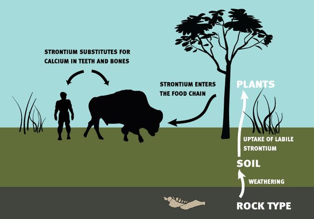
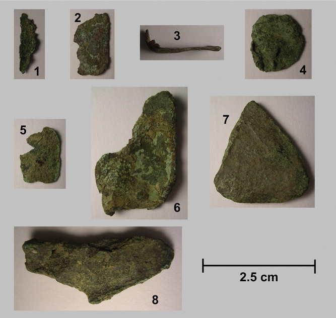
Recent class discussions about the Native American city of Cahokia, including the different political, social, economic and physical conditions which allowed it to both thrive and fall as described by Timothy Pauketat, have highlighted exactly how advanced Native American societies were pre-contact with Europeans. Another example of early but advanced systems in the Americas, active in roughly the same period as Cahokia, is a 1,400 year old Native American canal in Alabama. 

Figure 1. Harry King, a local who encouraged archaeological study of the “Indian Ditch,” near a trench dug to study the canal. Photograph by Gregory Waselkov, retrieved through Smithsonian Magazine.

This canal, nearly a mile long, is located in Gulf Shores, Alabama, in between bodies of water Oyster Bay and Little Lagoon. While some have acknowledged it as a likely pre-white settler build since the 1820s, it has lacked academic research entirely since, and some anthropologists like Gregory Waselkov believed it was a structure from the nineteenth century, such as a ditch produced through slave labor (Gannon 2022). Local resident Harry King (Figure 1), however, encouraged archaeologists to investigate the site, which locals called “Indian Ditch,” in 2017 (Powell 2022). 

In their two cross section diggings, the excavation team found charcoal samples on a surviving berm, or ledge, of the canal (Powell 2022). They were then able to radiocarbon-date these samples, which displayed that “the construction [occurred] between 576 and 650 C.E., at the end of the Middle Woodland period” (Gannon 2022). Gannon goes on to state that a small village from that time called Plash Island, located nearby one end of the canal, was likely responsible for its construction. By using this canal, they would have been able to access better areas for fishing, as well as cooking and preserving the fish, which would have been “crucial” as they did not use agriculture in this area during the time period (Gannon 2022). 

In addition to allowing easier access of bodies of water for fishing, curator William Marquardt states that the canal would have acted as “basically the front door to the Southeast,” as this was a time of significant travel and trade in eastern North America (Gannon 2022). Gannon’s article discusses how due to its location between the Gulf of Mexico and Mobile Bay, the canal would have been vital for goods to enter Mobile Bay from the Gulf or Florida and then disperse through several different pathways from Mobile Bay. Gannon also discusses how this canal may bring more evidence subverting the previous theories of hierarchical societies being needed to create these waterworks during the Middle Woodland period, as this society seemed relatively egalitarian. 

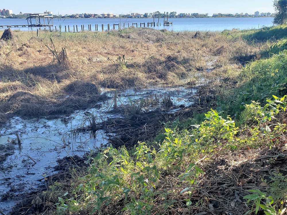
Figure 2. A 2018 image of the canal’s south end, showing where it connects with Little Lagoon. Photograph by Gregory Waselkov, retrieved through Smithsonian Magazine.

It is noted that there is still much research to be done not only on the hydrological engineering that made this canal possible, but also the “possible spiritual and symbolic dimensions of the waterway” (Powell 2022) that could give more insight on how Middle Woodland period societies in this area functioned and interacted with each other. However, despite the seemingly small span of this site, the research done on it has clearly already changed how anthropologists view the people living further southeast from Cahokia, as well as further proved just how advanced Native American engineering was. 


Further Reading 

The Middle Woodland Period – NPS Fort Smith

Ancient Canal Systems in the Americas – Ancient Wisdom 

References 

Gannon, Megan. 2022. “Archaeologists Dig Up 1,400-Year-Old Native American Canal in Alabama.” Smithsonian Magazine, October 6. (Retrieved from https://www.smithsonianmag.com/science-nature/archaeologists-dig-up-1400-year-old-native-american-canal-in-alabama-180980742/). 

Powell, Eric. 2022. “Opening the Alabama Canal.” Archaeology Magazine, November/December. (Retrieved from https://www.archaeology.org/issues/489-2211/digs/10896-digs-alabama-canal). 

Strontium Isotope Analysis in Hungary

Isotopes are atoms of a certain element that have the same number of protons but a different number of neutrons, resulting in different masses. Isotopic analysis is the practice in which isotopes are separated and studied on the basis of their differences in mass. This study is conducted through the use of mass spectrometry (Bronk, McCarthy 2008). Because unstable isotopes tend to degrade over time, stable isotopes are favored in isotope analysis. This is valuable to archaeologists because they can use it to study the movement of populations, diets, and past environments through ancient human remains (Blakemore 2019). 

Image 1. How Strontium enters the human body through specific diets. From the article “Isotope Analysis” published by PBS. 

Strontium is a popular subject for isotopic analysis in archaeology because it can determine “residential origins and migration patterns of ancestral humans” and is incorporated into the human body through diets (Dvoracek). Strontium isotopes can be obtained through tooth enamel and bones. The study of these isotopes is shown to be able to identify “more subtle shifts in prehistoric human mobility” (Giblin 2008). The analysis of strontium isotopes was employed on the Great Hungarian Plain, Alföld, to study the time period from the end of the Neolithic to the Copper Age. For this, Sr-86 and Sr-87 were analyzed. Before the application of strontium isotope analysis, archaeologists had reason to believe that there was a change in interaction between the people and the environment. For example, there is evidence that societies became increasingly more mobile, which could have been due to a transition to becoming an agro-pastoral economy, one in which “social organization [is] based on the growing of crops and the raising on livestock as the primary means of economic activity” (Giblin 2008; Hakansson, 1998).

The results of the strontium-isotope study in Hungary show that there was a big change in how societies interacted with the environment between the Neolithic Age and the Copper Age. The individuals from the late Neolithic population were proven to have less variability in their strontium isotopes compared to the Copper Age population, who had more variation (Giblin 2008). Archaeologists believe that this dramatic change in strontium presence can be attributed to a transformation in ways of life. In the late Neolithic period, settlements were large and  concentrated; contrastingly, Copper Age settlements were smaller and spread out over a greater distance. The change in social structures is consequently believed to have changed the mobility of societies, which further changed methods of agriculture and obtaining sustenance (Giblin 2008). 

Image 2. Results from the isotope analysis of Sr-86 and Sr-87 of people from the Late Neolithic period to the Copper Age. Circles = Late Neolithic; upward triangle = Early Copper Age; squares = Middle Copper Age. From the article “Strontium isotope analysis of Neolithic and Copper Age populations on the Great Hungarian Plain” (Giblin 2008). 

In the late Neolithic period, there was a dramatic increase in large game hunting and the consumption of cattle. In the Copper Age, hunting became less popular as there was a shift to a more systematic way of raising stock such as pigs, sheep, and goats. After the analysis of pig strontium isotopes, it has been determined that they have a wider range of values. The increased consumption of pigs in the Copper Age population’s diet would contribute to their higher level of strontium-isotope variability (Giblin 2008).

References:

“Isotope Analysis.” PBS. Public Broadcasting Service. Accessed November 13, 2022. http://timeteam.lunchbox.pbs.org/time-team/experience-archaeology/isotope-analysis/.

Dvoracek, Doug. “Strontium Isotope Analysis .” Strontium Isotope Analysis ” Center for Applied Isotope Studies (CAIS). Accessed November 13, 2022. https://cais.uga.edu/service/strontium-isotope-analysis/.

Giblin , Julia Irene. “Strontium Isotope Analysis of Neolithic and Copper Age Populations on the Great Hungarian Plain.” Academia . Accessed November 13, 2022. https://www.academia.edu/303945/Strontium_Isotope_Analysis_of_Neolithic_and_Copper_Age_Populations_on_the_Great_Hungarian_Plain?email_work_card=view-paper.

Giblin, Julia Irene. “Strontium Isotope Analysis of Neolithic and Copper Age Populations on the Great Hungarian Plain.” Journal of Archaeological Science. Academic Press, October 7, 2008. https://www.sciencedirect.com/science/article/abs/pii/S0305440308002392#:~:text=The%20strontium%20isotope%20ratio%20.

Blakemore, Erin. “How Your Bones Record Where You Grew up and What You Ate.” Culture. National Geographic, May 3, 2021. https://www.nationalgeographic.com/culture/article/how-bones-record-where-grew-up-ate#:~:text=Archaeologists%20use%20isotopic%20analysis%20to,high%20fevers%20as%20a%20child.

Additional Content:

Woodhenge: One Path to Reconstructing Mindsets and History

Cahokia is an ancient culture and city near Modern St. Louis that reveals much about the North American Indigenous history. It greatly affected the surrounding cultures of Indigenous societies, and the world is still feeling these effects today. However, the presence of Cahokia is not well-known to the general American public today, and the lack of Cahokia monuments does not help Cahokia become known to a variety of people. Thus existing monuments, like Woodhenge, are significant to the history of the site. Woodhenge is a monument very similar to Stonehenge, with its circle of wooden posts that aligns itself with astronomical and geometric qualifications (Pauketat 2009, 62). Its availability to the public is only possible because of the reconstruction done by archaeologists, opening up a path to Cahokia knowledge. 

The discovery of Woodhenge was accidental in the late 1960s, “Dr. Warren Wittry was studying excavation maps when he observed that numerous large oval-shaped pits seemed to be arranged in arcs of circles” (Keller, Young, Kronk 2022). Because of the careful arrangement of the holes, excavations continued, and posts made of red cedar were found alongside the post holes. This red cedar is significant to some Indigenous cultures in North America, and this representation suggests Woodhenge was possibly also sacred to the people of Cahokia. Because of this, in the reconstruction of Woodhenge, the team made sure to use red cedar logs, and when they couldn’t, they used black locusts instead that were painted red (Iseminger 2009). Thus, using the red cedar logs wasn’t just for accuracy; they also could convey to the visitors of Cahokia that red cedar is sacred to these cultures and keep the history of this connection alive. 

Figure 1. The red cedar logs in the recreation of Woodhenge. Photograph by John W. Schulze. April 2, 2010. Woodhenge and Monk’s Mound, Cahokia Mounds. Flickr.

Besides the reconstruction making an attraction that appeals to those who might want to visit, it also suggests the organization of the Cahokian people. The well-thought-out post holes are, “incontrovertible evidence of an ancient American Indian civilization with a sophisticated understanding of geometry, astronomy, and calendrics” (Pauketat 2009, 62). This structure reflects the large-scale planning that must have gone on to create such an incredible creation. The people had to carefully plan how the posts would align with astronomical and calendar events, and they had to use geometry to do so. Thus, reconstruction isn’t just valuable to show what Cahokia would’ve been like back in 1050. Reconstruction of the monument also helps reconstruct mindsets. By showing the general public that past Indigenous people were capable of such structures that display a thought-out plan, we can begin to deconstruct the idea that Native people were not intelligent and only gained knowledge when Europeans came to America. 

Figure 2. Layout of Woodhenge displaying the relationship between the poles and astronomy. Photograph by Herb Roe. Creative Commons Attribution-Share Alike 4.0 International license.Wikimedia Commons

Cahokia is just the beginning of teaching the world of ancient Indigenous cultures. By exposing structures like Woodhenge to people, an interest in learning more might be sparked, allowing history to include more truths about the Americas before European colonization. Reconstruction is the first step to reaching a more accurate understanding of the past and should be valued more when examining history.

Further Readings: 

https://www.onlyinyourstate.com/illinois/woodhenge-il/

https://scienceviews.com/indian/woodhenge.html

References 

Keller, Ken and Young, Eric and Kronk, Gary. 2022. “Woodhenge”. Cahokia Mounds State Historic Site and Cahokia Mounds Museum Society. https://cahokiamounds.org/explore/#tab-id-4

Iseminger, William R. August 28, 2009. “The Skywatchers of Cahokia”. Mexicolore https://www.mexicolore.co.uk/aztecs/home/skywatchers-of-cahokia

Pauketat, Timothy R. 2009. Cahokia: Ancient America’s Great City on the Mississippi


Why Did Chaco Canyon Fall? Numerous Theories Regarding Political and Social Discontent, Deforestation, and Droughts Come Together to Attempt to Provide Answers

Chaco Canyon, located in Northwestern New Mexico, was occupied by the ancestral Pueblo people between 830 and 1250 CE, reaching its peak between 1020 and 1110 CE (UNESCO). The canyon was a major center for political and cultural activity in the Four Corners of the American Southwest. The architecture (Figure 1) demonstrated the capability of the society’s leaders to plan and execute massive construction efforts, something that was only possible because of the immense power and influence that the leaders of the ancestral Pueblos held over the larger population. 

Figure 1. The remnants of downtown Chaco Canyon feature the intricate architecture of pit houses and kivas that existed in the ancestral Pueblo’s Chaco Canyon. 

Despite the evidence of a powerful political system that executed control over the area, Chaco Canyon, like other ancient civilizations, eventually fell. The lack of written records leftover makes it harder to determine the reason for Chaco Canyon’s downfall, but there are several theories as to why it occurred. 

The primary reason that Chaco Canyon collapsed, according to anthropologist Steve Lekson, was a difference in spiritual beliefs between the elite of Chaco Canyon and a new group of people that moved south to the area around Chaco Canyon (CU Boulder). Additionally, the arid weather was conducive to a drought that occurred around the time of Chaco Canyon’s collapse, causing the elite to move north while another group, the Aztec Pueblo, moved south. This came together to cause conflict that politicians couldn’t control (CU Boulder). 

However, another theory states that deforestation around the area in the Bonito Phase (860-1140 CE) for construction and fuel caused erosion that destroyed the agricultural fields, creating a food shortage that forced people to move away in order to survive. However, it is unclear exactly where the wood used to help construct the great houses originated from, so there is no concrete evidence to prove that deforestation incited the downfall of Chaco Canyon (Wills et. al. 2014). 

Another theory describes how a drought caused the downfall of Chaco Canyon. Tree ring analysis indicated a 50-year drought that occurred in the area as the Bonito Phase was ending. (Oswald 2018). This drought would have caused resources to be scarce, beginning the decline of the civilization as people moved out of the area to ensure their survival. 

There is evidence of great kivas (Figure 2) being burned and great house doors being sealed shut, indicating the possibility of spiritual acceptance and subsequent ritual burning to accept the change in conditions. (Oswald 2018). The Pueblo people’s origin stories are heavily reliant on migration, which makes sense when accounting for the likely migration of ancestral Pueblo peoples that occurred after the collapse of Chaco Canyon. 

Figure 2. The remains of a great kiva in Chaco Canyon. Political gatherings and religious rituals typically occurred in these subterranean buildings. 

Today, the specific reason for the downfall of Chaco Canyon is unknown. It is likely that all of the aforementioned theories come together to cause Chaco Canyon to no longer be a place of great wealth and leadership, but an environmentally and socially hostile place to be. This caused the ancestral Pueblos to migrate out of the area into areas with more stable environments.  

Reference list:

“Ancient Chaco Canyon population likely relied on imported food.” University of Colorado Boulder: CU Boulder Today. Last modified December 29, 2016. Accessed November 12, 2022. https://www.colorado.edu/today/2016/12/29/ancient-chaco-canyon-population-likely-relied-imported-food.

“Chaco Culture.” UNESCO: World Heritage Convention. Accessed November 12, 2022. https://whc.unesco.org/en/list/353/#:~:text=The%20Chacoan%20society%20reached%20its%20height%20between%20about%201020%20and%201110.

“Misunderstanding The Prehistoric Southwest: What Happened At Chaco?” University of Colorado Boulder: CU Boulder Today. Last modified February 16, 2003. Accessed November 12, 2022. https://www.colorado.edu/today/2003/02/16/misunderstanding-prehistoric-southwest-what-happened-chaco.

Oswald, Benjamin. “Chaco Canyon.” World History Encyclopedia. Last modified June 29, 2018. Accessed November 12, 2022. https://www.worldhistory.org/Chaco_Canyon/.

Wills, W. H., Brandon L. Drake, and Wetherbee B. Dorshow. “Prehistoric Deforestation at Chaco Canyon?” National Library for Biotechnology Information: National Library of Medicine. Last modified August 12, 2014. Accessed November 12, 2022. https://www.ncbi.nlm.nih.gov/pmc/articles/PMC4136604/.

Additional Content:

https://popular-archaeology.com/article/did-deforestation-really-lead-to-societal-collapse-in-chaco-canyon/

https://www.youtube.com/watch?v=o6i4NXN8ago&ab_channel=Megaprojects

New discoveries at China’s Sanxingdui site reveal secrets of the bronze age

     First discovered in the 1920’s, China’s Sanxingdui site provides one of the greatest archaeological finds of the 20th century. Located in China’s Sichuan province, it houses relics of the ancient kingdom of shu, which flourished more than 3,000 years ago before mysteriously disappearing. The site was discovered when a local farmer who was digging a trench stumbled upon the buried ruins. While the site went mostly untouched for the next 60 years of internal Chinese turmoil, it was rediscovered and explored in 1986 when another set of local workers once again stumbled upon the site. Chinese archaeologists swarmed the site, uncovering a vast trove of artifacts, including urns, vases, and striking masks of gold, bronze, and jade. These artifacts were discovered broken and buried within pits, leading to experts theorizing that they held some sacrificial value. Carbon dating placed these objects as far back as 13,000 bc.

(Sanxingdui Mask)

     While excavation and exploration of the site continued for decades, in recent years even more major discoveries have been made. From 2020-2022, Chinese archaeologists uncovered 6 new pits full of over 3,000 new artifacts. These new artifacts help point to the central importance of the Sanxingdui site for the people that lived there over 3,000 years ago. According to Chinese researcher Ran Honglin, the objects “Reflect the early exchange and integration of Chinese civilization”. Among one of the more notable artifacts is a statue featuring a human head upon a snake’s body, with its hands holding a type of ancient drinking vessel known as a Lei. A different type of vessel known as a zun is depicted upon the statue’s head. According to Ran Honglin, the object shows early connections between different cultures. The Human headed snake is typical of other Shu kingdom artifacts, while the two drinking vessels are predominantly associated with the ancient Zhou dynasty of china, possibly showing a connection between the two cultures.

(Sanxingdui Statue)

     One of the major questions still being asked by archaeologists regarding the Sanxingdui site regards why it was abandoned. Archaeological evidence shows that while the Kingdom of Shu remained active for centuries later, the Sanxingdui site was abandoned sometime around 1,300-1,200 bc. Many theories exist to attempt to explain why, from earthquakes, to flooding, to war, however as of yet a consensus has not been reached. What is known however, is where the people of Sanxingdui went. In 2001, another archaeological site was discovered only 30 miles away from Sanxingdui. Known as the Jinsha site, the artifacts discovered there were shockingly similar to those found in Sanxingdui, however the dates ranged from 1,200-500 bc, leading to archaeologists theorizing that after the decline of Sanxingdui, the Jinsha site became the new capital of the Kingdom of Shu.

(Jinsha Site Mask)


References

Magazine, S. (2022, June 14). Trove of 13,000 artifacts sheds light on enigmatic Chinese civilization. Smithsonian.com. Retrieved November 12, 2022, from https://www.smithsonianmag.com/smart-news/trove-of-13000-artifacts-sheds-light-on-enigmatic-chinese-civilization-180980254/ 

Weiss, D. (n.d.). Seismic shift. Archaeology Magazine. Retrieved November 12, 2022, from https://www.archaeology.org/issues/169-1503/trenches/2986-trenches-china-sanxingdui-civilization 

NBCUniversal News Group. (2022, June 15). Ancient artifacts found in Sanxingdui, China help illuminate Shu Kingdom. NBCNews.com. Retrieved November 12, 2022, from https://www.nbcnews.com/news/world/sanxingdui-china-archaeology-artifacts-sacrificial-pits-shu-kingdom-rcna33643 

How artefacts are being protected at the sanxingdui ruins in China. South China Morning Post. (2022, July 26). Retrieved November 12, 2022, from https://www.scmp.com/news/china/science/article/3186667/how-artefacts-are-being-protected-sanxingdui-ruins-china 

Jewelry and Decoration Found at Mound 34

Copper and shells were both used decoratively by the Cahokians, and recent research at Mound 34 has brought to light the methods behind the craftsmanship. Understanding the artistry and symbolism of jewelry allows for a better appreciation of Cahokian culture.

Mound 34 dates to the Moorhead phase (1200 AD to 1300 AD) (Baka 2019). The area around Mound 34 is thought to be the site of the earliest copper workshops in North America (St. Louis Public Radio 2014). Copper used at Cahokia was brought from the Southeastern and Great Lakes with a small portion being glacial litter (Chastain, Matthew L 2011). Two copper workshops that predate the mound’s construction were found north of the mound. Of the features that were filled in to create the mound’s foundation, a “deposit of 7 shells, possibly once in a container or wrapped up together” was also found (Cahokia Mounds 2015). One of the shells was a local mussel species and the rest were fragments of lightning and hawk wing whelk shells (Cahokia Mounds 2015). Like copper, certain shells like whelk would have conveyed status through the implicated connection to continent-wide trade. Trade for shells was widespread with lightning whelks coming from the Gulf of Mexico as well as Florida.

Figure 1. Copper fragments from Mound 34 examined by Chastain et al.

Copper jewelry was made by flattening nuggets into sheets through a process of alternating heating (annealing the metal) to 700–800 °C and hammering the metal (Chastain, Matthew L 2011). Even forming the initial sheet that would subsequently be embossed to create designs took great skill and effort. Certain copper ear ornaments, “maskettes,” represented the Long-Nosed God and may have symbolized the adoption of immigrants into Cahokia (Pauketat 2010, 146). Copper jewelry served not only as a symbol but also as ritual and cultural objects.

Figure 2. Lightning whelk shell. Photograph from Florida Museum courtesy of Bailey-Matthews National Shell Museum

Lightning whelk jewelry was also deeply symbolic, referencing death with the shell’s spiral acting as a “metaphor for the journey of the deceased soul” (Baka 2019). Shells were used because of their subterranean origin which allowed for a more profound connection to the realm of the dead than the world above water could (Baka 2019). Shell beads appear in many of the mounds at Cahokia most notably in the beaded burial at Mound 72 (Kozuch 2022). Unlike Mound 72, no evidence of materials holding the beads together is present, but the lack of beaded objects is probably due to the fire that occurred on top of Mound 34. Mound 34 was used for ritual ceremonies, and the beads found in the mound were likely part of ritual clothing that was stored within the mound at the time of the fire (Baka 2019). Shell beads were usually made of lightning whelk shells from the Gulf of Mexico, and Cahokia had its own artisans specially devoted to bead making (Kozuch 2022).

For those with status, copper and whelk shell decoration was an important part of ritual and identity at Cahokia, and the intricate techniques behind the art give context to how this form of decoration came to be preserved by the archeological record. 

Refrences:

Baka, Abby S. “Shell Beads at Cahokia, Mound 34” 31 (2019): 31.

Cahokia Mounds Museum Society. “Mound 34,” October 22, 2015. https://cahokiamounds.org/mound/mound-34/.

Chastain, Matthew L., Chastain et al., “Metallurgical Analysis of Copper Artifacts from Cahokia.”C. Deymier-Black, John E. Kelly, James A. Brown, and David C. Dunand. “Metallurgical Analysis of Copper Artifacts from Cahokia.” Journal of Archaeological Science 38, no. 7 (July 2011): 1727–36. https://doi.org/10.1016/j.jas.2011.03.004.

Florida Museum RANDELL RESEARCH CENTER. “A Very Special Seashell: Loved by Florida Tourists, Used for Tools by the Calusa, and Sacred to Many Indian People of the Southeastern U.S.,” September 7, 2016. https://www.floridamuseum.ufl.edu/rrc/blog/a-very-special-seashell/.

Kozuch, Laura. “Shell Bead Crafting at Greater Cahokia.” North American Archaeologist 43, no. 1 (January 2022): 64–94. https://doi.org/10.1177/01976931211048205.

Pauketat, Timothy R. 2010. Cahokia: Ancient America’s Great City on the Mississippi. Illustrated edition. New York, NY: Penguin Books.

St. Louis Public Radio. “Cahokia Mounds Hosted Only Copper Works In North America,” August 1, 2014. https://news.stlpublicradio.org/arts/2014-08-01/cahokia-mounds-hosted-only-copper-works-in-north-america.

Further Readings:

Dating Mound 34

Fire Usage in Bead Making

Cahokia and the American Bottom White-Tailed Deer

While Cahokia was an agricultural society, bone chemistry data and faunal remains indicate that farming did not restrict or diminish their hunting, fishing, and foraging. Rather, agricultural crops supplemented the meat, fish, and native plants in their diets, not vice versa (Yerkes 2005). Although seasonality affected the abundance of which species were being gathered and consumed, Cahokia residents never solely relied on their crops. 

Most of the game that was hunted, in particular, the white-tailed deer, may have preferred the oak/hickory forest habitats, however, they were not restricted to these areas. They would often move from the upland forests to floodplain prairies and fields throughout the year as their favorite food sources changed with the seasons (Yerkes 2005). This interface of habitats, forests and grasslands, is where the highest population densities of animals like deer occur (Kelly 2000, 26). That being said, the expansion of farmland in Cahokia, including burning and clearing parts of forests for planting crops, might have improved the habitat for deer as the interface increased. The deer population would not have been negatively impacted as deer were never abundant on the floodplains in general (Kelly 2000, 26). Looking at the white-tailed deer population, had the Cahokians not hunted them, they would have been overpopulated and overgrazed their habitat leaving them vulnerable to disease and famine (Yerkes 2005). By analyzing deer frequencies in the American Bottom, studies have shown that deer populations were stable during Cahokia and largely contributed to the diet of Cahokia people.

Figure 1. Map of the American Bottom showing creeks and lakes. Cahokia is shown as a diamond and triangles indicate smaller mounds. 

As mentioned earlier, stable isotope ratios and bone chemistry data suggest that residents of Cahokia consumed less maize and ate more meat than the inhabitants of outlying sites, and interestingly, Cahokian elites ate more meat than the commoners (Yerkes 2005). Excavations of refuse pits and middens at Cahokia revealed that the faunal and floral material found is quite variable, and a key reason is that trash deposits changed with seasons (Yerkes 2005). Deer were often hunted and consumed during the fall and winter seasons so the prevalence of deer assemblages in refuse pits would increase during these times when compared to the spring and summer months. When fewer deer were found in refused pits, meat from other game (such as birds, fish, and even reptiles) was often found in larger quantities, which may indicate the season of which the pit was filled with trash but also further proves that meat was a large component of Cahokian diet (see Figure 2).

Figure 2. Frequencies of identified mammal, fish, bird, and reptile bone fragments in faunal samples from locations in the central area of the Cahokia site. doi:10.2307/40035703.

Once we understand the seasonal patterns in refuse disposal, we can then use “the abundance of the identified food remains to reconstruct the subsistence cycle, evaluate the evidence for provisioning and feasting, and assess the levels of social ranking and leadership in prehistoric chiefdoms and tribes” (Yerkes 2005). 

References

Fritz, Gayle J. 2019. “Feeding Cahokia: Early Agriculture in the North America Heartland.” Tuscaloosa: The University of Alabama Press. https://books.google.com/books?hl=en&lr=&id=Bt98DwAAQBAJ&oi=fnd&pg=PR7&dq=cahokia+feasting&ots=KMMuC0gmkz&sig=3bnzEPtrxMxLwSFSwYJQ4xpBfaU#v=onepage&q=cahokia%20feasting&f=false 

Kelly, Lucretia Starr Schryver. “Social Implications of Faunal Provisioning for the Cahokia Site: Initial Mississippian, Lohmann Phase.” Order No. 9972676, Washington University in St. Louis, 2000. http://libproxy.vassar.edu/login?url=https://www.proquest.com/dissertations-theses/social-implications-faunal-provisioning-cahokia/docview/304629186/se-2.

Pauketat, Timothy R. 2009. Cahokia: Ancient America’s Great City on the Mississippi. New York, N.Y., Viking.

Yerkes, Richard W. “Bone Chemistry, Body Parts, and Growth Marks: Evaluating Ohio Hopewell and Cahokia Mississippian Seasonality, Subsistence, Ritual, and Feasting.” American Antiquity 70, no. 2 (2005): 241–65. doi:10.2307/40035703.

Further Readings

https://books.google.com/books?hl=en&lr=&id=_aDnCwAAQBAJ&oi=fnd&pg=PA221&dq=cahokia+feasting&ots=GJrpsXCMID&sig=jUegFTf73Nlxj7pjvV3TPjno228#v=onepage&q=cahokia%20feasting&f=false

https://doi.org/10.1016/S0278-4165(03)00036-9

Archaeology of Climate Change

Climate change is a major contemporary issue that we are trying our best to mitigate for future generations. However, we tend to forget that it is not a new phenomenon. For example, 2.5 million years ago volcanic eruptions caused a dramatic rise in carbon dioxide levels, which triggered the Ice Age. During that time, humans found solutions and adapted to it through migration and other methods. However, modern day humans place extreme value in property rights which makes it difficult to convince people to migrate in the face of natural disasters. 

Although the rising trend in atmospheric carbon dioxide seen today is much greater than the levels of carbon dioxide in the past, archaeological evidence of climate change is still a good source of information that has largely been overlooked. It provides a “solid foundation for assessing the implications of climate change across cultures and helps design sustainable development strategies” (Burke 2021). In retrospect, the archaeological evidence provides us with methods that humans have used in the past to adapt to climate change. It is important to realize that humans and culture evolved simultaneously. In the past, humans usually did not lead a sedentary lifestyle and were hunter-gatherers. Thus migration as a response to harmful climate activity was a viable solution. However, modern humans are unable to migrate due to their sedentary lifestyle and attachment to their homes.  

An example of human migration in response to climate change occurred in 1450 AD with the downfall of Cahokia. Climate change caused flooding, deforestation, and depletion of natural resources. When people first settled in the city of Cahokia, they adopted a lifestyle that over-exhausted their natural resources. Once the situation became untenable, Cahokians abandoned their city and moved to other parts of North America. This demonstrates a cultural difference between the Cahokians and modern people where the Cahokians were willing to migrate out of necessity, whereas modern individuals are unwilling to leave.

Image 1. Migration of humans during the Ice Age in North America.

An example of this cultural difference can be seen in coastal Miami. Despite the flooding of these areas, American corporations and individuals continue to invest money and live in these areas. One could argue that it is America’s capitalistic values that encourage people to stay in affected areas. This demonstrates the cultural difference between modern and ancient humans. The Cahokians and present day humans, despite having different cultural responses to the same issue, had very similar cultural values that lead climate change to destroy their societies. We are fortunate to live in a time that allows for communication between many populations. If we employ our cross-cultural knowledge correctly we can stave off the impossible decision populations have to make between migrating and staying.

Image 2. A flowchart depicting archaeology of climate change, its sources of information, and further developments.

Further Readings 

  • https://www.scientificamerican.com/article/miami-is-the-most-vulnerable-coastal-city-worldwide/
  • https://www.worldhistory.org/cahokia/

References 

Burke, Ariane, Matthew C Peros, Colin D Wren, Francesco S. R. Pausata, Julien Riel-Salvatore, Olivier Moine, Anne de Vernal, Masa Kageyama , and Solène Boisard. “The Archaeology of Climate Change: The Case for Cultural Diversity.” Photograph. PNAS, July 22, 2021. https://www.pnas.org/doi/abs/10.1073/pnas.2108537118

Dibble , Harold L, Aylar Abodolahzadeh, Vera Aldeias, Paul Goldberg, Shannon P McPherron, and Dennis M Sandgathe. How did hominins adapt to ice age Europe without fire? Accessed November 6, 2022. https://www.journals.uchicago.edu/doi/epdf/10.1086/692628

History.com Editors. “Ice Age.” History.com. A&E Television Networks, March 11, 2015. https://www.history.com/topics/pre-history/ice-age

Renwick , James. “Climate Explained: What Caused Major Climate Change in the Past?” The Conversation, August 4, 2022. https://theconversation.com/climate-explained-what-caused-major-climate-change-in-the-past 

Romey, Kristin. “Surprise Discoveries in Mexico Cave May Double Time of Peopling of the Americas.” Photograph. History. National Geographic, May 3, 2021. https://www.nationalgeographic.com/history/article/surprise-chiquihuite-cave-discovery-mexico-double-peopling-americas?cmpid=org

The Mesoamerican Ball Game’s Symbolic Complexity

The existence of the ball game in ancient mesoamerican civilizations served as an integral part of their culture that had physical, symbolic, and political influences. This widespread tradition was invented sometime in the preclassical period from 2500-100 BCE and does not originate with any one group (Cartwright 2013). Archaeologists have discovered over 1500 ball courts in Mesoamerica and have gathered knowledge about past iterations of the game through the surviving courts, game artifacts, and imagery depictions (Earley 2017). Variations of the game with different rules appeared across different cultures and time periods. Most consistently feature courts near sacred ceremonial centers such as temples and funerary shrines, suggesting significance beyond just sport. Most iterations of the game involve players aiming to shoot a solid rubber ball made from native rubber-producing plants through an elevated ring attached to a stone wall without using their hands or feet. Surviving sculptures show players poised to use their hips to hit the ball and wearing many layers of protective padding around their midsection to protect against the heavy rubber (Earley 2017).

Image 1. Mesoamerican ball game wall and goal in Chichen Itza. Photograph by Luis Miguel Bugallo Sainchez.

The game carried a heavy symbolic meaning and was often used as a vessel for human sacrifice. The mesoamerican ball game originates in a mayan creation myth in which a pair of brothers are tricked into playing the game with the gods of Xibalba(the underworld) and are subsequently decapitated (Cartwright 2013). Painted ceramic artifacts depict kings re-enacting the mythological game dressed as gods. Often the captain or the entirety of the losing team would be sacrificed as offerings to the gods. Relief panels in the game court wall from Chichen Itza depict a kneeling loser whose decapitated head sprouts vegetation and serpents (Cartwright 2013). This imagery signifies the believed nourishing and regenerative effects that sacrificial blood would bring. The mythological associations to the underworld are a representation of the battle between both day and night and life and death. The ball in constant motion is a representation of the sun’s movement across the sky and its passage through the hoop, representing the underworld, signifies the suns rising at the next dawn (Cartwright 2013). Victors of the games were regarded as warriors and would be rewarded with stone trophies. These consisted of hacha which were representations of human heads with handles and palma which were trophies designed to be worn on the costumes of players (Cartwright 2013). Stone versions of these artifacts were often placed in graves, showing the believed importance of these objects that needed to be carried on as belongings into the next life.

Image 2. Figurine of ancient ball player wearing protective padded belt. Photograph by Salazar Chávez.

The ball game aided in the political development of emerging mesoamerican societies. A social game could strengthen alliances between regions and ramp up trade. Emerging political leaders could flaunt their wealth through the ceremonious event and subsequent feasts. Social hierarchies could be implemented through socially ranked courtside viewing (Wade 2020). The games not only fostered a sense of community but expressed the power of political and religious leaders looking to establish a new inequality.

References

Cartwright, Mark. “The Ball Game of Mesoamerica.” World History Encyclopedia, September 16, 2013.

Earley, Caitlin. “The Mesoamerican Ballgame.” The Met, June 2017.

Wade, Lizzie. “3400-Year-Old Ballgame Court Unearthed in Mountains of Mexico.” Science, March 13, 2020.

Further Readings

https://www.smithsonianmag.com/smart-news/mesoamerican-ball-game-might-be-mountains-not-coast-180974422/

https://www.science.org/doi/10.1126/sciadv.aay6964

The Significance of the Black Drink in Cahokian Life

Presently packaged and sold by major tea companies like Harney & Sons, the consumption of Yaupon actually dates back to as early as 1050 A.D. Yaupon grows in the form of a shrub or small tree and is native in states from southern Virginia to Florida and in southeast Oklahoma and central Texas (Lady Bird Johnson Wildflower Center 2016). Evidence of the Yaupon plant was also found in Cahokia. More specifically, traces of the ceremonial “Black Drink” were discovered in Cahokian drinking vessels. This beverage was prepared by various Native American tribes in the southeast through the toasting and boiling of Yaupon leaves. While we may assume that this beverage was consumed in quantities resembling that of coffee and tea, this was unlikely to be the case. Yaupon is the only plant native to North America that contains caffeine and the Black Drink could contain about six times more caffeine than a typical cup of coffee (Maugh II 2012). Furthermore, as the plant was not native to Cahokia, it would’ve been difficult for trade to support daily consumption. 

Figure 1. Close-up image of the Yaupon Holly photographed by Joseph A. Marcus in 2003 for the Lady Bird Johnson Wildflower Center’s plant database.

Further supporting the hypothesis that the Black Drink was utilized for special, ceremonial purposes were the forms of drinking vessels present at Cahokia. The shell cups and beakers that were known to hold the Black Drink in purification and religious ceremonies in other parts of the continent were also found in Cahokia. This reinforces evidence that suggests the presence of a life-renewal cult in Cahokia that included these ceremonies and that the beakers could’ve been included in religious packages with other items, as they spread up the Illinois river Valley and into Wisconsin (Crown et al., 2012). In terms of rituals and in relation to its scientific name—ilex vomitoria—Yaupon was used to induce vomiting. Prior to battle or other major events, the Black Drink would be consumed in large quantities to ultimately purge and purify the body. Additionally, the drink was used for less physically taxing purposes. The drink would be consumed for decision-making purposes, as it was believed to have positive psychological effects, such as clearer thought and increased reaction time. These decisions could’ve determined the winner of stickball, or even the victor of war (Ellison 2009). 

Figure 2. Some of the beakers found in Cahokia. Photograph by Linda Alexander (Crown et, al. 2012).

The Black Drink was more than just a beverage—it was a method for purification and clarity. Therefore, while residue of the Black Drink in Cahokia may seem insignificant at first, it provides insight into the nature of activities that could’ve taken place in the city and represents their connection to other regions. 


References:

Crown, Patricia L., Thomas E. Emerson, Jiyan Gu, Timothy Ward, W. Jeffrey Hurst, and Timothy R. Pauketat. “Ritual Black Drink Consumption at Cahokia .” PNAS, August 6, 2012. https://www.pnas.org/doi/10.1073/pnas.1208404109. 

Ellison, George. “Yaupon and the ‘Black Drink’.” Smoky Mountain News, May 29, 2009. https://smokymountainnews.com/archives/item/2412-yaupon-and-the-%E2%80%98black-drink%E2%80%99#:~:text=%E2%80%9CTo%20make%20black%20drink%2C%20the,roasted%20for%20the%20same%20reason. 

“Ilex Vomitoria” Plant Database – Lady Bird Johnson Wildflower Center – The University of Texas at Austin, April 2, 2016. https://www.wildflower.org/plants/result.php?id_plant=ilvo. 

Maugh II, Thomas H. “Cahokia People Had Caffeine Drink Made from Holly 900 Years Ago.” Los Angeles Times. Los Angeles Times, August 6, 2012. https://www.latimes.com/science/la-xpm-2012-aug-06-la-sci-sn-black-drink-cahokia-20120806-story.html#:~:text=A%20dark%20tea%20made%20from,caffeine%20content%20of%20modern%20coffee.&text=The%20native%20Americans%20used%20it,before%20important%20events%20or%20battles. 

Additional Readings: 

https://lifeandthyme.com/drink/the-complex-history-of-drinking-yaupon-tea/

https://emh30.ace.fordham.edu/2018/12/10/black-drink-and-native-american-alcohol-use/