Awardee: Tobias Armborst
Semester of Award: Spring 2016
Materials Awarded: A one-year license for the Social Explorer software
Project Description:
Social Explorer is a data research and visualization program that provides easy access to a large amount of current and historic demographic information. The program also facilitates the preparation of maps and data visualizations.
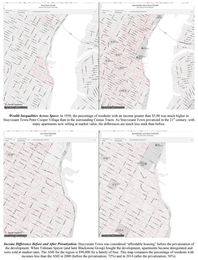
In my urban studies class Making Cities I ask students to identify an urban boundary in New York City (either a physical boundary or a socio-economic boundary that is only visible in a data map), and to research its history. As part of the research paper I ask students to submit a visual dossier of historical photographs, maps and data maps. For the preparation of this urban history assignment the social explorer software was extremely useful. While in theory students could have produced similar visualization with GIS, the social explorer software allowed for quick exploration of different demographic data by students without prior knowledge of GIS software.
Amy Laughlin installed the social explorer license on a public computer in the Arc-lab in Taylor Hall, giving the approximately 27 students in the class the option to sign up for time slots on the machine. This process worked smoothly, and the student projects were generally successful.
While I understand that the Frances D. Fergusson Faculty Technology Exploration Fund is only available for one-time grants, I also believe that in the longer term an unlimited license for social explorer would be a very useful tool for my and other urban studies classes.