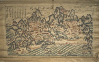


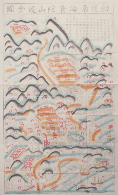
China, Qing period, early 20th century; hand-colored woodblock print; 43 5/16 x 24 7/8 in.; Courtesy of the Division of Anthropology, American Museum of Natural History, ASIA/0578.
This map simplifies the topography of Mount Putuo, a small island in the South China Sea consisting of low hills and a cave where Guanyin frequently appeared to pilgrims. The establishment of Mount Putuo as the Chinese Potalaka began in the Northern Song dynasty (960-1127); Japanese pirates destroyed it in the mid-16th century. In the Qing dynasty (1644-1911), imperial patrons reconstructed two major temples. This explains why the first two characters of the map’s title translate as “built by the Emperor.” Not a realistic depiction of Mount Putuo’s buildings and paths, the map instead conveys abstract shapes and saturated colors that represent the spiritual allure of this pilgrimage site. JS