China, Qing period, early 20th century; hand-colored woodblock print; 43 5/16 x 24 7/8 in.; Courtesy of the Division of Anthropology, American Museum of Natural History, ASIA/0578.


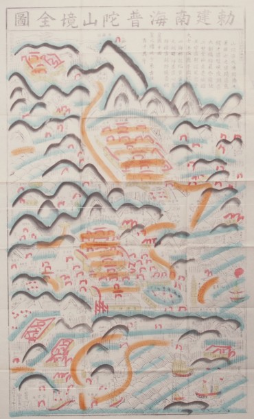
17. The Complete Map of the Imperially Established South Sea Mount Putuo Area
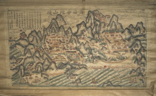
A View of Mount Putuo of the Southern Sea
China, Qing period, late 19th century; cloth, paper, pigment, wood, metal, string; image: 21 5/8 x 39 15/16 in., scroll: 27 15/16 x 44 1/16 in.; Courtesy of the Division of Anthropology, American Museum of Natural History, 70/11655.
The two maps shown here differ in their styles and inscriptions, but interestingly, both include the same poem. This poem narrates the foundational myth about the origins of Mount Putuo in the 10th century. A Japanese monk named Egaku (Hui’e in modern Chinese) decided to enshrine an icon of Guanyin on the island while waylaid at the Cave of Tidal Sound. This cave is shown at bottom center of the map. The depiction, painted in a portable handscroll format with extensive topographical details, may have primarily served as an orienting and educating device during pilgrimage. JS