Awardee: Mary Ann Cunningham
Semester of Award: Spring 2015
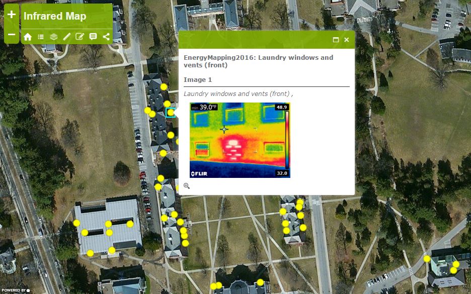
Materials Awarded: We bought an infrared camera (a front-looking infrared camera, FLIR) for imaging temperatures
Project Description:
The focus of this project is understanding energy inefficiencies. The purpose of energy assessments is to identify priority strategies for reducing our energy consumption. Because at least 55% of our carbon emissions result from building heating, this is the biggest single issue that needs to be addressed in reducing the climate impacts and social justice impacts of our energy usage.
Students took images of buildings to aid in visualizing energy efficiency needs, and they then mapped the images for distribution. We did this in my GIS class, so that it also served as a demonstration of online mapping methods and communication. In addition I had students using the FLIR to capture images as part of an independent study on building efficiency assessment, which was done by two students this semester. The mapping done in the GIS class will be continued this summer, but already it has been useful in conveying the ideas to other student groups. Because the FLIR can be used for summer imaging–e.g. air conditioning leakage or building heat gain–we have an URSI student this summer who will be continuing both the efficiency assessments and the mapping project so that they can contribute to energy efficiency studies and standards on campus.
The project is continuing for the foreseeable future, but I think it has been effective already in helping shift how we are seeing energy on campus.