
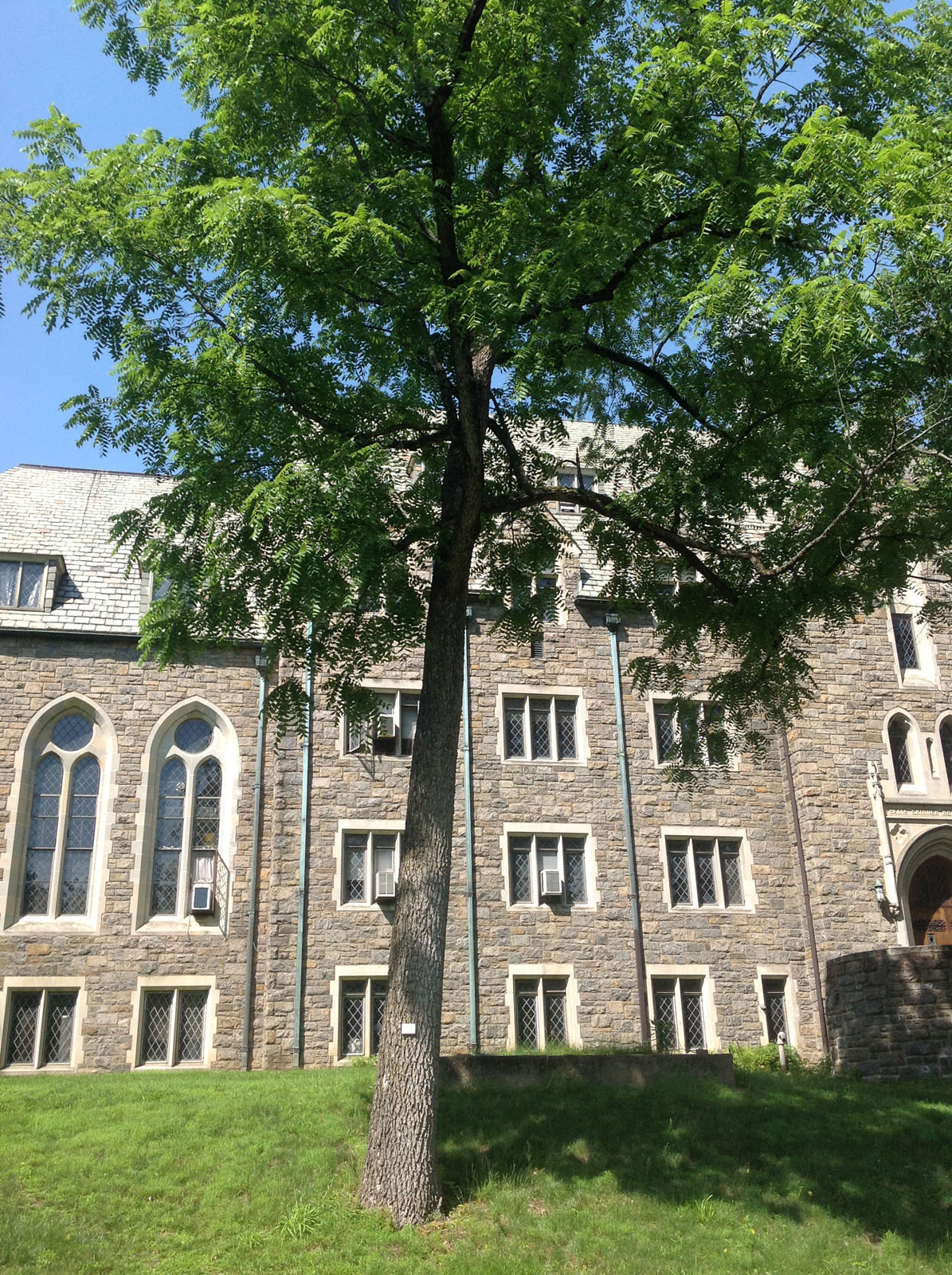
Black Walnut (Juglans nigra) behind Skinner Hall
During the summer of 2015, students participating in two different URSI projects gained experience using GIS and GPS as an integral part of their work. These projects demonstrate some of the range of applications to which geospatial technologies can be applied to assist faculty in their research and help students gain valuable experience, from archaeology field work in the Catskill Mountains and to mapping and inventorying the trees of the arboretum here on the Vassar campus.
Archaeology in the Catskill Mountains
A team of four Vassar students (Cayla Neipris ’16, Dan Swerzensky ’18, Drew Leventhal ’17, and Dzifa Binka ’16) led by assistant prof. of anthropology April Beisaw used GIS and GPS to help document the history of the Ashokan Reservoir and its surrounding watershed over the past 100 years since its creation.
Located in the Catskill Mountains less than 40 miles northwest of Vassar campus, the 8,300-acre reservoir was created on the site of several former villages to feed New York City’s water system. Students consulted maps and GIS data provided by New York City Department of Environmental Protection and other sources, performed multiple field surveys armed with GPS units, and created maps using GIS software in the Anthropology lab with the data they recorded, which informed their study of the area.
Vassar College Arboretum Tree Inventory
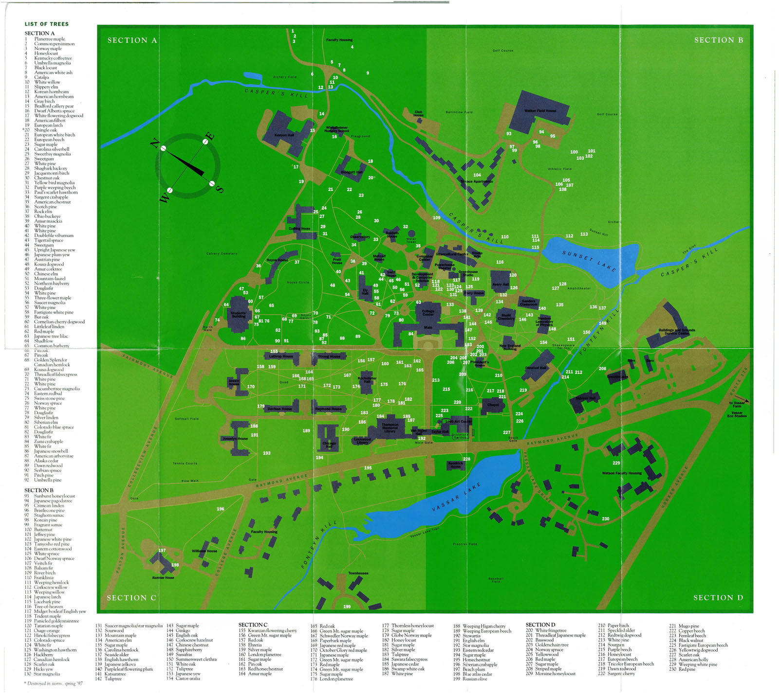
Arboretum Map c. 1990 (click for larger image)
The history of Vassar’s arboretum dates back to 1865, when Mathew Vassar made the first plantings on what was a practically treeless campus. Since then, a number of Vassar faculty, staff, alumnae and alumni have all contributed to making the arboretum the unique exhibit of rare and common specimens it is today. During the summer of 2015, professor of biology Mark Shlessman and student Samuel Short ’16 used GPS to inventory the specimens based on past maps of the Arboretum, which were created at different times as the collection has changed. The results of their work will be used to create a new map and provide documentation to an accreditation body that will formally recognize the Vassar College Arboretum among other arboretums of the world.
Based on previous surveys of the arboretum trees, the team developed a list of existing species information and other desired information about each tree to be verified and/or collected in the field. Points were plotted to each tree’s location based on historic arboretum maps, matched with the existing species information and published to Vassar’s ArcGIS Online mapping platform. Then, using ArcGIS Collector on an iPad equipped with GPS, the team accessed the data on ArcGIS Online, navigated to each tree’s location, moved the point location if it was positioned incorrectly, and verified and/or recorded the appropriate information. The result is a comprehensive inventory of the arboretum trees.
How can you use GIS and GPS?
The GIS Academic Computing Consultant provided support for these projects through generating GIS data and maps, providing technical assistance and training to faculty and students involved, and performing troubleshooting on the technology used. For help with your project or how you might use geospatial mapping technologies like GIS and GPS, please contact the GIS Academic Computing Consultant at 437-7708 or email necurri@vassar.edu.