
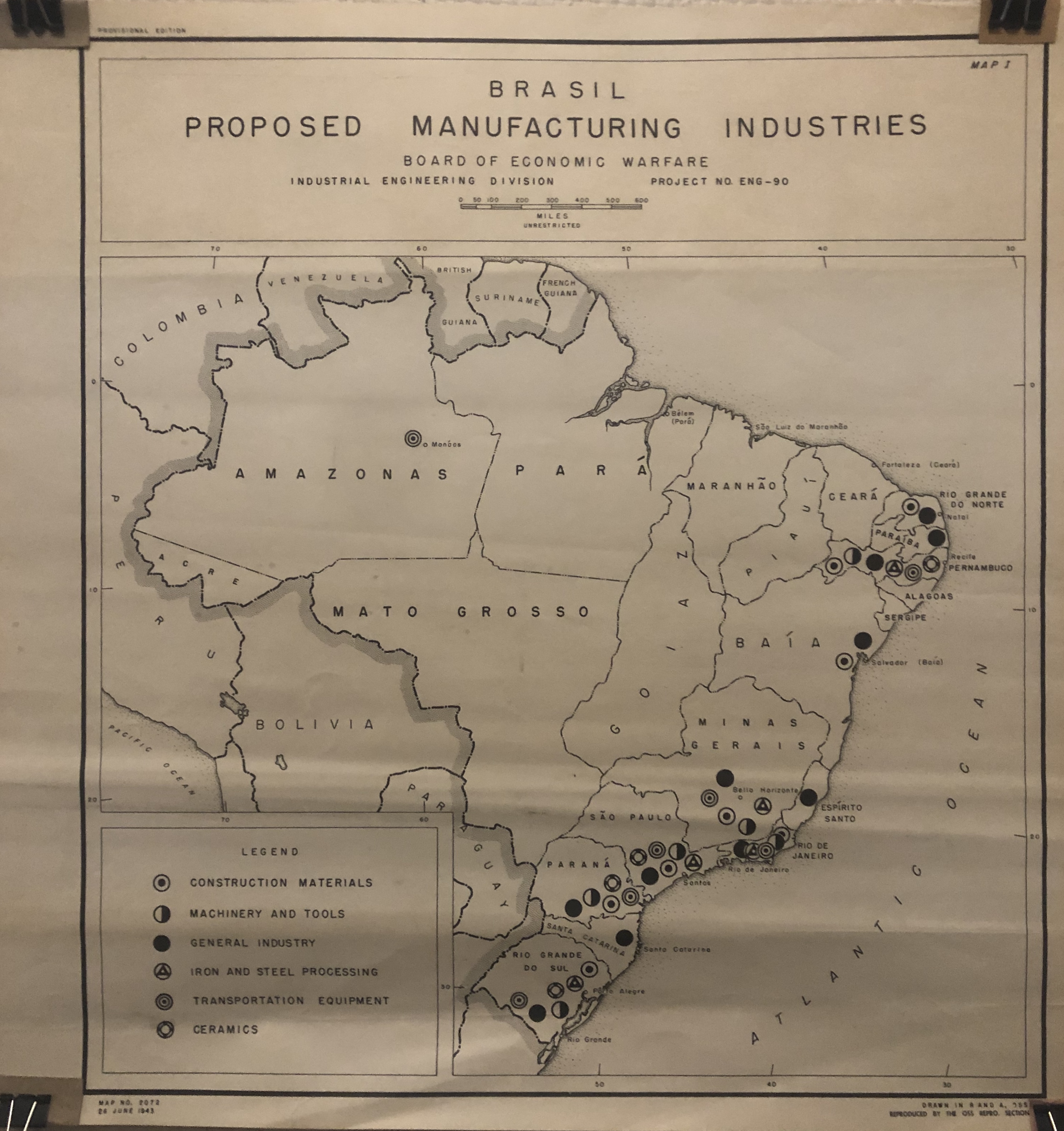
This map of Brazil from 1943 shows the locations of various natural resources and industries. It’s unclear from the “proposed” in the title who is proposing these industries and to what level they may be already existing. Note the lack of cartographic information, like projection, or exact markings of industry locations.
The producer of this map– R and A, OSS, in the bottom right corner– is the Research and Analysis branch of the Office of Strategic Services. According to the CIA website, this office was the agency’s forerunner. It was created in June 1942– less than a year after the U.S. formally entered World War II– by President Franklin Roosevelt. I couldn’t tell from preliminary research if the Board of Economic Warfare (under the title) was part of the OSS, but they at minimum worked together–geographers, historians, and political scientists worked in the U.S. bureaucracy to assess resources and infrastructure in certain areas or regions abroad (check out this declassified document referring to these practices in relation to Japan during the war).
How might the context of the world war have influenced what industries were chosen for this map, and what technologies might make these industries important? What is “economic warfare” in the context of World War II, who might it effect, and how might this phrase take on different meanings over time and in reference to different places?
Have a good week,
Aidan Antonienko ‘21