
Archaeology is not all about artifacts. One of the archaeologist’s most important jobs does not even include touching, let alone taking with them, remnants of the past. This vital part of archaeology is called a “survey” and is phase 1 in any research project [2]. This past week, I was able to participate in an archaeological survey in the Catskill Mountains and experience first-hand the thrills associated with real archaeology.
When New York City turns on the tap, the water that comes out likely originates over 70 miles north in a gigantic man-made lake called the Ashokan Reservoir. One hundred years ago, this reservoir did not exist and the areas surrounding it were cities and pastureland. [1] Below is this area today:

Over the years, New York City bought the land surrounding the reservoir, removed the people living there, and planted thick forests. Our research project tries to find evidence of people who lived near today’s Ashokan Reservoir in order to learn more about their lives, how they lived, and how we can apply this information to today.
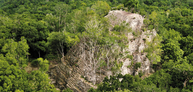
Like any archaeological adventure story, my group did not follow a designated path as we traversed the Catskill woods, barging our way through the underbrush. Thirty minutes into the survey, a fellow student spotted a bone. One would logically assume it belonged to some woodland creature like a deer or a raccoon; however, upon closer examination the professor surmised that it may have belonged to a pig. A pig in the rural woods? This type of “ecofact” (a part of nature telling us about a past culture) is the truly exciting part of archaeology [2]. Stereotypical treasure does not always provide insights into past cultures. A simple bone, on the other hand, can provide a wealth of information such as evidence that pigs may have lived on this property. Our group then stumbled upon this stone structure:
At least it seemed to look like this. In reality, we found a stone wall that originally bordered a pasture and looked similar to this:
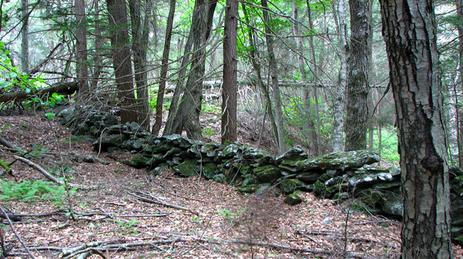
Such an immobile structure is formally called a “feature” [2]. Providing no magnificent worth, this feature gave me a thrill greater than discovering any golden treasure or long-lost pyramid. Where I was standing was once populated by farmers. How many cows grazed at my feet? How many people dealt with life’s difficulties in long-abolished houses not far from where I stood? These images and stories of the past whirled through my mind as I saw the lives of those now gone. How did they live? What can we learn from them? These types of questions drive every archaeological project. We learned that the area we surveyed was populated and that people indeed used it as pastureland. Once further archaeological research is done in the areas that seemed to have the greatest activity (such as near the wall), we will be able to know how these people lived and apply this knowledge to better management of the land surrounding the Ashokan Reservoir.
Works Referenced
[1] Ashmore, Wendy, and Robert J. Sharer. Discovering Our Past: A Brief Introduction to Archaeology. Mountain View, CA: Mayfield Pub., 1988. Print.
[2] “Ashokan.” Watershed Protection. The City of New York, n.d. Web. 05 Oct. 2013. <http://www.nyc.gov/html/dep/html/watershed_protection/ashokan.shtml>.
Images
Rosspilot. Ashokan Reservoir. Digital image. Aerial Photography by Rosspilot. Sky View Pictures, n.d. Web. 5 Oct. 2013. <http://www.skyviewpictures.com/skyviewstore/products.php? pid=258&detail=true#thumb>.
Ziegler, Christian. The Peak of La Danta. Digital image. El Mirador, the Lost City of the Maya. Smithsonian, May 2011. Web. <http://www.smithsonianmag.com/history- archaeology/El-Mirador-the-Lost-City-of-the-Maya.html>.
Digital image. Our Woodlands. Greenhill Center for Outdoor Activities, n.d. Web. 5 Oct. 2013. <http://www.centerforoutdooractivities.com/1_main/facilities/woodlands/woodland s.shtml>.
Looking at the vast expanse of the Ashokan reservoir, it can be difficult to believe that it was built with human hands. Even more surprising is the fact that abandoned towns, razed to make room for the reservoir, lay under the water. The signs near the now-uninhabited forests surrounding the reservoir often note that this is the “former site” of such-and-such town. As the field work you talk about here revealed, New York City’s construction and political maneuverings in the area have a very real human element. As the city’s land acquisition may become even more aggressive in the near future – in order to create a land buffer to protect NYC’s water supply – studying the communities that were destroyed here may be more important than ever. Current residents are still affected by the Department of Environmental Protection’s policies, just like the people whose abandoned farmland you surveyed.
It is very fascinating to imagine that numerous towns once stood under the surface of the Ashokan Reservoir. According to the following site, “Nine villages were either removed or obliterated forever” when the reservoir was built:
http://itsaboutthehudsonvalley.com/Reservoirs/reservoirs-Ashokan.html
New York City would likely never allow it; however, it might prove helpful if under-water archaeology was conducted at the bottom of the reservoir to see what remains of those villages. We could then use this information to further our research.
Understanding how people are still affected today also provides deeper insights into understanding how people lived here in the past. The following article which was published less than a month ago details how New York City agrees to research ways to not release turbid water into the Esopus Creek watershed, a problem about which local residents complain:
http://www.watershedpost.com/2013/dec-announces-agreement-new-york-city-lower-esopus
Furthermore, the article mentions how NYC appropriated the Ulster County Rail Trail, showing that NYC is still seizing land. The information we gained from the archaeological survey around the Ashokan Reservoir can definitely be used as action archaeology to help New York City plan various strategies to still get clean water without affecting people living around the reservoir.