Where Did the Names Casperkill and Fonteynkill Come From?
June 3, 2010 by admin

The following passages are from the glossary of the 1924 book Poughkeepsie: The Origin and Meaning of the Word by Helen Wilkinson Reynolds:
Kil
“In the Netherlands in the seventeenth century the word kil was used to designate narrow connecting water-channels. In the Dutch settlements in America it was applied to running streams and was in common use. The English-speaking inhabitants corrupted kil into ‘kill,’ the form now current.”
Jan Casper’s Kil
“Jan Casper’s Stream. This name was found in 1699 in two deeds given by Colonel Peter Shuyler. In 1688 Pieter Pieterse Lassen and his wife (Catrina Hofmeyer) were living in a house south of the mouth of the stream. Mrs. Lassen had a half-brother, Jan Casperse Hallenbeck of Albany County, in whose honor the stream that passed her house was named. Jan Casper’s Kil rises a little south of Van Wagner’s Station (Central New England Railroad) and follows a long course to the Hudson.”
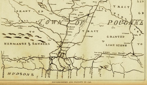
Casper’s Vly, which can be seen in the upper right hand corner of 1798 Platt map of Poughkeepsie above, was just south of the Lassen residence along Bedell Road.
The Indian names for the Casperkill were Thanakonok and Pietawickquasseick.
Fonteyn Kil
“Spring Brook. A stream now known by the hybrid name of ‘Fountain Kill.’ Its source is a spring (in Dutch a fonteyn) in Arlington, north of Main street, which in late years has been used to flood an adjacent hollow to form a skating-pond in winter. Its outlet is into Jan Casper’s Kil in the glen south of the open-air theater on the campus of Vassar College. During its course it is dammed to form the first Vassar Lake, on the west side of Raymond Avenue. Between Arlington and Jan Casper’s Kil the stream takes a long and circuitous course and is fed by a network of small meadow-runs, largely surface-water and hence sometimes dry. The purity of the spring-source of Fonteyn Kil is evidenced by the fact (known to fishermen) that trout will travel its length and avoid its tributaries. As a whole, the flat land traversed by the Fonteyn Kil and its tributaries has quicksand beneath it.”
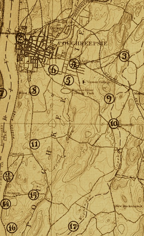
The Fonteynkill was also known as the Mill-Cove Brook, it is number 5 in the 1891 U.S. Geological Survey map below. Unfortunately the stream is not nearly as pure today as it was throughout the 19th, 18th, and early 20th centuries.
Information and 1891 map from:
Reynolds, Helen Wilkinson. Poughkeepsie: The Origin and Meaning of the Word, Volume 1. Poughkeepsie, NY: Collections of the Dutchess County Historical Society, 1924.
1798 map from:
Platt, Edmund. The Eagle’s History of Poughkeepsie: From the Earliest Settlements 1683-1905. Poughkeepsie, NY: Platt & Platt, 1905.
