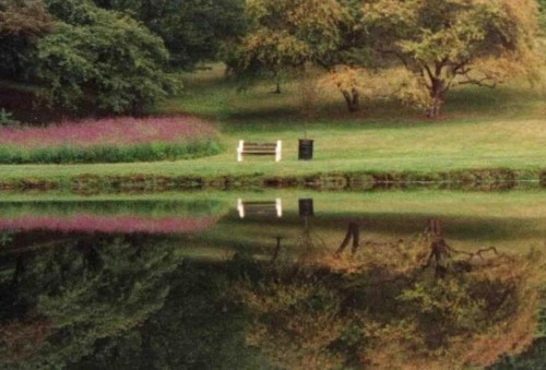
The Fonteynkill, a major tributary of the Casperkill, drains a portion of the City of Poughkeepsie. It flows from Park Avenue to Vassar Lake, then under Raymond Avenue and onto the main Vassar College campus. On campus the Fonteynkill runs between Olmstead and Skinner Halls before joining the Casperkill just south of the Sunset Lake dam.
It is hard to conceive of the space between Olmstead and Skinner Halls as anything other than an overgrown wetland. However from 1923 to 1948, when this site served as the Dutchess County Ecological Laboratory, it looked drastically different.
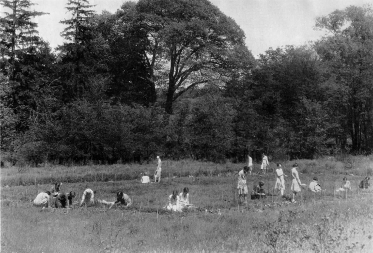
In the early 20th century this space bordering the Fonteynkill was primarily an open field of poison ivy with a few oak trees. In 1920, when Botany Professor Edith Roberts was granted four acres of land by Vassar President MacCracken and the Board of Trustees, she set to work developing the space as an Ecological Laboratory. After traipsing through “every bit of field, woodland, and bog in Dutchess County” to obtain plant specimens, Roberts and her students constructed an outdoor laboratory that included all of the major plant associations found in the county at that time.
Roberts’ motive for developing the space was to provide students with the opportunity to learn about the taxonomy, morphology, and physiology of native plants. Additionally, she wanted the Ecological Laboratory to be a demonstration of the beauty of such plants. She and her students often gave tours and lectures in order to share their knowledge with the general public, and thus expand restoration initiative throughout the county and nation. For example, Vassar students helped to organize an exhibit at the 1926 NY Flower Show where they handed out informative leaflets on how to propagate dogwood trees. Three years later, Roberts collaborated with Elsa Rehmann to write the book American Plants for American Gardens. In that book Roberts and Rehmann “presented the material in a popular manner to encourage the general public to use native plant associations as a model for landscaping around their homes and properties.”
By the 1930s twenty-eight of the thirty plant associations of Dutchess County were well established in the Ecological Laboratory. When Roberts retired in 1948 there were only three plant species, out of some two-thousand, that were not established (depending on the association [open field, swamp forest, pine, juniper, emergent aquatic, etc.] the quantity of component species [trees, shrubs, herbs, and ferns] numbered one-hundred or more).
Unfortunately the Ecological Laboratory that Roberts started in the early 1920s has transformed over several decades of neglect so that only some of the original plant associations remain. Initially the Laboratory’s position alongside the Fonteynkill was very favorable. The space offered locations naturally adapted to the different associations found throughout Dutchess County; Roberts and her students used the Fonteynkill in order to establish the stream association, the pond association, and the emergent, floating, and submerged aquatic associations. However, when Raymond Avenue was straightened and widened in 1964, much of the Fonteynkill silted in. This caused the hydrology to shift to a wetland, and thereby destroyed many of the original associations.
Photograph of Vassar students working in the Ecological Laboratory in the early 1930s
Information from:
“Outdoor Ecological Laboratory at Vassar, First of Kind in United States, Bears Most of Area’s Native Plants.” The Poughkeepsie Eagle. 5 April 1948.
Roberts, E. 1933. Development of an out-of-door botanical laboratory for experimental ecology. Ecology 14(2):163-223.
Ronsheim, Margaret. Personal interview. 2 June 2010.
Posted in Fonteynkill | Tagged Ecological Laboratory, Edith Roberts, Fonteynkill, Raymond Avenue, Vassar College | No Comments »