Feed on
Posts
comments

F clean-up 3

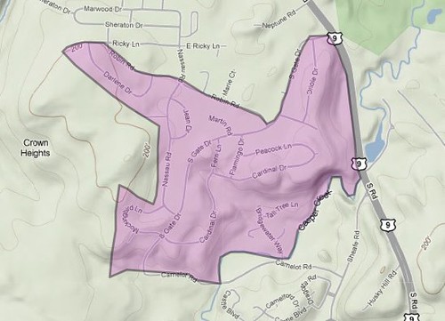
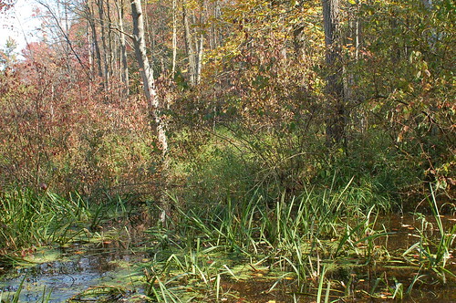
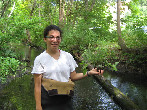
Arial Shogren, a rising sophomore at Vassar College, holds up a piece of trash recovered from the Fonteynkill during a creek clean-up.

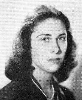
Earlier this week I caught up with Arial Shogren.  Arial has been working with biology professor Margaret Ronsheim this summer studying ecological succession in the Edith Roberts Ecological Laboratory that borders the Fonteynkill. We discussed the work that she has been doing this summer and the complications associated with managing the ecological laboratory.

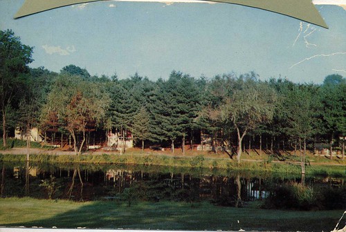
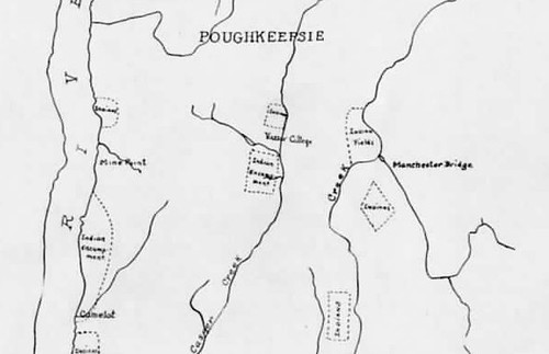
In the late 1920s botany professor Edith Roberts established a 4-acre ecological laboratory on the Vassar College campus.  By the 1930s professor Roberts and her students had planted most of the ‘natural’ plant associations of Dutchess County in the space.  Today, due to several major disturbances at the site, almost all of the original associations are gone.  Arial’s project this summer was to look at the plants that were originally in the ecological laboratory, to figure out exactly what plants are there now, and to predict what plants could potentially be there in the future via the seed bank.  According to Arial, “the soil seed bank helps ecologists predict what the trajectory of the succession of plants will be in a particular area.” It may sound complicated, but Arial told me that the procedure is essentially just to take several samples of soil from different areas you want to look at, and then grow the soil.  “You basically just put it in a big tray and see what comes up.”

And what have these big trays been yielding? Here’s Arial:

Well, right now the seed bank is predominantly purple loosestrife.  There are a lot of very aggressively invasive non-native plants.  Out of the original 11 general associations, only six exist today.  That’s due to construction, the straightening of Raymond Avenue, and the changing hydrology of the space.  So six exist, but they are changed.  Whenever you have a disturbed space—like the Ecological Laboratory or the Vassar Farm—it basically becomes a corridor for non-native species to come in.  They’re very good at it.”

Given the take-over by non-native plants, I asked Arial if there were any future plans for the space.  Are there going to be any efforts to bring back plant associations that are now missing or to control invasive plants?

Well, right now there’s already control of non-native purple loosestrife (beetles were released to help control purple loosestrife on Vassar campus and on the Vassar Farm and Ecological Preserve), so it’s not as much of an issue.  I think that Professor Ronsheim’s plan is basically to try to pull as much porcelain berry as possible, and to maybe try some other methods for the multiflora rose and possibly the honeysuckle.”

Arial told me that one of the big questions that ecologists and managers must grapple with when removing invasive species is what to plant to replace those species.  In many cases managers will plant a different native plant species just to see it eaten by a non-native bug or taken over by another non-native plant species.  Management is a constant struggle. Ultimately, it becomes an issue of coming up with a plan that preserves the space and respects its history while also working with the ways in which the space has changed.

I guess the whole premise for my project is just trying to figure out what to do with the space.  It’s a question of management…do we let the area go, or do we try to return it to what Edith Roberts planted as its ‘natural state.’  I do know that Professor Ronsheim does not just want to let the space go.  We do want to have some kind of invasive management; it’s just a matter of deciding what’s best and what’s the most time and cost effective.”

Clearly the major landscape changes and the associated influx of invasive species have created major complications for those in charge of managing the space.  However, Arial tells me that these changes have also actually provided a good opportunity to study ecological succession, in ways that Edith Roberts never imagined:

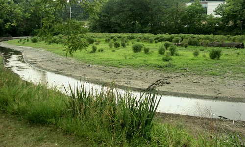
The succession really shows, especially with the change in the hydrology.  The areas that got wet with the straightening of Raymond Avenue—which used to be open field associations—have progressed so that there are more wet tolerant species there.”

Even after all of these decades, the ecological laboratory is “still an experiment.”

This is, in fact, one of the things that Arial likes so much about her project.  Knowing the history of the space has allowed her to study long-term ecological trends, and it has given her an extra sense of attachment to the project.  It’s exciting to walk through the 4-acre plot and happen upon the water spigots that students used to water the laboratory in the 1930s.  For Arial, this makes it all the more upsetting that the history of the space is not well-known:

I’m very attached to the space.  I guess it’s just because I’ve been traipsing through it and I have seen all the trash—people really don’t know or care about the area.  I mean it still is an Ecological Laboratory.  It still is a project.  I wish that it got more recognition as that.”

South Gate

Hampton Farms outline

A rough outline of the Hampton Farms property in South Gate

South Gate is one of several residential suburbs in the Town of Poughkeepsie. Now almost completely covered by housing developments, the area was once all farmland.

Up until 1941 Jim Warner’s family owned an apple farm called Hampton Farms. He still remembers what the lay of the land was like then: mostly fields and the occasional wooded hill. There were certain areas that were never plowed and remained virgin forest.  The family would sell some of the timber, but rather than allow loggers into the woods they towed the trees out themselves. Although the virgin forest is no longer there, one can still see century-old trees towering over South Gate.

Some of the buildings currently occupied by families and businesses on the north side of South Gate were originally part of the Hampton Farms infrastructure. The white barn where Jack’s Autobody now resides used to be used for storage. Apples were kept there using sawdust and ice (scraped from a nearby pond) up until they started using gas for preservation purposes. Later, the building housed a riding academy.

The Casperkill Creek, which flows through South Gate, was the southern boundary of the Hampton Farms property. Jim Warner remembers fishing in the stream as a child:

We had sunnies.  They were little fish so if you caught about a hundred of them they would make a meal.  They were little bitty fish.  It also had suckers but you didn’t get those because they were always sucking on the bottom, you know, eating dirty stuff.  They weren’t clean.  I tried to hunt musk rats because the fur on those are worth something.  I set traps and set traps, but never caught one.  I’m glad I didn’t because I don’t know how I would have gotten it out of the trap.  They fight.

Mr. Warner remembers that his family’s farm used to border other properties, including the White Head and Malady’s farms to the north and the Tilcon quarry – popularly referred to as “Stone Crusher” – to the west. Ed Lynch, another watershed resident, remembers what happened when the area began to be developed:

Of course, all those houses in South Gate were built long after the quarry started. And then these people are all up in arms when their china on the shelves rattles when they set off blasts every so often. I haven’t seen anything about it recently but there were times when there where uproars because maybe they were setting off bigger charges than they do today or maybe people got used to it. But then the thing was “Well, we were here first. This is what we do. And now you’re building next to us and complaining about vibration form our blasting?”

Another landmark in South Gate during the 1950’s was the famous chinchilla farm. Helmuth Bihn remembers what it was like:

His name was Chet Hogan.  You walk up Sheafe Road, not too far, and there’s a road that comes out called Camelot Road.  At that corner, he owned that whole corner there, and that’s where the chinchilla ranch was.  He had a big old farmhouse there, which is all gone now, of course.  I just saw some of the coops that he kept them in.  I remember as a kid seeing some, but I never really got up close.  I think he started off with only a couple of them, and they made more.  I guess maybe the breed like rabbits, I don’t know, but I understand that the fur of the chinchilla is kind of rare and very expensive.

To read more about Jim Warner and Hampton Farms, see Jim Warner: from farming to computers

Wooded Wetland

Wooded Wetland near Bedell RdWooded wetland between Bedell Road and the FICA landfill site.

The land area in the upper portion of the Casperkill watershed is primarily wooded wetland—a forested area with water or wet soil found along the edge of a lake, river or stream—with limited residential and commercial development.  Wooded wetlands are important for a variety of reasons including:

–  Flood and Storm Water Control: Wetlands absorb and slow down the movement of rain and melt rater, minimizing and stabilizing water flow.

–  Surface and Ground Water Protection: Wetlands often store and infiltrate rainwater to the underlying groundwater system.

–  Erosion Control: Wetlands store and infiltrate water, reducing runoff and flooding hazards downstream.

–  Pollution Treatment and Nutrient Cycling: Wetlands improve water quality by absorbing pollutants, reducing turbidity, and breaking down and recycling organic materials back into the environment.

–  Fish and Wildlife Habitat: Wetlands are one of the most productive habitats for feeding, nesting, spawning, resting and cover for fish and wildlife, including many rare and endangered species.

–  Public Enjoyment: Wetlands provide areas for recreation, education and research. They also provide valuable open space, especially in developing areas like the Casperkill watershed, where they are some of the only green space remaining.

Unfortunately, the importance of wetlands has come to light only recently.  Before the 1970s, wetlands were often considered nuisances; places that were too wet too develop and therefore good mostly for dumping trash.  Mary Ann Cunningham, a geography professor at Vassar College, told us “it was pretty typical to throw junk in a stream.”  She showed us 1936 aerial photographs of the Casperkill watershed, pointing out how the FICA and Brickyard Hill landfills were both initiated in wooded wetland. In fact, the FICA landfill actually filled in the wetland so much that it displaced the Casperkill by 20 meters.

In 1975, the New York State Legislature passed the The Freshwater Wetlands Act (PDF, 129 kB) to “preserve, protect and conserve freshwater wetlands and their benefits, consistent with the general welfare and beneficial economic, social and agricultural development of the state.”  The act protects wetlands larger than 12.4 acres, although smaller wetlands can be protected if they are considered of unusual importance. The following section of the act (Title 7 §24-0701) explains which activities are regulated:

Activities subject to regulation shall include any form of draining, dredging, excavation, removal of soil, mud, sand, shells, gravel or other aggregate from any freshwater wetland, either directly or indirectly; and any form of dumping, filling, or depositing rubbish or fill of any kind, either directly or indirectly

(…) These activities are subject to regulation whether or not they occur upon the wetland itself, if they impinge upon or otherwise substantially effect the wetlands and are located not more than one hundred feet from the boundary of such wetland.”

The U.S. Army Corps of Engineers (ACOE) also protects wetlands, irrespective of size, under Section 404 of the Clean Water Act.  Although the ACOE definition of wetland is slightly different than the state definition, the Clean Water Act protects basically the same areas as the NYS Freshwater Wetlands Act.

The FICA landfill was ultimately cleaned up after a federal civil lawsuit was brought against the operators of the site in 1987 for violating the Clean Water Act and causing harm to the wetlands surrounding the Casperkill.  Although the laws protecting wetlands have certainly gotten better over the years, there is still more that can be done.  First, you can encourage state and local governments to enforce the acts and to establish programs to effectively protect smaller wetlands (remember that the NYS Freshwater Wetlands Act only protects wetlands that are larger than 12.4 acres).  Second, if there is a small wetland going through your property, try to maintain a buffer and limit pesticide, fertilizer and road salt use.

For more information about the Freshwater Wetlands Act, visit the NYS Department of Environmental Conservation website.  The Regulated Activities webpage contains more examples of regulated activities and those exempt from wetland permits.

For more information about federal statues governing wetlands in the United States, visit the EPA website.

Photo credit:

Chris Freimuth, Fall of 2006

Cliffdale Estate
Anyone who has ever gone along Boardman Road will have seen the attractive “Cliffdale” estate. Also known as the Kenyon House, the estate is currently occupied by the Poughkeepsie Day School.

The impressive 23-room house was built between 1909 and 1913 by the famous raincoat and tire manufacturer Clarence Kenyon. After his death, the property was inherited by his daughter Helen Kenyon, Vassar graduate and chairman of the Board of Directors for the college for ten years. In 1944, the property was purchased by IBM in order to accommodate a modern research and engineering laboratory.

Phyllis Teasdale, also a Vassar graduate and resident of Boardman Road, told us what she remembers of the Kenyon House before it was bought by IBM:

It was where they lived; it was the homestead of the Kenyon family. He was an industrialist and he manufactured something that I think was needed in World War I, so he made a fortune that way. They built themselves this very fine mansion. And all the land around it – you may have noticed, there’s a whole complex of yellow stucco houses— that’s where the chauffeur lived and livery stables and maids’ quarters and that kind of thing.

Helen Kenyon was very fond of my older sister and asked her if she would like have her engagement party on the porch, and why not? It’s a beautiful house. We were a little distressed when IBM bought and we thought, “oh dear, are they going to turn it into an office complex?” But they at least left the exterior and much of the interior intact. And then, of course, the Poughkeepsie Day School took it over, so that one house has had quite a history.

Boardman Road stone pillars

Before it started to be developed in the 1950’s, Boardman Road served as the entrance to the Kenyon estate. In fact, you can still see what remains of the stone pillars that supported the gates halfway down the road. Chris Teasdale, Phyllis Teasdale’s son, told us what became of another set of pillars:

There were two at the entrance of 376, but the County or the City must have knocked them down for road improvement. But you can still see the stone pillars right before you get to what was IBM and is now Our Lady of Lourdes [High School]. They were grand stone pillars. Recently, the one on the east side was knocked down by the City because one of the residents said there was a sight distance problem for vehicles.  He thought that they would move the pillar but they came and knocked it over. And two years later they moved the road, so they didn’t even have to knock it down. But you get a sense that these were massive stones of the old, grand stonework.

David Page also grew up on Boardman Road. He remembers that, at the time, the area was still surrounded by pastures:

On Boardman Road there were three houses in a circle and one of them was my father’s, one of them was a machine shop with some people living upstairs, and one of them was where the tractors and things were.

Just to the west of that were IBM’s cattle.  At the other end of IBM’s cattle were Vassar’s heifers.  As a youngster I had to get through these two pastures to get to the creek.  I was afraid of those cattle because when they saw you they’d run up to you.  I didn’t know that they probably weren’t going to do anything.  So we had a lot of adventures getting past them.  We’d wait until they weren’t looking.  There was also a cabin there, a Vassar cabin with a horse trail that went to it.

Years later, in the 1960’s, Chris Teasdale remembers sledding on the hill next to Spackenkill Road that was once all pasture. “When you’re little, everything is so much bigger,” he recalls. “This was like an Olympic bobsled course.”

Ed Lynch, another watershed resident, also spoke of sledding on that hill. Apparently, it is now owned by the Assembly of God church, which has controversially planned to build a “monster church” there.

Information from:

Poughkeepsie New Yorker, IBM Buys Kenyon Estate, “Cliffsdale, July 1, 1944

Image from:

Ghee, Joyce C. and Spence, Joan. Poughkeepsie, 1898-1998. A Century of Change. NY: Arcadia Publishing(Sc), 1999

Phyllis Davison Teasdale '43

Phyllis Davison Teasdale graduated from Vassar College in 1943

Phillys Teasdale is 87 years old. Having spent most of her life in the Casperkill watershed, Mrs. Teasdale has many fond memories of events and locations along the Creek.  Her son Chris grew up on Boardman Road, where he remembers playing in the big playground that was the Casperkill and its surroundings. Chris and Phyllis Teasdale shared some of their favorite memories with us.

Phyllis Teasdale was born on Fulton Court in 1922. During her childhood and early youth, Mrs. Teasdale remembers visiting the Kimlin Cider Mill on a regular basis:

They had what they called a museum in the back room.  It had a hodgepodge of things, and one of the things was a two-headed calf.  I was absolutely fascinated by it.  Of course when I was young I’d say, “Mommy, why are those calves dancing?” because they were connected all the way down the side.  Then, when I figured out that it was just a freak of nature, I was a little bit turned off, but not enough to not want to go see it every time we went to the cider mill.

But, primarily, we went there for the cider.  The cider was just fantastic.  In those days they put everything that fell off the tree along with the apples into the cider; they didn’t pasteurize it or anything.  It was just wonderful.  We’d take our jug; you had a Kimlin’s jug.

Between 1939 and 1943, Mrs. Teasdale attended Vassar College.  Like so many other Vassar students before and after her, she enjoyed many a fun moment on Sunset Lake:

We used to skate on Sunset Lake.  There was a shed on the west bank with benches.  We’d sit there and put on our high skates and lace them up and go out on the lake. After I was out a few feet I’d be on my bottom.  But it was a lot of fun.  I remember playing with –the President of the College was Henry Noble McCracken, and he lived in the President’s House with his family, and the oldest son was Calvin. And, of course, I worshipped him because he was my sister’s age.  Calvin McCracken would be out there and we’d play Red Rover.  “Come on over, Red Rover, Red Rover,” we’d have to skate through and they’d have to stop us, or whatever it was; I don’t remember.  All I remember was that (in a dreamy voice) Calvin McCracken was there.

In 1960, Phyllis Teasdale moved to Boardman Road with her husband and children. The first houses along Boardman had been built in the 1950’s; before that, the road had served as the entrance to the Kenyon estate. Even in the 1960’s, the area was not yet fully developed, which made it an ideal place for children. Chris remembers playing football in the farm fields next to Spackenkill Road and riding his bike on the IBM parking lots. He also remembers skating on a small pond along Boardman Road:

Phyllis: We used to call it Reynolds pond because the Reynolds lived there.  All the neighborhood kids, as soon as it froze over, which was pretty early since it was small, would zero in on Reynolds pond.

Chris: It was big for hockey and skating.  The houses on this road were built in the 1960’s, right in the Baby Boom era, so there were lots of kids; there were probably about 15 or 20 kids, all the same age.

Chris Teasdale Casperkill

Chris Teasdale paddling the Casperkill in 1961

The Casperkill itself was a source of entertainment for Chris and his young neighbors. The stream flows right through the backyards of several houses on the west side of Boardman, including the Teasdales’, so Chris and his friends would take little one-person paddle boats down the stream. Sometimes they even boated on more sophisticated vessels:

The neighbor, Mr. Taylor, built a significant raft made out of two 50 gallon oil drums with 10 gallon gas cans, and the whole thing was welded together.  Boy, you could not tip that thing if you tried.  It was a significant regatta kind of thing.  We could paddle up a quarter of a mile and then down to the culverts below Zach’s Way.

Chris also remembers the Casperkill on Vassar campus:

As a kid, I would ride my bike along the creek starting on the other side of 376 and going onto the Vassar property.  My recollection is that it always got a little industrial as you got into where the power plant was because there would be coal cinders.  It always just felt…I don’t know what the word is, but it wasn’t the play place of just sort of outdoors: trees, grasses, all of that kind of stuff.  There were cinders and I imagine that there was stuff seeping into the creek right there.

He also told us about a very special spot on the Vassar Farm; a treeless hill. At the top, he believes there must have been a sheep farm:

As you go into the Preserve there’s a jog in the road and there’s the rugby field.  That hill was completely denuded of trees except for three trees at the top. Three tree hill.  And you could find old goat skulls as a kid.  Even then, in the 1960’s, it was old. The goats and sheep were no longer there, but the forest had not come back yet.  At the end of the road on the Preserve there was an old barn and an old house and we called it the haunted barn and the haunted house.  There’s still a well over there.

A lot has changed in this area since the 1960’s. Mrs.Teasdale has seen developments take over much of the green space that once surrounded her home on Boardman:

The older residents did kind of resent the developments.  Now we’ve gotten used to it like you get used to it.  We say, “oh well, let them eat their cake in their fancy houses.”  But I will say this…I used to be a schoolteacher, for much of my career I taught junior high—which, if you can remember your junior high days is the absolute pits—so I’d have what I would consider a rough day and I would come home and come up Raymond Avenue, turn onto 376, and as I turned onto Boardman Avenue, I’d feel the cares of the day just wafting away.  There were lovely trees.  But Boardman Road was just sort of a peaceful place to come to.  And I haven’t lost that feeling.  I still like to turn into Boardman Road.

For more stories from the Teasdales, see The Kenyon Estate and Boardman Road

Images from:

Vassarion 1943, Vassar College Yearbook

Chris and Phyllis Teasdale’s personal collection

Hagan Farms

Hagan farmhouse
The original Hagan farm house still stands.  The unique architecture of the building distinguishes it from the other houses in the neighborhood.

From the 1930s until the 1950s the area that is now the Spackenkill neighborhood, or Hagan Town, was the property of Hagan Farms.

Jim Warner, who worked at Hagan Farms in the early 1940s, told us that Hagan started Hagan Farms with the money he made putting in roads for the World’s Fair in New York City.  In addition to being a model farm with prize-winning Guernsey cows and beautifully tiled barns, Hagan Farms was also an exotic zoo with buffalo and other animals.  By the early 1950s, Hagan Farms lost its status as a model farm and Hagan sent all of his Angus cattle from Poughkeepsie down to South America, where he started a new farm.  In the early 1960s, IBM bought the land to make subdivisions.

Jim Warner and several other people that we have interviewed remember visiting the Casperkill as it flowed through Hagan Farms.

When asked about swimming in the Casperkill, Jim remembers one spot that he and his friends always went to:

At Hagan farms they had a mill—a grist mill—along the Casperkill, with all wooden gears.  I’d never seen it really used, but just beyond the grist mill there were some trees with some ropes set up and you’d go out and drop yourself.  It wasn’t in over your head; it was just some place you’d go down and swim and whatnot.  We’d go down there.  I remember one time and it scared the heck out of this guy.  There was a black snake going across the road and he stepped on it.  Well when you step on them, they move.

Kathi Bihn used to ride her bike to Hagan Farms from her house:

It was all open.  You could ride bicycles down because it was all dirt roads. When we were kids we found this old barn by the Creek.  We climbed up inside of it.  There was a chest and we opened up the chest, and inside there was Confederate stuff in there.  We got really spooked and ran away because we had no business being up there (…) They had this bridge that went over the stream, and it would have these—like in caves, those things that hang down—stalagmites.  It was the coolest thing.  The smell…I can still smell it.  There was just a fragrance that came from the stream and those things hanging down.  It would be hot, hot, hot, and we’d ride our bicycles down there and sit by the stream underneath the bridge.

Today, Karen Blonder and her husband live right next to the same bridge:

I’m living here now 38 years.  My kids grew up on the Creek and we had heard that the bridge across the stream was the shortcut from Hagan Farms, and the cows used to cross over this bridge to go to the pastures by Pasture Lane and the barn: there was a barn up on Hagan.  This was like a cow path, and now it’s the path for kids to cross to go to school.  My kids used to play back there and there was an island, which has now eroded and dried up.  When they ran away from home that’s where they went, or if they were playing pirate, or having picnics, or whatever.  I remember my son had to do a project for school on a religion so he and his friends did the druid religion and went out to the island there and set up torches. Somebody called the police.

(…) We have all kinds of animals there.  We have snakes, we’ve seen possum, fox, woodchucks, raccoons.  We have eight deer living back there; we see the same ones every year.  We have the ducks from Ron Lipp’s house that swim down here.  For a few years the Creek appeared to be very dirty.  People had thrown things in, and you’d see the foam.  I haven’t noticed it recently though, so I don’t know if it’s cleaner.  We walk along there all the time with the dogs.  It’s just pretty.  It’s a nice place if you have time to just go out and look at it.

Hagan Farms bridge

The bridge over the Casperkill once led up to the original Hagan farm house.  Today the bridge connects the backyards of Old Mill Drive and Casperkill Drive.

For more stories about the Casperkill in the Spackenkill neighborhood, check out these previous posts:

Interview with Ron Lipp, watershed resident

Fran and Frank Hartenfels enjoy wildlife, battle flooding and erosion

Old Farms Road

Old Mill Drive Homeowners Struggle with Sewage and Deer Along the Casperkill

The Casperkill at Hagantown Park (40 Millbank Road)

Hampton Farms house

This house, now a law office, was the main farmhouse at Hampton Farms

Jim Warner is 80 years old. He has lived his whole life in Poughkeepsie, so he remembers the transition from agriculture to industry that took place within the Casperkill watershed over the course of the 20th century. Mr. Warner himself was part of that transition, having grown up on a farm and spent the majority of his working years at IBM.

Jim Warner’s grandfather was a wealthy lawyer in New York City. He owned a property named Hampton Farms in Poughkeepsie, and would ride the train up regularly to supervise its operation. At the beginning, the farm was engaged in the boarding of horses, but this did not last long. Mr. Warner told us about the early transitions on his family’s farm:

My grandfather bought the farm with the idea that we would board New York City horses up there.  So he bought the barns and everything and set them all up.  When it came fall, the time for horses to come up here, [the owners] didn’t let the horses come because they wanted to keep an eye on them.  The horses were a big asset to them and, if they got sick – you’ve got to make sure to get some kind of care– the care was down there.  So that never worked out.  Just to give you an idea of how eccentric he was: he equipped it for cows because he had the stalls, so he just put the silo in. One of the guys said: “You realize with cows you’ve got to work on them seven days a week, you don’t get any time off.”  And he said: “I don’t want my men working on Sunday.”  So we planted apple trees and that’s how it became an apple farm. This all happened within the course of three years.

In 1929, with the stock-market crash, Jim Warner’s grandfather lost everything and was forced to move to Hampton Farms. His father quit college and came to Poughkeepsie to run his parents’ farm:

From 1929 to 1941, he was able to run the farm.  We paid all the bills and whatnot.  On the farm, my grandfather and grandmother had the big house and my two aunts lived in the two houses there.  So essentially my father ran the farm and supported all these people.  He did a fantastic job and kept us goin’ good.

Jim Warner himself started working on the farm at the age of two. At first, he was only in charge of feeding the chickens, but soon he was given more important tasks:

[My father] let me drive the tractor.  I was five years old and I had to spray the trees early in the morning before the wind came up because that just blew it all over the place.  And when the farmhand didn’t show up, who was supposed to drive the tractor? “I guess you’re going to drive the tractor.”  So at five years old I’m sitting up there driving the tractor all over the place.  From then on I had it made. The tractors, you had to crank them.  I was not allowed to crank them because you’d break your arms if they kicked back.  But, for all the people who worked for my father; I was the boss’s son.  If I wanted something started, ”Can you start this for me?”  “Sure, Jim, we’d be happy.”

In 1941, Hampton Farms went bankrupt. Jim Warner’s father went to work at IBM and Jim himself went to neighboring Hagan Farms:

I started there when I got my working papers; I was either 12 or 13.  That was a model farm, a beautiful farm.  It had brand new a tractor. They used to simoniz the tractors, because they could write it off in their taxes.  So it was a beautiful farm.  He hired me and he says, “OK, go out and mow the lawn.”  I said, “I don’t want to mow the lawn, I want to work on the farm.”

My job was to cultivate the corn.  They couldn’t get anybody else to do it.  We had one older guy and he’d go out and fall asleep.  The tractor would hit the stone wall and the front wheels would go over the fence, and they had to go get the bulldozer to go get it out of there.  So I did that, but then I got a little concerned because I was getting heavy and the girls weren’t looking at me.  I didn’t like that.  We didn’t have any girls on the farm, but I wanted the girls that were around to look at me, so I said I want to put the bales of hay up. Well, boy, you were rugged with that.

After high school, Jim Warner left Hagan Farms to do an apprenticeship at IBM:

When I graduated from Wappingers [High School], I applied for an apprentice tool-making school at IBM, making dyes and fixtures, things like that.  I eventually spent five years in the apprentice program.  That fit me perfectly because I grew up on a farm and we did everything on the farm ourselves.  You had to be self-sustaining on the farm.  But I was in there just eleven months and Uncle Sam says, “I want you.” I got drafted and they sent me down to Fort Monmouth to learn about radios and TVs, and to Huntsville, Alabama to work with guided missiles.  And I ended up for a year and a half teaching the computer systems on the guided missile systems. That was in 1951.

After the army, Jim Warner went back to IBM. He worked there for a total 38 years. He is very thankful to IBM for training him and giving him the opportunity to do what he liked.

I really made out like a bandit. I got my education from the IBM and the army.  And I loved to play with that stuff because as a farmer I used to be the expert tractor and truck repairman.

With a sharp memory and a witty mind, Jim Warner has many stories to tell regarding the changes he witnessed throughout his life. When asked what it has been like to experience so many transitions, he says, “I’m glad I’m not going to live for 150 years.”

The Hampton Farms property was bordered by South Gate Drive, Camelot Road and Sheafe Road. The entrance was at the intersection of South Gate Drive and Route 9.

For an overview of land-use changes and development in the Casperkill watershed, see Harvey Flad on the history of the Casperkill Watershed

The Rochambeau Pond

Rochambeau Pond
Vinnie and Helmuth Bihn grew up on Rochambeau Road. Their parents owned a motel there, along with a pond created by damming the Casperkill. Although the dam is no longer functional and the pond has all but dried up, the Bihns still remember what it was like when the pond was deep enough to fish and skate in. Helmuth, Vinnie, and his wife Kathi shared their memories of the Rochambeau pond with us:

When was the pond built?

Helmuth Bihn: The dam was built by people by the name of Perkins. In fact, they call this the Perkins Holdings. They owned everything around here. It was called the Perkins Dam Property originally.

Vinnie Bihn: I had a book of the Hudson Valley School of Painters and it had a map in there; it was from the 1800’s, and it showed the Perkins property.

What do you remember about the pond?

Kathi Bihn: I remember my parents, younger sister and I coming to skate in the pond. They used to have bonfires and there were places you could sit. It was packed with people.

VB: We used to clog up Route 9. People used to park on Route 9 to go skating. It was actually a bit of a traffic hazard. And we had the spotlight at night. My father mounted a spotlight on an old tree to shine over a section so people in the motel and people in general could skate. It was a community gathering place.

And it froze every year?

VB: Oh, yeah. The water was deep. It was basically two or three feet all the way around and maybe 10 or 12 feet at the dam. It would get so thick that we used to be able to get a tractor and plow off the snow.

How long ago did people come to skate here?

KB: Back in the 50’s.

VB: And into the early 60’s. The pond was still there after that, but we didn’t own it anymore, [the new owners of] the motel owned it. They didn’t want to get involved with lawsuits so they wouldn’t allow anybody to skate anymore. And the whole thing changed, you know: video games, TV and whatever. Going out to the pond to skate wasn’t even an option anymore. But it was a wonderful time, you know. It’s hard to describe, but all these families were out there.

HB: People always used to ask me when I was a kid: ‘Helmuth, is the ice thick enough yet?’ Usually right around Thanksgiving.  Now, you don’t get ice until almost Christmas.  Anyway, most of our skating was in the area we called ‘the cove,’ that would be the area around the pool; on the other side of the pool.  Then eventually it all froze.  Of course in the so-called ‘old days’ you didn’t have anything to do: television was in its infancy; there was no place to go, you either had to take a bus to the city of Poughkeepsie or a car to the theatre.

VB: One night, somebody needed fodder for the bonfire, and my parents had patios in some of the motel units with wooden furniture. And we lost some of it. My father wasn’t real happy about that.

There used to be a tree over there, a blue spruce, that we put lights on. That thing must have been fifty feet tall and it would reflect down on the ice.  It was beautiful. And there used to be a little island out there with a big weeping willow on it. It was a great place to grow up. The neighborhood was pretty limited. But I used to spend most of my time in the [Brooklands] farm next door.

That pond, when it was deep, was loaded with bass. I used to live out there with my fishing pole. It was loaded with bass, sunfish, perch, catfish, eel

We also used to spear suckers. In the late winter or early spring. You had to wait for the creek to settle down a little bit.  You’d go out with a flashlight and you had a broom handle and a spear on the end of it with about four or five prongs.  And with the flashlight you would see them, and then you’d spear it.  They were good sized.  I took them home and cleaned them all, the first time, I had about 18 of these things.  I filled the freezer with them.  Wrapped them in aluminum foil.  And I kept one out to eat it.  I took about three bites of the fish.  Oh, boney.

KB: My biggest thing with the pond was the day my son went through the ice when we were skating on it, and I had to get him out.  That’s the thing I remember most about the pond.  That was about 25 years ago.

VB: It was still deep enough then that you could fall through it at the channel and a kid could not touch bottom.  It was still a decent pond when Kathi and I moved back here.

KB: It was; the kids used to be able take their sleds, go down, and then shoot across the ice.

VB: Back in the olden days, if conditions were perfect—and that didn’t happen very often—we used to start way up at County Club Estates, which is hard to describe but it’s almost a half mile away. We’d come down the old farm lane on our sleds through a couple of treacherous turns, come down through the barnyard, shoot out and come down the road, and then onto the ice all the way to the edge of Route 9.  The whole thing was about half a mile and very few people ever made it.  That was the challenge: to make it to Route 9, because you would probably wipe out before.  You only made it once or twice because the walk back was… I remember one time when it snowed and then it rained and froze. Man, it was perfect.  You would fly.  Except that going around the turns was tough.  The drifts would get so big over at the farm—since it was all open back then—that [my childhood friend] Katie and I used to dig tunnels and make little rooms in the snow.

Rochambeau Pond in July 2010

The Rochambeau pond in July 2010

To read about the Bihn family’s motel, see The Rochambeau Motel

Ralph T Waterman bird club

On Saturday I joined the Ralph T. Waterman Bird Club on one of the five bird walks that they are leading for Dutchess Watershed Awareness Month.  The walk was at the Vassar Farm and Ecological Preserve, which is one of three places that the Club frequents in the Casperkill watershed (the other two locations are the Vassar College campus and Peach Hill Park).

The members of the Bird Club were eager to share their expertise with a newcomer like me, so I was quickly overwhelmed by information and bird vocalizations to remember.  For example, the Kingbird’s genus name is Tyrannus, which can help you remember that they are fierce fly-catchers that aggressively defend their breeding territories.  Another bird, the Eastern Towhee, has a call that sounds strikingly close to “drink your tea-ee-ee-ee.”  Throughout the morning we saw Indigo Bunting, Wood Thrush, Song Sparrow, Phoebe, Killdeer, Catbird, Barn Swallow, Kingbird, Yellow Warbler, House Wren, Gold Finch, Black-Billed Cuckoo, Red-winged Blackbird, Flicker, Mockingbird, Robin, Morning Dove, Pileated Woodpecker, Common Yellowthroat, Eastern Towhee, Green Heron, Downy, Cedar Waxwing, Blue Jay, Field Sparrow, and a Red-Tailed Hawk.

After the walk, I had the chance to catch up with the president of the Bird Club, Maury Lacher, and his wife Miriam.  The Lachers moved to Dutchess County in the 1970s, and we spoke about how they got into birding.

Miriam Lacher:

When I was a young girl my father put peanuts in my hand to attract the chickadees at the Botanical gardens, right outside of the rock garden in the Bronx.  He took me on other walks and because I was a good girl I got a set of bird cards that Arm & Hammer gave to schools and I kept those (…) When we (Maury and Miriam) met as undergraduates we didn’t take ornithology classes because we didn’t have a car.  But when we went to grad school we had some friends who were also interested in bird watching and we got to go to Point Pelee, which is the lowest point in Ontario, Canada, and funnels through the great lakes.  There’s a narrow point where Ontario gets close to Ohio, and the birds funnel through that during migration.  It’s marvelous, all this shower of birds.  So we got to see this in graduate school and we were hooked.  By then my dad had gotten us a pair of binoculars (…) When we joined the bird club here, there were people who knew more then we did.  With all those pairs of eyes and all that knowledge, we were able to learn a lot more.”

One of the best things about birding is that it is not that difficult for people to get into it once they start going out with more experienced birders. “People get so excited about birds!” Miriam told me.  One time, when the couple went to an American Birding Association meeting in Southern California, they even got the bus driver  hooked. “He started seeing things that we hadn’t seen. I kept telling everyone that we had to tip him enough so that he could get decent binoculars.”

And once you are hooked, says Maury, “it makes you a conservationist.”

The thing that’s sad is that over the years that we’ve been doing this, there are a lot of birds that have declined; you just don’t see as many anymore (…) I think there’s been a reduction of night hawks, we only see them in migration now.  There have been Wood Thrush and Meadowlark declines.”

There have also recently been more problems with non-native introduced birds.

Eastern Bluebirds have been declining due to European Starlings and House Sparrows (…) Other birds are in danger because of the Cowbirds (…) There’s also been a general trend of southern birds moving north over the years.  For instance, Mocking Birds and Cardinals used to be southern birds.  In the 1970s we started to see them.  Carolina Wrens have moved up here, they’re among the latest.”

Seeing rare birds is exciting, so trends like these make birders more likely to want to protect green spaces—and especially wetlands—from development.  In the Casperkill Watershed in particular, preserving wetlands is highly critical for bird diversity. For example, the Brickyard Hill wetland was once a fruitful birding destination until shopping centers were built there in 1965 and 1975.  Maury reminded me a number of times that “birds are habitat-dependent.  Although some of them are generalists, there are many birds that are attracted particularly to wetlands.  Some obvious ones are Red-Winged Blackbirds, Bitterns and Herons.”

Despite destruction of habitat, and increasing numbers of introduced generalist birds, the Lachers made sure to emphasize that the bird declines are not a hopeless situation.  The creation of the Vassar Ecological Preserve is encouraging.  And the big Osprey and Bald Eagle comebacks following the ban of DDT are good examples of the resilience of many birds.

If you are interested in joining the Ralph T. Waterman Bird Club for any of their bird walks (I highly recommend it), visit their website.  The club goes out every Wednesday and every other Saturday.

Lucy Johnson at Maple Grove
Professor Lucy Johnson at the U-puku-ipi-sing site

Last Friday, as part of Dutchess Watershed Awareness Month, archeologist Lucy Johnson of Vassar College led a walk-and-talk to a very special place in local history. She took us to the spring, known as U-puku-ipi-sing, which gave Poughkeepsie its name. Although it is not located within the Casperkill watershed, the history of this site sheds light on the role that local springs and streams, such as the Casperkill, may have played in the lives of Native Americans. Lucy Johnson spoke about the importance of the Hudson River and its tributaries for the Valley’s earliest inhabitants:

The Hudson River has been a major artery of traffic for the past five to eight thousand years.  The Hudson had a real advantage for Native people whose only way of powering their boats was to paddle, which is that it runs both ways. The people living along its shores clearly understood that when the tides were running in, they could go upriver easily and when the tides were running out, they’d go really fast downriver. But there was a problem with that. A little south from here the water is brackish and therefore not drinkable. That means that all of these side-watersheds that feed into the Hudson were extremely important because they brought down fresh water, and therefore Native Americans could drink from them. They were also important because they provided access to the interior, so people could go up the Casperkill or the Fallkill and into the prime farmland.

Apart from facilitating access to farmland and freshwater, the tributaries also provided attractive habitat for wildlife and vegetation. The Native Americans made good use of these natural resources. They adapted streamside plants, such as cat-tails, elm bark, native hemp, and cedar bark to the construction of buildings and making of materials like mats and bags. The berries and fruits that grew along streams were also a good source of food, as were the deer, raccoons, beavers and other creatures that lived on the stream banks.

The U-puku-ipi-sing spring, however, had a very particular role in the lives of Native people in this area. It feeds a small creek that eventually flows into the Hudson River (starting at what is today the Maple Grove estate and running through the Poughkeepsie Rural Cemetery). Lucy Johnson explains why this small watershed, with a name that translates as “little reed house by the water”, was so important to the Native Americans:

You may or may not know that Route 9 is an old Indian trail. This road that goes all the way up the East side of the Hudson has been here since before the arrival of the first Europeans. It was a well-worn, well-used trail by the Native Americans.  If a group was hiking that trail, they may not have wanted to camp by the river, particularly if it was a period of tension between different groups of Natives. So they could come very close to the trail, but stay down here by this nice source of fresh water. Another translation that I have heard of U-puku-ipi-sing is “meeting place.” It also may have been a place where people from the river tribes and the inland tribes met to negotiate and trade.

The U-puku-ipi-sing watershed is too small to be navigable. Therefore the Natives didn’t have to worry about people coming up from the Hudson—even an itty-bitty canoe wasn’t going to make it up that stream —as they did if they were on the Fishkill or the Wappingers or even the Fallkill or the Casperkill. So, this would have been a really nice place as a temporary camp. And all of the names that we have for it suggest that it was a temporary camping place along the river. Then, obviously, the Dutch found it and collected the name and named their settlement that they put a little upriver from it Poughkeepsie, which seems rather strange since it’s between the Fallkill and the Casperkill. You’d think they would have named it after either of those. But this was probably the place where the Dutch came to trade with the Native groups and that might have been why this little spring gave its name to the City and Town that we live in.

Native American Site Roberts Map selection
Many years ago, Helen Wilkinson Reynolds, former County historian, and Edith A. Roberts of Vassar College, also wrote about Native American presence in the area.  In their 1938 book, The Role of Plant Life in the History of Dutchess County, the authors included a map highlighting the various Indian encampments that may have existed in the County, noting that:

…. a typical Algonquin site is a gently sloping knoll at the junction of two streams. These sites in Dutchess County therefore are typical. The areas that were occupied then are still under cultivation today and show that the white settlers of the County agreed with the Indians in the selection of areas for development.

Hence, it is not surprising that the map shows two Native American camps at the junction of the Casperkill and Fonteynkill creeks, where Vassar College is located today.

To read more about pre-20th century history of the Casperkill watershed, see Harvey Flad on the history of the Casperkill Watershed

Information and map from:

Roberts, Edith Adelaide and Reynolds, Helen Wilkinson. The role of plant life in the history of Dutchess county. New York: Lansing Broas Printing Co., Inc., 1938, pp. 11-21

« Newer Posts - Older Posts »

Social Widgets powered by AB-WebLog.com.