Feed on
Posts
comments

A Visit to Whitman Land

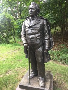
People think of John Burroughs as a writer whose acclaim is lost in time. Unlike his contemporary John Muir, Burroughs observed the subtleties of the East, imbued more with finery than with drama, and spoke to a cosmopolitan audience. Muir, remembered today as a patriarch of environmentalism, captivated a nation with politically charged rhetoric and images of grand natural temples in the West, thus giving language to finalize America’s manifest destiny and consecrating vast “open” spaces within the American identity. Burroughs wrote in a tenderer tone with human appeal; “love is the measure of life,” he says, and intimacy with nature offers “an inexhaustible storehouse of that which moves the heart.”

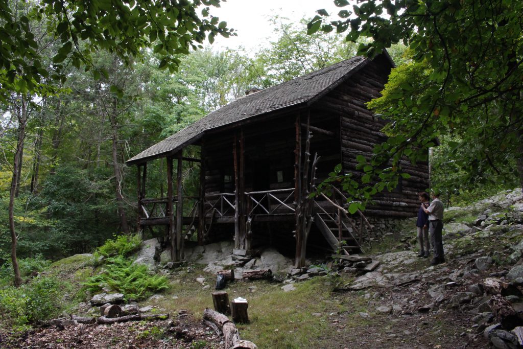
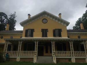
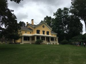
An exterior view of Slabsides.

Burroughs, more than Muir, gave Americans a new way of thinking. With his nature essays, Burroughs aroused a previously untapped curiosity toward the environment and its beauty. Though Burroughs is not widely remembered by name, his legacy is trusted by anyone who urges that people open their eyes to the world around them.

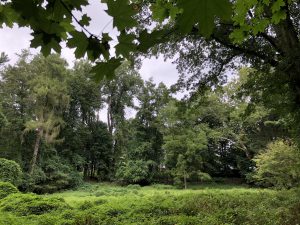
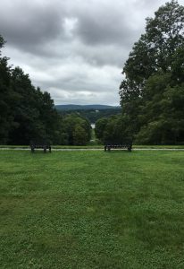
Slabsides is a place where I yearn to spend more time; to steep and to observe, to lose some cares. Working alongside and listening to Burroughs’ great-granddaughter Joan, I wanted to ask about her earliest memories of the place. What does it mean to her? What is her vision for it? – this “Whitman Land,” as Burroughs affectionately dubbed it after the poet whom he much admired.

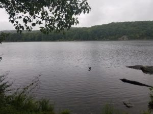
A young teacher from the rural Catskills turned clerk at the US Treasury in Washington, DC, Burroughs encountered Walt Whitman. What the poet told him Burroughs took to heart. “Write what you know,” Joan recounted. And so Burroughs began to write of his place in the world. Around him, society transitioned from agriculture to manufacture; Burroughs could have watched from Slabsides the commerce sailing between wharves on the Hudson. For all his isolation, Burroughs was keen to listen and build trust. He understood the danger of enmity with hunters and loggers, and he treasured guileless youth above all.

Standing in the cabin at Slabsides, darkness draws attention to the windows and the forest outside. One window, festooned with books on shelves all about its frame, lets in an arm of light that comes to rest on Burroughs’ old straw hat. In the uncommon stillness of the place, it feels as though Burroughs has just left, descending the steps between the cedar posts for a long walk in the woods.

John Burroughs’ desk.

This past Friday our course visited Maple Grove and Locust Grove, two historic sites of the Hudson Valley. Although they are both places of significance, their management and upkeep differ greatly.

Maple Grove is funded by the NY Environmental Protection Fund, paid for by the public’s tax dollars. Previously home to a wealthy banker, the large yellow estate is surrounded by land that was previously utilized for farming, though now several trees and shrubbery have grown throughout the land, obscuring what used to be a clear view of the landscape. Though this property used to be of great value, someone hoping to demolish the house and create space for condos set fire to the house in 1985. Because the fire has made the building so expensive to renovate, plans to fix it up have been progressing quite slowly over the past few years, and the manor’s interior is closed to the public due to safety regulations. Beyond this information, not much can be gained, as there are no tour guides or placards to educate the public about the site.

Maple Grove Manor

Locust Grove, on the other hand, is much better maintained and has regular staff that work to promote upkeep and publicity. This also means that they can support educational initiatives; during our visit Ken provided us with a thorough historical background of Locust Grove. The 200 acres of gardens and grounds was first owned and named by the Livingston family in the 1770s for the black locust trees surrounding the property along Route 9. In the 1850s 125 acres were bought by Samuel Morse to be used as his summer home. The first of a dozen big estates in the region, Locust Grove was acquired by Mr. and Mrs. Young in the 1890s when Morse died. A wealthy family that owned most of Poughkeepsie at that time, the Youngs purchased 100 acres, which was later inherited by their daughter Annette Young in the 1950s. She declared in her will that the property be utilized as a museum and nature preserve, so when the current owners acquired 140 acres, they put in the effort to make this happen. In 2006, 35 more acres were acquired for $2.5 million from what was to be a condo area. The independent, not-for-profit owners do not receive funds from local or federal government except for use of grants from capital projects, so 70% of their progress depends on private sources. Their operating budget of $1 million is gained mostly from party rentals, as well as entrance fees, school trips, the gift shop, and donations, though these can be difficult to raise. The grounds are free to the public though, and school trips are often subsidized, agreeing with Annette Young’s wishes. Open 8am to dusk, the grounds take extensive maintenance work. With a garden staff of two, it can be difficult to constantly keep up the fences that protect the land from ten times the amount of white-tailed deer in the area as there should be. Additionally, their new educational building with classrooms, storage, lecture rooms, exhibits, and rental rooms takes a lot to maintain, and they are finding that as much publicity as they do, their tourism is not increasing. Despite the fact that 48,000 cars pass their gates each day, that they put on approximately 50 weddings per year and often change exhibits and family activity options, Ken says that their visitors are often local, and revenue isn’t increasing much.

Locust Grove Viewshed

Nonetheless, the museum holds fantastic historical treasures. Due to the 10,000 photographs stored in their archives, the staff can set up rooms of the old house just as they were decades ago, down to the exact details, and 300 family diaries show exactly how daily life was at that time. Furthermore, the extensive grounds and trails provide a beautiful respite from busy day-to-day life and are a welcome change of scenery.

Perhaps most interesting to me was Ken’s explanation about why the museum no longer advertises the site as Samuel Morse’s historic property. A man with a problematic and complex political career, Morse was pro-slavery, anti-Catholic, and essentially “didn’t like anybody who wasn’t a Morse.” The museum’s choice not to advocate for or engage with that history has been described by Ken as a way for them to celebrate the history, art, and life of the Youngs rather than that of Morse.

Our visit to these two sites are exemplary of the impacts that funding can have on preservation of sites. Maple Grove’s public funding doesn’t provide much for tourists to see, while Locust Grove’s private funding, though exhaustive and difficult to maintain, keep the historic site accessible and open to the interested public. Just a few minutes driving distance from each other, it is easy to visit both in one trip – take a visit and explore the fascinating history and preservation of the Hudson Valley for yourself!


Matthew Vassar’s Legacy

Matthew Vassar, the founder of Vassar College, was born in 1792 in England. He moved to New York when he was four and eventually began working with his dad’s brewing company when he was a young man. As his business grew, he became involved with various charitable projects and town leadership positions. He founded Vassar College, one of the first colleges for women in the United States, in 1861. He died seven years later.


We visited two sites of significance to Matthew, his former estate and his burial place. Many of the wealthy families in Poughkeepsie built their mansions along the King’s Highway, what is now Route 9. Estates such as Locust Grove, Maple Grove, and Springside belonged to these families and featured large family homes as well as smaller houses for the folks who managed the wide farm fields that opened out onto the Highway and the Hudson River.


Unlike the other families, who established summer homes in Poughkeepsie as a getaway from their New York City lives, Matthew and his family were immigrants who only began to establish their wealth once they set up business in Poughkeepsie. Matthew’s home at Springside has fallen into disrepair over the past century. What once was a large, very landscaped estate, is now a series of walking trails completely dominated by invasive plant species and surrounded by a condominium complex built in the 1970s. Only the gatehouse remains standing, and there are two foundations left in shambles on the property. The facade of the original house is on display at the New York State Museum. Matthew and his wife Catherine never had children, and so Matthew’s nieces and nephews were the primary heirs to his wealth and legacy. Without anyone to set up a foundation or preserve at the site, like at Locust Grove, Springside manor has almost completely fallen to the wayside.

Similarly, Matthew’s grave site is not a site of high public historic interest. The grave is not advertised outside the Poughkeepsie Rural Cemetery, and is tucked into the middle of the winding paths. The headstones themselves are decently ornate, featuring three acorn carvings and two live oak trees shading the site. Matthew is buried with his parents and his wife, Catherine, about whom extraordinarily little is known. There is no reference to the founding of Vassar College or to his brewing business. It is possible that Matthew did not foresee that the College would become his lasting legacy.

While Matthew’s home might not remain, and his grave site is fairly understated, his legacy remains very much alive in Poughkeepsie, primarily through Vassar College which keeps his name alive. Matching statues of Matthew are one of the only visual connections between his estate at Springside and Vassar College. Below the statue of the petit man at Springside, the inscription reads (1 of 2), making reference to Matthew’s lasting impact through the College he established shortly before his death.

The town of Poughkeepsie consists of a number of intriguing historical locations that pay tribute to the founder of Vassar College, Matthew Vassar. While the most obvious of these is his namesake college, two more of these places are the Poughkeepsie Rural Cemetery and Springside. Together, they provide compelling insights into the life and death of Mr. Vassar.

The Poughkeepsie Rural Cemetery, where Matthew Vassar is buried, has quite a stately entrance, with flowers lining the gates and an elegant sign. Inside, the cemetery is impressive due its 165 acres of sloping hills, neat tombstones, and scattered trees which overlook the Hudson River. While some of the tombstones have a monumental design that clearly belong to an era of the past, there are also plenty of tombstones that are from more recent times. Visitors should find the directions to a specific grave beforehand to avoid the hassle of getting lost in the seemingly endless number of graves and the slightly confusing roads within the cemetery. For instance, visiting the graves of Mr. Vassar and his wife, Catherine Vassar, is much easier with the help of printed directions. However, the Vassars’ graves are quite distinguishable from surrounding graves due to the massive egg-like design of a stone structure with VASSAR etched into the front of part of its square base.

This unique structure also includes carvings of both Matthew and Catherine’s names and the dates of their deaths. Interestingly, Mathew and Catherine’s actual graves are marked by smaller tombstones that are simply marked by M.V. and C.V. Each of these tombstones stands in front of the egg-shaped memorial and is surprisingly topped by a giant stone acorn!

While the spot is shrouded by a few overgrown trees, the unusual egg and acorn designs are likely to catch the eye of any passerby.

Another location that commemorates Mr. Vassar is Springside, which was previously Mr. Vassar’s home. Mr. Vassar purchased the property from the Allen family in 1850 and had the acclaimed landscape designer Andrew Jackson Downing redesign the place to accentuate the beauty of the natural landscape. Unfortunately, many of the buildings that existed during Mr. Vassar’s residence cease to exist. However, old drawings of those buildings are attached to posts at the approximate locations of those buildings along trails at Springside. This gives visitors a unique perspective on the shift from man-made to natural design over time. Despite this distinctive feature, Springside could be improved with better maintenance. A few signs of unkemptness at Springside are the lack of brochures, the overgrown look of some forms of vegetation along a trail, and a brick building that possibly has nails sticking out of its crumbling remains. Overall, though, Springside is well suited for hiking, running, or simply touring.

Together, the Poughkeepsie Rural Cemetery and Springside provide visitors with captivating snippets of Matthew Vassar’s life and death. Clearly, Vassar College is not the only place in the town of Poughkeepsie where Mr. Vassar left his mark!

Additional Resources

https://www.poughkeepsieruralcemetery.com/information.php

Home


Maple Grove and Locust Grove

The Hudson Valley once teemed with the waterfront homes of the rich and powerful, including such famous estates as Vanderbilt mansion and Springwood, the home of Franklin D. Roosevelt. Among those houses that remain Dutchess County include Maple Grove and Locust Grove. Both once estates of wealthy owners just off Albany Post Road (now Route 9), their current preservation strategies provide an interesting study in contrasts. Maple Grove, pictured below, and its surrounding land was acquired by a developer who wished to build retirement condominiums on the property, not dissimilar to the development of Springside, once the home and property of Matthew Vassar.

Maple Grove

While the house itself was protected due to its historic status, the hope was to have it function as some kind of common space or meeting area for the community within the new development in such a way that would add value to the property. However, the house was burned by an arsonist in 1985, and while the outside remains in tolerably good shape and parts of the house have been used for minor events, it remains generally disused and not maintained.


In contrast, Locust Grove, just on the other side of Route 9, was willed by its last resident, Annette Young, to a trust for the preservation of the property and grounds at her death in 1975. Once best known as one of the homes of Samuel Morse, the design of interior grounds date to his time. However, the majority of the estate was acquired by the Youngs in the 1890s and thereafter, and the house and museum draw on the collections of art, antique furniture, and other items that the Youngs collected in their near century of ownership. The main house is currently run as a house museum showing life among the Hudson Valley elite in the 1910s, with other collections also being displayed in the visitors’ center. It also offers over 5 miles of hiking trails open daily as part of its mission to make preserve this land and make it accessible to the public. In contrast to Maple Grove, Locust Grove presents an example of historic houses being upkept and accessible to the public.

The historic viewshed toward the Hudson River at Locust Grove has also been preserved.


Nuclear Lake Hiking Trip

Pawling Lake Goes Nuclear

The Nuclear Lake earned its moniker after a secret facility owned by United Nuclear Corp that was placed by a lake in Pawling, New York experienced a chemical explosion that blew out two windows and released an unknown amount of weapons grade plutonium into the adjacent body of water and woods.


(Rock wall near North edge of lake)

While almost all evidence of the chemical factory has been erased to any that were not aware of its presence before their arrival, remnants of former property owners’ rock structures are still visible today to any that walk the trail. At various points near the path, walls of rock of varying height can be seen stretching their way across the forest floor. These walls served multiple purposes ranging from marking property lines to penning in livestock.

United Nuclear Corp was licensed by the government to experiment with uranium and plutonium for bombs starting in 1958 at the Nuclear Lake facility and did so up until the incident the incident in December of 1972. While the area has supposedly been well cleaned of radiation to the point that soil samples by the trail show similar levels to non-affected areas, the environmental effects and state of the water itself is unknown.

(Lake’s edge right next to old United Nuclear Corp building)


After a three million dollar effort to remove plutonium and contaminated soil, the site was cleared for unrestricted use as it is today by the federal government in 1975. Controversy over the location sprung up once again after a report was released in 1986 stating that unusual objects were found in the lake. Due to the nuclear past of the location, speculation arose that barrels of nuclear waste were the described objects. This story spread until 1992, when a team of scuba divers went down to search for barrels of radioactive material. None were found. Instead, the scuba team found “rocks, tree stumps, a sunken jeep and a sunken boat” according the official report, putting the nuclear rumors to rest.


Source:

https://www.poughkeepsiejournal.com/story/news/local/2014/08/12/dateline-nuclear-lake/13976085/


The Appalachian Trail and other American long-distance trails such as the Pacific Crest Trail are primarily known for the thousands of people who take months away from their lives every year in attempting their notorious and daunting thousands of mile long end-to-end “thru-hikes”. Though it is relatively commonplace in the communities neighboring the trails, media representations in novels like Bill Byson’s A Walk in the Woods and Cheryl Strayed’s Wild, have so instilled in my conscious the sanctity of the thru-hike that it almost feels like sacrilege to break these trails into smaller, more digestible sections.

Day hikers on the path.

Last Friday, my perception of the Appalachian Trail as an inseparable 2,200 mile stretch was challenged by being taken on an approximately 2.5 mile long white-blazed section off of NY Route 55. The reputation of this small section of the trail came from a nuclear accident in a small research facility next to a lake. Nuclear Lake, as it is now known, is surely not unique in its colorful past within the grand scope of the Appalachian trail. The trail, I’m sure, is an endless mosaic of 2 or 3 mile sections with their own storied, compelling, and sometimes suspect histories.

Nuclear Lake from the side of the Appalachian Trail on an overcast afternoon.

Though anecdotes of an environmental accident hung over me when traversing past Nuclear Lake, I realized that the scenery therein left no trace of the hazards for which it is known. The sky being gray the day of our hike was mere coincidence and had nothing to do with nuclear winter. The lake had a beautiful andenchanting mist cascading down from the forested hills peeking out of the fog in the distance. The only actual visible trace of explicitly harmful human impact was a mountain of glass bottles and discarded electronics farther down the trail on the opposite side of Route 55.

A mountain of bottles and a discarded television set a few feet off a section of the Appalachian Trail.

One of the most remarkable things about the Appalachian Trail is that it hasn’t been a feature of the Eastern Seaboard of the United States since the dawn human history. No, in a nation dominated by the ideas of private property and quick transportation, the Appalachian trail started as the humble grassroots idea that the coast should be united by a public footpath available to all. It is difficult to wrap my head around the countless hurdles which must have stood in the way of bringing this trail into existence. Yet somehow, almost 100 years later, this small section of trail around Nuclear Lake stands as evidence that the people’s path has persisted.

Appalachian Trail Visit

Taking advantage of a cool, drizzly day, our group hiked (strolled?) some of the trails surrounding Nuclear Lake in Pawling, NY. With the trail head at our backs, we were almost immediately greeted by some friendly hiking companions: Eastern Newts (the little orange fellow in the middle of the image being one of them).

While there were are different trails that crisscross the Nuclear Lake area, the one on which we spent the most time was the Appalachian Trail. Extending for roughly 2200 miles from Maine to Georgia, the AT is a popular destination for a variety of outdoor enthusiasts. The trail, which was completed in 1937, is marked from end-to-end with 2-inch by 6-inch white blazes. These blazes are usually painted within sight of each other on trees alongside the trail. However, there are places, due to a lack of vegetation, in which they are painted on the ground. Below is a snapshot of the AT alongside Nuclear lake:

Impressively, the entire trail is usually well maintained. This is thanks, mostly, to untold numbers of volunteers working through the network of Appalachian Trail Conservancy branches and maintenance clubs. The trail segments in the Hudson Valley fall under the protection of the New York- New Jersey Trail Conference. Maintenance of the trail is an incredibly intensive process, and includes, but is not limited to, collecting litter, breaking new or existing trail, clearing debris (such as fallen trees), ensuring visible blazes, and maintaining infrastructure such as bridges and signage. There are several bridges, for instance, located just on the few miles of trail around Nuclear Lake, such as the one below:

Perhaps the most enchanting aspect of hiking along the AT (or any trail for that matter), is that you never know what is going to be around the next bend or over the next hill. The variety of landscapes, vegetation and wildlife is both captivating and humbling. For instance, the majority of our afternoon was spent walking along wooded sections of the trail, like in the images above. Suddenly, after a slight climb and railroad crossing, we were looking out over an isolated swamp. Stumbling upon hidden gems like these lends hiking, or any utilization of public lands, an air of mystery and the exciting possibility of discovery. I left, as I usually do, hungry for more.

Based on aerial imagery, the building in which the larger of two explosions occurred was located near the shore on the left of this frame. The plutonium dust would have burst out of windows on the the north side, away from the location where this photo was taken.


In the absence of a name, Nuclear Lake is just another body of water along the Appalachian Trail, its gentle waves and secluded, forested shore inviting hikers of all distances to pause for a moment of repose. Northbound hikers embark onto this section of the trail from Route 55, which was designed to streamline and accelerate traffic over the hills. Hurtling police cars and full school buses serve as a jarring disruption of wildness, insofar as the surrounding forests and their non-human inhabitants have been left undeveloped, at least in recent years.

Though hikers might find refuge in the isolation offered at the lake, over a mile from Route 55, this same isolation played a role in securing Nuclear Lake’s dubious name. The trimmed, grassy meadows on the west side of the lake are innocuous enough, scarcely different from any other open field in the region, and yet; there is a certain way of responding to nuclear incidents. It involves removing all evidence, all threat of much-feared radiation.


On the west side of the lake to the north of the former nuclear site numerous felled trees hinted at possible storm damage. Underneath upturned root bolls, bedrock was visible within several feet of the surface, one reason why the trees were particularly vulnerable to toppling over.


In the mid-1950s, Nuclear Lake was selected to house a uranium and plutonium laboratory because the experiments being conducted there would be well guarded, in part by limited accessibility and distance from prying eyes. Almost 20 years later, in the early 1970s, the facility was rocked by two accidents in which plutonium dust burst from storage, the second time exploding through two windows and into the air. If company officials are to be believed, the operation shut down in 1973 because “business had not developed as expected” (1). Soon after, the land came into consideration for use in the Appalachian Trail corridor.

Trail developers were attracted to Nuclear Lake again for its isolation. Through much of Dutchess County, the Appalachian Trail had been routed on public roadways, which made it unattractive to non through-hikers. Nonetheless, outcry from residents and trail users stalled efforts to reroute the trail past Nuclear Lake for fear of radiation. Eventually, decontamination measures and investigations into suspected radioactive waste at the lake bottom (2) were brought to term and the area was deemed safe for light use, as it remains today.  

The name Nuclear Lake is veiled in the mystery of its past. Fear of radiation might tell people this is a place not to linger, not to swim, and not to camp, but nature has shown itself ready and raring to take back what humans have left behind.


With a dam at its outlet, Nuclear Lake is clearly artificial. According to the New York Times, the nuclear site on the lakeside was preceded by a charcoal production operation (1). Numerous stone walls criss-crossing the trails around the lake offer evidence of even older agricultural land-use. The white bar in the bottom left of this frame appeared to be a water-level gauge on closer inspection.


Additional References:

(1) https://www.nytimes.com/1955/02/18/archives/dutchess-to-get-nuclear-center-rockefeller-group-acquires-hunting.html

(2) https://search.proquest.com/docview/1554264873?pq-origsite=summon

Here are the students’ top recommendations out of the sites we visited in the Spring of 2017. ENST 291 Brochure

« Newer Posts - Older Posts »