Evaluating Perspectives on the Collapse of Viking Greenland

For centuries archeologists have hypothesized about the causes of the demise of the Greenland Vikings. Most theories are relatively similar, though there are many points that archaeologists disagree on: chiefly perspectives on adaptation, and the roles of environment, economy, and identity.

Climate change has come into focus, with some describing it as the main cause of the collapse while others seeing a more minor role. Archaeologist, Matthew Mason argues that climate change was the most significant reason for the Greenland Vikings disappearance. Mason states that the initial Medieval Warm Period was misleading, causing the Vikings to adopt farming, which was unsustainable in the Little Ice Age (Mason 2018). However, archaeologist Nicolas Young, believes that blaming climate change is not only an oversimplification, but ethnocentric. Young explains that as the Medieval Warm Period only affected parts of Europe it is ethnocentric to give it a central role. Young believes that economics mainly underlie the collapse as the climate was cold and harsh the entire time the Vikings lived in Greenland (Connor 2015).

Another economic argument suggests that an over reliance on tusk ivory – thought to be the main item of trade with Europe – led to the  Greenland Vikings demise. Some archaeologists believe that Russian ivory coming to the market in the 14th century devalued the Viking ivory. Furthermore, as climate worsened, storms made Walrus hunting harder, leading to an ivory shortage and declining profits (Kintisch 2016).

A less popular perspective, highlighted by Mason and Connor, is the role of religion in the collapse. Connor explains that resources were directed to the building of Churches and Cathedrals, led to deforestation and soil erosion (Connor 2015). Mason argues that the Vikings rejected hunting as outdated and associated it with Paganism, though it sustained the Inuits. This rejection lead to food shortages and environmental destruction from failed farming attempts (Mason 2018).

Mason argues that there was an “unwillingness to move away from practices of European identity” and this inflexibility in identity doomed the Vikings. The idea of the Viking’s inability to adapt is one of the most popular theories. Mason argues that the Vikings inability to adapt is evident in their failure to switch from crops and farming methods meant for richer, European soil (Mason 2018). However, archaeologists Arneborg and McGovern believe that the vikings did partially adapt. McGovern uses the contradiction in Seal hunting as evidence: although the Vikings did not use spears to hunt like the Inuits, appearing to reject this adaptation, they did hunt seal extremely successfully even as climate changed (CUNY Media 2011). Arneborg finds evidence for adaptation in the Viking’s rejection of livestock practices when they became profitless in the worsening climate (Kintisch 2016).

Whether it was environment, economics, ingrained identity, adaptation, or some yet-to-be-discovered cause, the story of the Viking collapse provides Archaeologists with a model to study the rise and fall of societies. The ultimate cause of the demise of the Greenland Vikings may serve as a warning and framework for directing our own thinking on sustainability and adaptation in modern societies

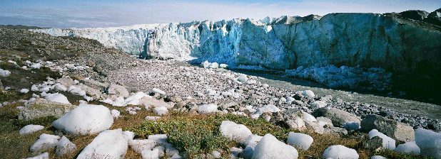
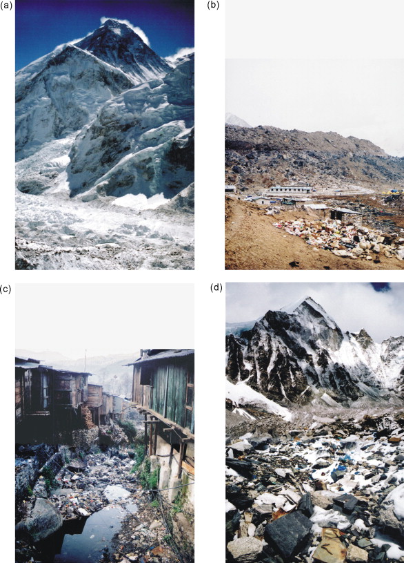
Above is an image exemplifying the harsh climate of Greenland today, comparable to the environment of the Viking period.

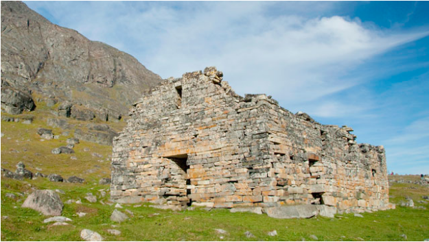
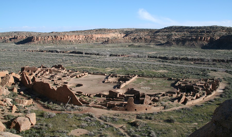
Above is an image exhibiting ruins of Greenland’s Hvalsey Church, an example of one of the religious buildings built as highlighted by Steve Connor.

Reference List

Connor, Steve

2015 Geologists have all but ruled out claims the Medieval Warm Period accounts for Greenland’s colonisation from 986AD. Electronic document, https://www.independent.co.uk/environment/climate-change-did-not-force-vikings-to-abandon-greenland-in-15th-century-a6761026.html, accessed November 11th, 2018.

CUNY Media

2011 How Nature Vanquished the Vikings of Greenland. Electric document, https://www.youtube.com/watch?v=TncIO4SRBic, accessed November 11th, 2018.

Eli Kintisch

2016 Why did Greenland’s VIkings disappear? Electronic document, https://www.sciencemag.org/news/2016/11/why-did-greenland-s-vikings-disappear, accessed Nov 6th, 2018.

Mason, Matthew

2018 What Environmental Data Can Tell Us about the Greenland Vikings. Electronic document, https://www.environmentalscience.org/environmental-data-greenland-vikings, accessed November 5th, 2018.

Image Sources 

Stockinger, Nther and Spiegel

2013, Ruins of Hvalsey Church, Hvalsey, Qaqortoq, Greenland. Electronic document, https://abcnews.go.com/International/archaeologists-find-clues-viking-mystery/story?id=18183196, accessed Nov. 11th, 2018.

Kelly, Gwyneth

2015, Minutes. Electronic document, https://newrepublic.com/minutes/125135/glaciers-reveal-greenland-wasnt-warm-vacation-vikings-all, accessed Nov. 11th 2018.

Additional Sources

1. https://newrepublic.com/minutes/125135/glaciers-reveal-greenland-wasnt-warm-vacation-vikings-all

2. https://www.smithsonianmag.com/history/why-greenland-vikings-vanished-180962119/

The Creation and Adoption of Gunpowder

Image

The ancient Chinese accidently invented one of the most widely used weapons.  Alchemists in ancient China spend centuries trying to concoct an elixir of life with no success.  During the Tang Dynasty, an alchemist mixed 75 parts saltpetre with 14 parts charcoal and 11 parts sulfur, which exploded when it was exposed to an open flame.  

At first, China used gunpowder simply to scare or surprise their enemies.  When the Chinese realized the significance of what they had invented, they started to use gunpowder to kill instead.  The military forces of the Song Dynasty started using gunpowder devices against the Mongols as early as 904 A.D. The first of these devices was “flying fire”: an arrow with a burning tube of gunpowder attached to the shaft, primitive hand grenades, poisonous gas shells, flamethrowers and landmines.  By the 11th century, the Chinese were filling bombs with gunpowder and firing them from catapults. These fire cannons needed two people to carry them and were fired from moving platforms placed near the wall of the enemy city.


The Song government realized the extreme advantage they had in warfare and tried to keep gunpowder a secret from other countries.  In 1076, they even banned the sale of saltpeter to foreigners. Despite all their efforts, knowledge of this new substance was carried along the Silk Road to India, the Middle East, and Europe.  By 1280, recipes for gunpowder had been published in the west.

Gunpowder is just another example of how when a new technology is created, the rest of the world must either adapt or become obsolete.  This is extremely relevant when it comes to weapons and tools of warfare. If one civilization has better weapons, they will be able to conquer everyone else unless other civilizations learn the technology.  This is a constant cycle as civilizations create new technology while also trying to keep up with the new technology of others.

Additional Content:

http://www.monkeytree.org/silkroad/gunpowder/europe.html

Work Cited:

“Flying-cloud Thunderclap Eruptor.” depts.washington.edu/chinaciv/miltech/firearms.htm.

“Flying Fire.” ffden2.phys.uaf.edu/211.fall2000.web.projects/I.%20Brewster/History.html.

“Gun and Gunpowder.” Silk-Road, www.silk-road.com/artl/gun.shtml.

Ross, Cody. “Middle Age Technologies Gunpowder.” Four Rivers Charter, fourriverscharter.org/projects/Inventions/pages/china_gunpowder.htm.

Szczepanski, Kallie. “The Invention of Gunpowder: A History.” ThoughtCo, 23 Apr. 2018, www.thoughtco.com/invention-of-gunpowder-195160.

The Editors of Encyclopaedia Britannica. “Gunpowder Explosive.” Encyclopedia Britannica,www.britannica.com/technology/gunpowder.

Warfare in the Late Stone Age: Nataruk, Kenya

The origin point and reasoning for human warfare is widely debated. Yet, an answer would provide valuable information that could help humans cease or prevent wars. Warfare is said to be common after state societies emerged 5,000 years ago. This does not mean that there aren’t accounts outside of those descriptors, though. At one sight in Kenya, evidence of warfare was dated to 10,000 years ago. This site combats the generalization of warfare’s origin story.

(Figure 1. The Nataruk site during excavation, Photo from Wikipedia)

In 2012, at a site in Nataruk, west of Kenya’s lake Turkana, researchers discovered a large number of battered skeletons. The skeletons were widely spread out. The remains seem to be of a small hunter-gatherer band who lived approximately 9,500 to 10,500 years ago. The remains and surrounding sources were dated using radiocarbon dating, optically stimulated luminescence, and uranium series.

There were 27 skeletons at a minimum. All 27 of them were not buried. The remains comprised of six children and 21 adults. Trauma was found on the crania, cheekbones, hands, knees, ribs, and neck, to name a few (Handwerk 2016). There is also evidence of bound wrists on four skeletons. These locations of trauma are the most commonly targeted in violence cases. The weapons used to create all of these lesions were projectile points, a club-like weapon, and another weapon to be held at close proximity. This knowledge implies that the people had undergone violent deaths.

(Figure 2. Distribution of finds at Nataruk. Graphic by Esri, DigitalGlobe, GeoEye, i-cubed, USDA, USGS, AEX, Getmapping, Aerogrid, IGN, IGP, swisstopo, and the GIS User Community)

Usually conflict arises in sedentary societies. Since sedentary societies control land and resources, is believed that the “root causes for most warfare was control of resources… Including food, labor, and raw materials” (Sabloff 67). This, however, is not true at the site in Nataruk. The projectile points show inter-group conflict (Lahr 2016) and the rest of the weapons show that the hunter-gatherer group was victim to a premeditated attack. This shows that the group had valuable resources, even though it wasn’t a state society.

This begs the question, “what valuable resources did they have?” Evidence shows that West Turkana was a fertile landscape. The hunter-gatherer group found could have been raided for this fertile territory. They also could have raided for their women or children (Lahr 2016). There was some political complexity between the attackers and the attacked that led to this act of aggression. This exemplifies that raiding for resources is not only inherent in state societies, but foraging societies as well.

Since the Nataruk site shows us that warfare was evident in prehistory, we can conclude that warfare has existed for much longer than we assumed. Warfare seems to be a recurring phenomenon in human history and prehistory. If we study the past examples of warfare like the one at Nataruk, we may gain knowledge helpful in preventing or stopping war.


Further Reading:

http://www.pnas.org/content/112/36/11217 (Another study showing prehistoric warfare, in Central Europe)


http://science.sciencemag.org/content/341/6143/270 (Warfare in mobile hunter-gatherer bands and the implications on warfare origins)


Reference List:

Handwerk, Brian

2016, An Ancient, Brutal Massacre May Be the Earliest Evidence of War. Smithsonian.com. D.C., Washington. Accessed 10 November 2018.


Lahr, Mirazon M.

2016, Inter-group violence among early Holocene hunter-gatherers of West Turkana, Kenya. Nature, International Journal of Science. 529, pages 394–398. Accessed 10 November 2018.


Sabloff, Jeremy A.

2008 Archaeology Matters: Action Archaeology in the Modern World. Left Coast Press. Walnut Creek, California.


Images:

https://www.nature.com/articles/nature16477/figures/4

https://en.wikipedia.org/wiki/Nataruk#/media/File:2._Excavations_at_NATARUK.jpg

Archaeology and the Ethical Dilemma

When most people think of an archaeological monument, the Great Pyramid of Giza, Stonehenge, and Machu Picchu are usually the most popular to come to mind. However, a new name should be added to the list. In Kenya’s Lake Turkana, archaeologists have recently been examining several pillar sites, including the Lothagam North Pillar Site. At the Lothagam site, the archaeological team have learned that the platform and pit below the pillared site had been built by a community for the use of a communal grave site. In excavating the grave site, the team found an estimated 580 people, spanning across multiple ages and generations. The site has awed the field of archaeology for it seems that community that built the monument constructed it as a means of uniting the people and an example of an egalitarian society, whereas in the past, it has been suggested that the construction of monuments was a way by upper class rulers to emphasize the hierarchy. (Daley) Yet, perhaps more importantly, it raises the question about the relevance of ethics in archaeology, specifically with the uncovering of human remains.

This ethical predicament stems from whether it is acceptable to exhume the dead from their burials when excavating a site and the implications surrounding the cultural context. In the past, archaeologists would commonly disrespect sites of human remains when searching for artifacts, and along the way, collected the skeletons and put them in museums. Because they were no sources of power actively trying to protect their history, many of these skeletons were taken from Native American burials during plundering, and the removal of a body from their places of burial ignorantly disregards the importance of the final resting place in many Native American  communities. (Alex) Now, more archaeologists are aware of the gravity of their actions, but the issue still arises for many teams whether it is ok to disturb if it is for the benefit of an scientific discovery. The American Anthropological Association has sought to mediate this problem by emphasizing “People and groups have a generic right to realize their capacity for culture, and to produce, reproduce and change the conditions and forms of their physical, personal and social existence, so long as such activities do not diminish the same capacities of others.” This response to the ethical dilemma puts clear stress on how while they do encourage the research into learning cultural past, they condemn it begins to affects the values and wishes of other cultures.


In some ways, we have taken this declaration to heart. The establishment of the Native American Graves Protection and Repatriation Act in 1990 requires the permission of the local community in order for scientists to excavated remains on federal or tribal land. This is a big step in the right direction for achieving the respect Native Americans have been demanding regarding the treatment of their burials, but unfortunately, the law is not regularly enforced and many remains are still taken to museums or reburied.


So, how do we begin to further approach an ethical and safe solution for archaeologists? First, by adhering to the demands of Native American groups and other misrepresented cultures around the world when addressing their burial grounds. This also includes respecting their wishes in all research, including online, by not posting images of human bones in case it does belong to one of their people. (Class) Next, we encourage scientific development in excavation tools that will allow archaeologists to investigates, but disturb as little as possible.


In the Lothagam site, archaeologists have already found through the study of some the remains that the drying of Lake Turkana forced diverse groups of people to unite and work together. (Alex) This is important for outlining more of the area’s history, but again, it can only truly be successful should it be done responsibly and ethically. Thankfully, that is the case.


Further Readings:

Killgrove, Kristina.

2018 International Experts Refute ‘Alien’ Mummy Analysis, Question Ethics and Legality. Forbes, July 18, 2018. https://www.forbes.com/sites/kristinakillgrove/2018/07/18/international-experts-refute-alien-mummy-analysis-question-ethics-and-legality/#32327dc93722

Strauss, Mark.

2016 When Is It Okay To Dig Up The Dead? National Geographic, April 7, 2016. https://news.nationalgeographic.com/2016/04/160407-archaeology-religion-repatriation-bones-skeletons/


Reference List:

Daley, Jason.

2018 Their World Was Crumbling But These Ancient People Built a Lasting Memorial
Read. Smithsonian Magazine, August 22, 2018. https://www.smithsonianmag.com/science-nature/when-their-world-was-chaos-these-ancient-people-coped-building-monument-180970087/, accessed November 4, 2018.

Alex, Bridget

2018 When Is It Ok For Archaeologists To Dig Up the Dead? Discover Magazine Blog, September 7, 2018. http://blogs.discovermagazine.com/crux/2018/09/07/when-is-it-ok-for-archaeologists-to-dig-up-the-dead/#.W9-pXS2ZP-Y, accessed November 4, 2018.

Image Sources:

Daley, Jason.

2018 Their World Was Crumbling But These Ancient People Built a Lasting Memorial
Read. Smithsonian Magazine, August 22, 2018. https://www.smithsonianmag.com/science-nature/when-their-world-was-chaos-these-ancient-people-coped-building-monument-180970087/, accessed November 4, 2018.

How We Can Learn from the Fall of the Mayan Civilization


The fall of the Mayan civilization has puzzled scholars for years. At the Mayan’s peak, the civilization was made up by more than 19 million people. However, during the 8thor 9thcentury the Mayan civilization suddenly collapsed. In his book “Collapse,” Jared Diamond puts forth a theory about the sudden demise of the Mayan civilization. Diamond believes that a prolonged drought which was intensified by rapid deforestation led to the collapse of the once great Mayan civilization (Stromberg).Studying the collapse of the Mayan civilization can be beneficial for a multitude of reasons. We can determine the ways in which the Mayans exacerbated deforestation along with the effects which it had. In the book, “American Anthropologist,” Fisher and Feinman link past human activity to a range of environmental changes. Analysis of past human activity and its effects on the environmental are critical to evaluating contemporary environmental debates and policies. As seen in Figure 1, the decline of the Mayan population was closely tied to rapid deforestation coupled with the soil erosion. The Mayans burned and chopped down their forests in order to clear land for agriculture and also to acquire wood for the elaborate construction of their cities (Stromberg). Deforestation in Central American still remains extremely problematic today. In Honduras, it is estimated that up to 85% of timber which is cut down is done so illegally (Charlotte). Deforestation is a great threat to biodiversity, leading birds, animals and plants to lose their natural habitats. The world’s forests are one big carbon sink, storing and locking away carbon dioxide avoiding its immediate release into the atmosphere. When a tree dies all of the carbon that has been stored away is released back into the atmosphere. If the tree is cut down prematurely, the process is accelerated. Currently global loss of forests is contributing 12-15% of total greenhouse gas emissions (Charlotte). This information about the fall of the Mayan civilization becomes increasingly alarming when we look into what is currently going on in Brazil. Recently, a new President was elected in Brazil, Jair Bolsonar. Bolsonar’s environmental policies can be perceived as being a threat to human existence all together. As seen in Figure 2, deforestation of the Brazilian Amazon has been on a general downtrend. However, this may soon change. Bolsonar’s policies favor business over biodiversity and calls for pro-market ways of exploiting Brazil’s natural resources. Bolsonar also has promised to weaken the enforcement of environmental laws. It is extremely important to learn from the failures of past human societies and civilizations. It is thought that we have 12 years to prevent the dangerous destabilization of the Earth’s climate (The Guardian).  We have seen how deforestation led to the demise of the once great Mayan civilization. Hopefully we will use the information we have learned from the past to solve the deforestation problems which are still extremely prevalent today.


Additional Readings:

www.cropcycle.org/2011/07/25/deforestation-in-central-america/.

https://www.theguardian.com/commentisfree/2018/oct/31/the-guardian-view-on-brazils-new-president-a-global-danger

Figure 1. Population density, Deforestation and Soil Erosion for the Mayan Civilization

Source: https://ourworldindata.org/forests

Figure 2: Deforestation in Brazil

Source: https://rainforests.mongabay.com/amazon/deforestation_calculations.htm

Works Cited   

Charlotte. “Deforestation in Central America.” Crop Cycle,   www.cropcycle.org/2011/07/25/deforestation-in-central-america/.

Fisher, Christopher T, and Gary M Feinman. American Anthropologist .

Stromberg, Joseph. “Why Did the Mayan Civilization Collapse? A New Study Points to .   Deforestation and Climate Change.” Smithsonian.com, Smithsonian Institution, 23 Aug.        2012,www.smithsonianmag.com/science-nature/why-did-the-mayan-civilization-    collapse-a-new-study-points-to-deforestation-and-climate-change-30863026/?no-ist.

“The Guardian View on Brazil’s New President: a Global Danger | Editorial.” The Guardian,          Guardian News and Media, 31 Oct. 2018, .            www.theguardian.com/commentisfree/2018/oct/31/the-guardian-view-on-brazils-new-        president-a-global-danger.

What Soil Conveys About Maya Culture and How It Informs the Present World

Soil used to be cast aside: important only for the provenience of artifacts that were found. With modern technology; however, the matrix itself can provide valuable archaeological evidence. In the case of Tikal, an ancient Maya city in northern Guatemala, chemical analysis of soil has provided conclusive evidence of Maya agriculture (American Society of Agronomy 2012). Corn uses a different photosynthetic pathway than most of the vegetation native to Tikal and produces a higher ration of carbon-13 to carbon-12 in the soil (Eberl 2016). Richard Terry, a soil scientist at Brigham Young University, conducted research on 185 soil cores taken from around Tikal (Figure 1) which have been used to map where the Maya did and did not plant maize (Hollingshead 2013). With the model his team created of long-term corn production in Tikal, it is possible to determine the number of people the city could support (Hollingshead 2013). With this technique, it is then possible to look at modern soil and determine the population limit our agriculture can support before environmental collapse.

Figure 1. Soil scientists from Brigham Young University taking soil samples near Tikal, Gautemala (Gannon 2013).

Soil also provides direct evidence to overexploitation of resources, a problem that persists to this day. The Maya achieved widespread maize production but with this came invisible degenerative soil processes like erosion and fertility depletion (Olson 1981). Soil analysis in Tikal indicated that corn-production occurred mostly in low-lying wetlands called bajos, but erosion was discovered in upslope soils which suggested that farming had spread to hills (American Society of Agronomy 2012). It is likely that the spread of farming was due to increased demand because of population growth, but the larger production drastically affected soil viability and inevitably would have undercut the food source (American Society of Agronomy 2012). Again in Tikal, soil use was mapped based on the color: soil used for agricultural production was lighter than the mineral-rich soil which had been left undisturbed (Olson 1981) (Figure 2). The fact that the soil in Tikal has retained the nutrient character the Maya left it with for thousands of years is a sobering thought. Not only does overexploitation lead to decreased production in the relatively short-term but also affects the ability of future civilizations to survive in the far long-term. We not only need to consider the effects of our agriculture on how much food we can create for the present population, but also whether our supposed sustainability means future civilizations will be unable to survive. In order to maintain an ability for agricultural production the current rate of farming needs to decrease or needs to increase in variation (through consultation with experts on the nutrient use of each specific plant) so as to reduce mineral depletion.

Figure 2. An example of soil color being recorded with a Munsell Color Chart— to be recorded the soils must all be in the same conditions such as sunlight or shade and wet or dry (Maya Research Program).

Reference List:

American Society of Agronomy

  2012  Researchers Unlock Ancient Maya Secrets with Modern Soil Science. Electronic document, https://www.sciencedaily.com/releases/2012/11/121112090732.htm, accessed November 2, 2018.

Eberl, Markus.

  2016  Ancient Maya Agriculture at Tamarindito, Guatemala. Electronic document,  https://my.vanderbilt.edu/universityfundingprograms/2016/11/ancient-maya-agriculture-at-tamarindito-guatemala/, accessed November 2, 2018.

Gannon, Megan.

  2013  How Many Mayans Were There. Electronic document,  https://www.livescience.com/37773-ancient-maya-farms-population.html, accessed November 2, 2018.

Hollingshead, Todd.

  2013  Newly Revealed Maya Farming Hotspots Hold Key to Ancient Culture. Electronic document,  https://news.byu.edu/news/newly-revealed-maya-farming-hotspots-hold-key-ancient-culture, accessed November 2, 2018.

Maya Research Program

  2016  Soil Excavations with the Maya Research Program. Electronic document, https://munsell.com/color-blog/soil-excavation-maya-research-program/, accessed November 2, 2018.

Olson, Gerald W.

  1981  Archaeology: Lessons On Future Soil Use. Electronic document,  http://www.ciesin.columbia.edu/docs/002-225/002-225.html, accessed November 2, 2018.


Additional Content for Interested Readers:

Ballantyne, Marissa.

  2007  BYU Research Team’s Special Methods Find Ancient Maya Marketplace. Electronic document,  https://news.byu.edu/news/byu-research-teams-special-methods-find-ancient-maya-marketplace, accessed November 2, 2018.

Burnett, Richard L., Richard E. Terry, Ryan V. Sweetwood, David Webster, Tim Murtha, and Jay Silverstein

  2012  Upland and Lowland Soil Resources of the Ancient Maya at Tikal, Guatemala. Electronic document,  https://dl.sciencesocieties.org/publications/sssaj/abstracts/76/6/2083, accessed November 2, 2018.

Muhs, Daniel R., Robert R. Kautz, and J. Jefferson MacKinnon

  1985  Soils and the Location of Cacao Orchards at a Maya site in Western Belize. Electronic document,  https://www.sciencedirect.com/science/article/pii/0305440385900573, accessed November 2, 2018.

The Debunking of Androcentric Archaeology by the Priestesses of San José de Moro

When most people think of archaeology, the picture that comes to mind is more-often-than-not one closer to that of Indiana Jones than to that of Lara Croft. Despite both characters existing on a fictional spectrum, this observation of how such popular media culture is represented and absorbed by the general public is an example of a much bigger problem within the field of archaeology itself: androcentrism and the male bias.

A mask of copper, a symbol of status, found near the skull of one of the Moche priestess-queens.

Excavations of the Moche civilization in San José de Moro, Peru that inhabited the area between 1 CE and 800 CE have been taking place for decades. But in the past 27 years, up to eight notable tombs have been discovered in what was once thought of as a society consisting of only male warriors, priests, and kings. Tomb after tomb, archaeologists’ preconceived notions of the civilization’s societal composition were put to the test and quickly fell apart. In 2006, archaeologists were shocked to come across a lavishly decorated tomb on the El Brujo site filled with the remains of—you guessed it—a woman. The findings from a burial analysis of her mummified skeleton and the artifacts deposited in her grave—buried with wooden scepters wrapped in copper, a large crown with an image of a puma, and several tattoos symbolizing sacred figures including snakes, spiders, trees, and stars—led archaeologists to believe that she lived as a high priestess or even a queen of the Moche people. She was later referred to as the Lady of Cao, her burial’s discovery only to be followed by seven additional discoveries of other burial sites of women. The mummies adorned extravagant headdresses and beaded necklaces, were buried next to sacrificed victims, and were surrounded by grand artifacts including scepters and goblets that indicated that they, too, were of higher status and had possessed a more prominent role in the Moche society.

A reconstructed 3D-printed replica of the face of the Lady of Cao, a female priestess-queen of the Moche civilization.

The impact of androcentrism in archaeology is thoroughly and explicitly exemplified in the long-held assumption by archaeologists that the Moche society was ruled only by male figures; with further analysis of the burial sites, findings implied that the buried Moche women belonged to a higher social class, further breaking the notion that the Moche civilization exclusively comprised of higher orders of men and, rather, included—or more often comprised of—women as social elites.

The tomb of the eighth Moche priestess to be discovered, buried 1,200 years ago with an array of artifacts that indicates her high social status.


The discoveries of the priestess-queens of the Moche remind us that we must stay aware of our presumptions and biases as they often bring us to incorrect conclusions. As archaeology is still developing when it comes to including, recognizing, and rewarding women, the male bias is especially important to keep in mind when considering historical archaeological conclusions about the role of gender in ancient societies and cultures. With an awareness of the biases of not only ourselves but also those of archaeologists before us, we can make sure that we are not discounting any potentialities on a matter of assumption or misinterpretation of evidence and that we are, instead, taking into consideration all possibilities in order to accurately restore the archaeological record.

Sources

Renfrew, Colin, and Paul Bahn 2010 Archaeology Essentials. 2nd ed. Thames & Hudson, New York.

Excavated Tombs of Peru’s Moche Priestesses Provide Archaeologists with Troves of Artifacts, Data

Lady of Cao Comes to Life: Face of Peruvian Priestess Reconstructed from 1,700-Year-Old Mummy

Where Women Once Ruled: Excavated Tombs of Moche Priestesses Provide Archaeologists with Troves of Artifacts

Male Bias in Anthropology

Moche Civilization

Mask Image Source

The Lady of Cao and the Royal Tomb Images Source


Additional Readings

Tomb of a Powerful Moche Priestess-Queen Found in Peru

1,500-year-old Ruins Shed Light on Peru’s Mysterious Moche People

LiDAR in Rainforest Archaeology

Traditional methods of archaeology include on-ground exploration and using historical maps and records. Many of these methods have been replaced by or are now practiced in conjunction with newer technologies, such as LiDAR. LiDAR, which stands for Light Detection and Ranging, is a “remote sensing method that uses light in the form of a pulsed laser to measure ranges (variable distances) to the Earth. These light pulses—combined with other data recorded by the airborne system— generate precise, three-dimensional information about the shape of the Earth and its surface characteristics” (NOAA 2012). The most common platforms used for LiDAR surveys are helicopters and airplanes, and the LiDAR equipment is, in basic form, a laser, scanner, and GPS receiver (NOAA 2012). The data received by the LiDAR instrument measures the time it takes for the light pulses to return to the aircraft (Renfrew 2015). This information is then translated into an aerial map of landscapes archaeological features such as man-made structures.

“Lidar equipment and detection principles.”(https://www.researchgate.net/profile/Andrei_Utkin/publication/221616433/figure/fig1/AS:305682927636484@1449891897394/Lidar-equipment-and-detection-principles.png)

This LiDAR technology has been incredibly valuable within the field of archaeology because it is able to map and record things that humans are incapable of on foot. For example, studying rainforest sites is extremely difficult due to the extreme terrain and abundant wildlife, especially the expansive rainforest canopies. Because of this limited access to these sites, some of the histories of these areas is largely unknown. This leads to many legends and even articles to be written about these “lost civilizations” that have been “discovered.”

One study by the University of Central Florida, for example, used LiDAR to recover ancient Mayan cities at Caracol in Belize. Before this technology, archaeologists were mostly unable to analyze the innovative accomplishments and ingenuity of the Maya because of the dense and difficult to navigate rainforests. One interesting question that was raised in this study is as follows:

“It often appears that sites in more easily studied areas of the world–plains, sparse forests, or areas cleared in modern times—are larger and more complex than their tropical forest counterparts. Does this impression reflect the inability of ancient humans to create large, sustainable settlements in the tropics, or is it the result of incomplete investigations, hampered by the complications of working in a rainforest?”(Chase 2010).

“In this LiDAR image of the Caracol epicenter, the jungle cover has been removed. Clearly visible—as ripples in the valleys and hillsides—are the agricultural terraces the ancient Maya constructed to feed the sprawling city.” (Courtesy Arlen Chase) (https://archive.archaeology.org/1007/etc/caracol.html)


The LiDAR system can read through the thick forest canopies, revealing the features underneath, allowing archaeologists to analyze these structures and to identify potential activity areas that might warrant further excavation. This study was able to confirm that Caracol was a “low-density agricultural city encompassing some 70 square miles” (Chase 2010). The researchers’ previous data, documented through ground field work had recorded some features, but the LiDAR assisted them in documenting the site’s “entire communication and transportation infrastructure at its height during the Late Classic Period” (Chase 2010). Other sites where LiDAR has been exponentially valuable are those at Tikal in Guatemala and Calakmul in Mexico. LiDAR, however, does have a few drawbacks. It cannot record completely perishable structures and although it can distinguish features that are less than a foot in height, it is still not completely accurate and will always require further research and groundwork. The benefits of LiDAR, however, are invaluable in excavating archaeological sites and in allowing archaeologists to reconstruct ancient civilizations.

Additional Content:

Clynes, Tom. “Laser Scans Reveal Maya ‘Megalopolis’ Below Guatemalan Jungle.” National Geographic, National Geographic Society, 14 Feb. 2018, news.nationalgeographic.com/2018/02/maya-laser-lidar-guatemala-pacunam/.

Loughran, Jack. “Lidar Used to Make 3D Model of the Amazon to Understand Drought Impact.” RSS, The Institution of Engineering and Technology, 13 June 2018, eandt.theiet.org/content/articles/2018/06/lidar-used-to-make-3d-model-of-the-amazon-to-understand-drought-impact/.

References:

Chase, Arlen F., et al. “Archaeology Magazine – Lasers in the Jungle – Archaeology Magazine Archive.” Who Were the Hopewell? – Archaeology Magazine Archive, Archaeological Institute of America, 2010,                             archive.archaeology.org/1007/etc/caracol.html.

NOAA. “What Is LIDAR.” NOAA’s National Ocean Service, Department of Commerce, 1 Oct. 2012, oceanservice.noaa.gov/facts/lidar.html.

Renfrew, Colin, and Paul G. Bahn. Archaeology Essentials: Theories, Methods, Practice. 2nd ed., Thames & Hudson, 2015.


The Details Behind a Landscape

       Landscapes have become a major concept in archaeology. More often than not, archaeologists must study today’s landscapes to fully understand how they were used in the past. Archaeologists focus on landscapes, for “a landscape perspective can be used to address the built environment of cities, the physical layout of hinterlands, and the ways in which these distinctly shaped spaces would have been experienced by their inhabitants” (Smith, 2014). Landscapes are very important, for they hold valuable details of the people who once occupied the land.

Stone Chamber in Kent, New York (http://www.ancientpages.com/2015/10/11/mysterious-ancient-stone-chambers-and-unexplained-energy-force-in-the-ninham-mountain-putnam-county/)

As archaeologists study these landscapes, they find a wide variety of artifacts, and features, depending on the region they are in. For instance, if an archeologist were to explore upstate New York, such as Kent, they would be expected to find various stone chambers. These chambers could lead an archaeologist to believe these features were once used to store objects, such as grain perhaps. However, one cannot simply infer this, and be sure they are correct. Therefore, it is important archeologists study the entirety of a landscape in order to find other objects that support their ideas.

4 of the various landscapes shown to participants (Beza, 2010)

Unfortunately, archeologists do not just find artifacts from the past on these landscapes. More often than not, archaeologists encounter trash from those living today. This dumping of trash is very dangerous, for it is the beginning of a vicious cycle that depreciates the value of land immensely. In locations where there are loads of trash, most people tend to infer this land as flawed, or invaluable. For instance, a study was done by Beau Breza in the article, The aesthetic value of a mountain landscape: A study of the Mt. Everest Trek, to see what people viewed as valuable lands, versus displeasing. Participants were shown a variety of mountain landscapes and were told to rank them in an order which they found most aesthetically pleasing. After conducting the survey, it was clear the participants viewed the landscapes with more garbage as less valuable, despite the beauty underneath it (Beza, 2010). This is unfortunate, for in reality the value of land is based on what it could provide a population with, not the disrespect that has accumulated on its surface. However, once there is a noticeable amount of trash on a landscape, many people begin to believe it is acceptable to continue to trash these lands because they have already been deemed worthless. This is dangerous to archaeology, for trash hinders what details archeologists are able to uncover about the populations that previously inhabited these lands. Once a group disrupts a landscape, the untold stories of that land can almost never be retrieved. Thus, it is important to keep landscapes clean, otherwise, the information they hold may never be found.

Landscapes have a large impact on the details archaeologists uncover about the people of the past. It is important society keeps this in mind, for there are many questions still left unanswered. These answers will never be found if trash continues to accumulate on Earth’s landscapes.


Additional Content

This study was done to show how local preferences have a large effect on what landscapes are chosen for better future management and explains what characteristics of landscapes are ideal.

https://www.sciencedirect.com/science/article/pii/S0169204607002241

This study was done to discuss the pressures of urban planning in rural areas, emphasizing the need to keep the natural landscapes.

https://www.sciencedirect.com/science/article/pii/S0169204610002148


References

Beza, B. B. (2010, August 16). The aesthetic value of a mountain landscape: A study of the Mt. Everest Trek. Retrieved September 30, 2018, from https://www.sciencedirect.com/science/article/pii/S0169204610001490#!

Smith, M. L. (2014). The Archaeology of Urban Landscapes. Annual Review of Anthropology,43, 307-323. doi:10.1146/annurev-anthro-102313-025839

Image Sources

Mysterious Ancient Stone Chambers And Unexplained Energy Force In The Ninham Mountain, Putnam County. (2017, December 12). Retrieved from http://www.ancientpages.com/2015/10/11/mysterious-ancient-stone-chambers-and-unexplained-energy-force-in-the-ninham-mountain-putnam-county/

Beza, B. B. (2010, August 16). The aesthetic value of a mountain landscape: A study of the Mt. Everest Trek. Retrieved September 30, 2018, from https://www.sciencedirect.com/science/article/pii/S0169204610001490#!


Pueblo Bonito

Rimrock view of Pueblo Bonito.

For over 2,000 years, the Pueblo people occupied a region of the United States in the south western section sometimes referred to as Oasisamerica. These ancient peoples built settlements, called Pueblos, with huge many roomed buildings and grand ceremonial plazas. Elaborate road- like networks connected the Pueblos, which extend east onto the Great American Plains. During this time Pueblo Bonito, Spanish for beautiful town, was built and used over a period of approximately 300 years, between 850 A.D and 1200 A.D. The site seems to have been evacuated around the end of 1300 A.D.

At the center of Chacoan society, Pueblo Bonito became an important ancestral site and one of the largest Great House sites in the Chaco Canyon region. This site is known as the main center of the Pueblos living in the region of Chaco Canyon. This archaeological site was actually found by a United States army lieutenant during a military expedition. Covering more 3 acres, this was quite an intricate setup.

Pueblo Bonito has a semicircular shape, with clusters of rectangular shaped sections that were used as rooms for living ad storage. There are more than 800 of these rooms that are enclosing a central plaza. In this central section of the site, kivas were built. Kivas a chambers that are partially placed in the ground, for the purpose of ceremonies, such as contacting their ancestors or spirits. Near the center of the pueblo was a hidden chamber, six feet long by six feet wide, which was only accessible through a small hatch in the roof.

Archaeological findings show a surprising lack of domestic activities in many rooms. There were 32 kivas built, and 3 great kivas, and with in those, there were evidence of communal ritual activities, such as feasting. This leads historical archaeologist to believe that the Pueblo Bonita held an important role in religious, political and economic functions within the Chacoan society.

Pueblo Bonito Great Kiva in the West Plaza in the foreground
The Great Kiva in the West Plaza is in the foreground,
the larger Great Kiva adjoins the North-South wall to the south. 

I mentioned before that there were small hidden chambers found. In one of these chambers skeletal remains were found. Excavation and DNA research tells us that over a dozen people were buried in here, and that they were most likely members of a powerful Native American dynasty, related through their mothers.

 We learned about this site and some of the other pueblo sites found in the south western section of America. I was very interested and wanted to find out a little more research about these sites, Pueblo Bonito in particular. Archeaology can tell amazing stories about the past that is not often told or written. This is very important because it can teach us important information, such as, how they kept unity, how and when religious practices started being used, diets that they ate. Basically how they survived and then we can learn off of the findings.

More information on Chaco Culture

https://whc.unesco.org/en/list/3

References and further Reading

https://news.nationalgeographic.com/2017/02/chaco-canyon-pueblo-bonito-room-33/

https://www.thoughtco.com/pueblo-bonito-chaco-canyon-great-house-172140

http://www.chacoarchive.org/cra/chaco-sites/pueblo-bonito/

https://en.wikipedia.org/wiki/Pueblo_Bonito#Discovery

Picture References

http://www.jqjacobs.net/southwest/pueblo_bonito.html