Merging Socioeconomic Concerns with Archaeology

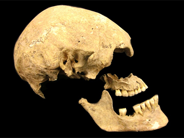
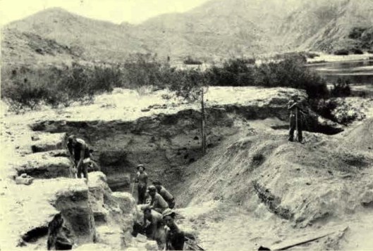
Marxist Archaeology was a field created in the early 20th century by soviet archaeologist in which they started questioning archaeological sites with the class struggle and unfair business practices. Vere Gordon Childe was the most prominent Marxist archaeologist when the field was first formed it was his love with socialism that transferred over to his works in archaeology. Man Makes Himself and What Happened in History are Childe’s most prominent works in literature. Childe is also famous for his excavation of Skara Brae, a Neolithic village of the Orkney Islands. Marxist archaeology resurged in the 1980’s with Post Processual Archaeology.

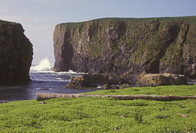
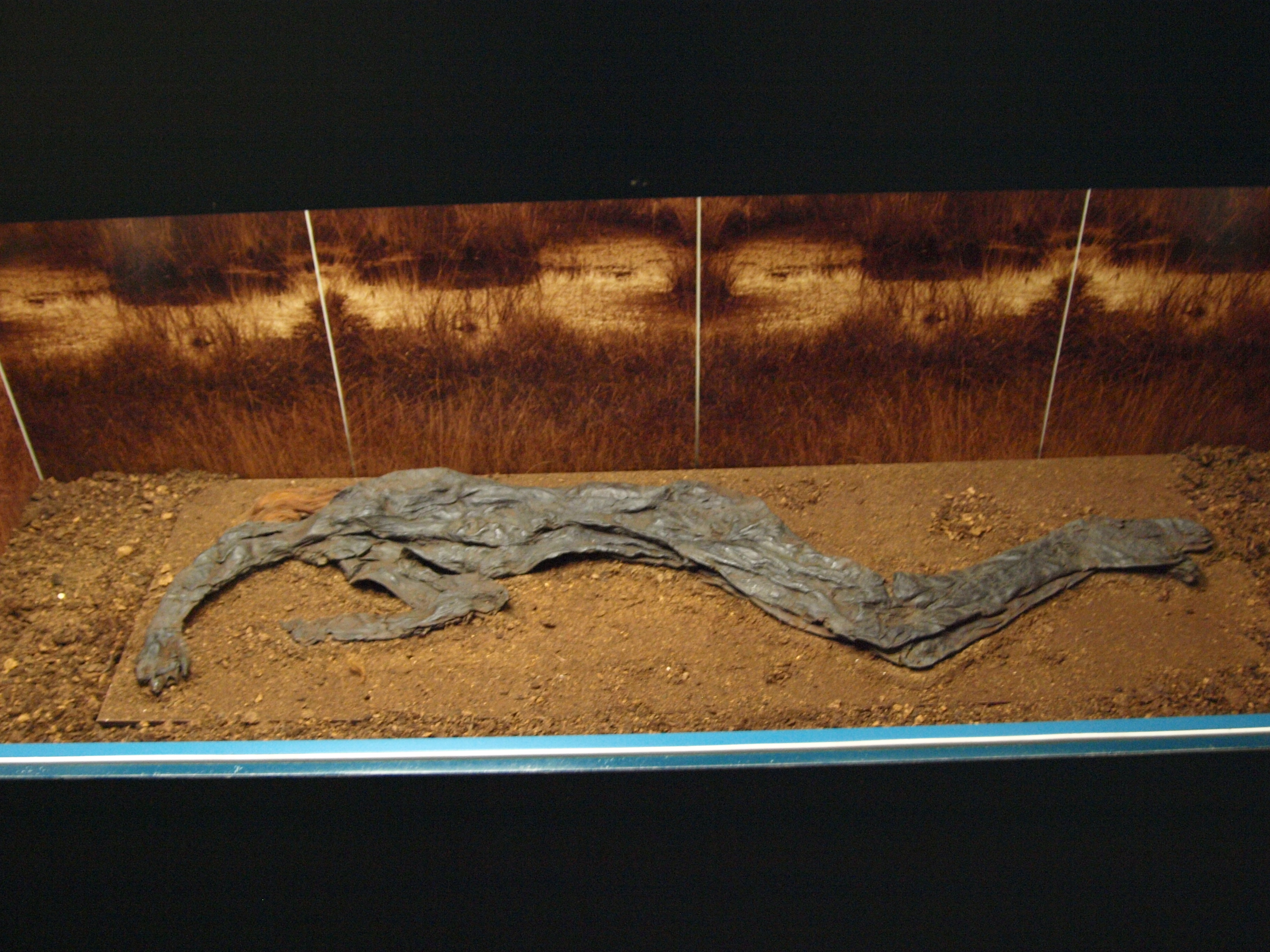
Skara Brae was discovered when the ocean sea waves and wind unearthed the former stone village.

Social classes are not a modern idea, there have been hierarchies in cultures ever since the  original chiefdoms. The unequal distribution of wealth/resources what is considered a natural phenomenon comes with other consequences to those who are found lower on the pyramid. Application of Marxism can be seen in an excavation of the roman city of Dorset, in Great Britain, examined 291 bodies of all classes to determine the demographics of that area. The findings are not surprising those who were of high class has a decrease in chance of fallen sick compared to their poor counter part. The lower class had a lower life expectancy and the infant mortality rate was increased for those of the lower class versus the higher class.  These examinations were non-bias as the bodies were of all age categories.  This also covered the timespan of 400 years from the first century C.E to the Fifth century C.E. So what can this tell us about today well if you look at what the western world considers a developed and undeveloped nations we can see that the infant mortality rate between the two haven’t changed for over 1500 years!

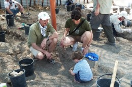
Another example of Marxist Archaeology is with the Aboriginal southwest &northwest in the united states. The original Archaeologist studying these areas felt that they were considered chiefdoms, that never got out of a middle barbarism state. The first fault with this idea was the fact that the elite lived in grand houses while the rest lived in brush huts.  The research shows that the pueblo people are not exactly like their former ancestor and have an increase communal order then their predecessors.  The complex hierarchies of the original Aboriginals seemed to have diminished once the Spanish reached them. This interference is why their culture went from a complex system to a simpler egalitarian system. This is important because if this can occur  than that means that this successful structure can occur with other societies/cultures as well maybe even ours.

Pueblo homes, debates about classification of ancestor society

In a paper  “Reflexiones Acerca De La Arqueologia Social” questions the conservatism of excavations and  argues that  just  looking at what the upper class  have prevents us from truth. The authors believe that we must study the working class of a civilization to learn about the truth of their culture as a whole. These authors also believe that in doing this way we can help relate these to our own socioeconomic problems through the artifacts discovered in past cultures.

Additional Reading

The Archaeology of V. Gordon Childe: Contemporary Perspectives edited by David R. Harris

http://capitalisminarchaeologicaltheory.wordpress.com/randall-h-mcguire/

Works Cited

Faulkner, Neil. “Gordon Childe and Marxist Archaeology.” International Socialism 116 (2007): n. pag. Print.

García, Juan Carlos M., and Javier E. Rodríguez. Reflexiones Acerca De La Arqueologia Social. Academia. N.p., n.d. Web. <https://www.academia.edu/1961179/Reflexiones_acerca_de_la_Arqueologia_Social>.

“Gordon Childe.” BBC News. BBC, n.d. Web. 21 Sept. 2014.

McGuire, Randall. Rethinking Power and Social inequality. N.p.: n.p., n.d. Print.

“Skara Brae.” Orkneyjar. N.p., n.d. Web. 21 Sept. 2014. <http://www.orkneyjar.com/history/skarabrae/skarabraepano.jpg>.

“Status and Health in Roman Dorset: The Effect of Status on Risk of Mortality in Post-Conquest Populations.” Pubmed. weilly, 8 Aug. 2011. Web. 21 Sept. 2014. <http://www.ncbi.nlm.nih.gov/pubmed/21826637>.

“Taos Pueblos Mud Houses.” National Geographic. N.p., n.d. Web. 21 Sept. 2014. <http://images.nationalgeographic.com/wpf/media-live/photos/000/280/cache/taos-pueblos-mud-houses_28026_600x450.jpg?01AD=3ISgALNq0LEkDFequRA7Afh4TwHKKEIQ1-1P_svNBuDi35fCYIGQl5w&01RI=BEBD2311EE49E17&01NA=>.

Discovery in the Wake of Construction

Looking at One World Trade Center from across ground zero

The One World Trade Center stands tall, 1776 feet to be exact, above Ground Zero, a site deeply entrenched in the hearts of millions of Americans.  Earlier this year, workers placed the final touches on the building that justly defines the New York City skyline, completing one of the nation’s most emotional construction projects to date.  The tower’s current influence will shape United States history for years to come, but the building, or its construction rather, has much older ties to America’s past.

In July of 2010, workers excavating a part of the foundation made a discovery, and what began that morning as routine construction quickly evolved into an archaeological dig.  Where the One World tower stands today was once a part of the Hudson River.  The debris-filled area, actually a landfill dating back to 1790, gave up a curved timber to a backhoe, and archaeologists working on site immediately went in to investigate.

After the silt and accumulated soil had been carefully removed, researchers and laborers alike peered down at the skeleton of half of a ship.  The remainder was later unearthed in an adjacent quadrant.  Estimates place the medium sized merchant vessel at approximately sixty feet in length, leading to the conclusion that it would have engaged in local trade along the East Coast.  The exact details as to where the ship had traveled are hoped to be revealed under further analysis.

A top view of the ship after the majority has been unearthed. Note the tell-tale curved timbers, overall hull shape, and silty soil.

In its day, this type of ship was standard, seen in nearly every port city.  However, detailed drawings and plans are uncommon for these ships, as they were expendable.  “[the ships] were considered mundane, and the building techniques weren’t documented.  It’s a once-in-a-lifetime discovery” stated Diane Dallal, one of the archaeologists present on-site.1

The ship was unearthed approximately thirty feet under the modern-day surface of New York, but stratigraphy did not yield a date.  Instead, scientists from Columbia University’s dendrochronology lab were able to accurately date and place several the ship’s timbers using tree-ring analysis.  “The same pattern of growth variability in the World Trade Center boat was found in timbers in southeastern Pennsylvania.  There is no indication that timbers came from a more remote area,”2 stated Edward Cook, who spearheaded the investigation.  It is likely then, that the ship was constructed in Philadelphia on or after 1773 and sailed from there to the sea.  According to Martin Bridge of University College London, “With shipbuilding you usually use [timbers] within a year or two [after they are felled] because it’s easier to work with,”3 meaning the ship left port on the eve of the revolution.

Some of the ship’s timbers ready to be arranged at their current resting place in Maryland

One World Trade Center, now complete, attracts the eyes of thousands each day.  But on display in Maryland, the remnants of a merchant ship draw researchers, architects, and archaeologists interested in our nation’s past.  Thanks to Diane Dallal and her team, this ship is resurrected, and while New York has reclaimed her skyline, anthropologists have made their own monumental achievement.


Sources:

1. Neely, Paula. “Ship Found at World Trade Center.” American Archaeology, Fall 2010.

2, 3.  Langin, Katie. “Wooden Ship Unearthed at World Trade Center Site From Revolutionary-Era Philadelphia.” National Geographic. http://news.nationalgeographic.com/news/2014/07/140731-world-trade-center-ship-tree-rings-science-archaeology/ (accessed September 15, 2014).

Renfrew, Colin, and Paul G. Bahn. Archaeology essentials: theories, methods, and practice. 2nd ed. New York, NY: Thames & Hudson, 20102010.

Pictures:

  1. http://www.renewnyc.com/images/wtc_ship_remnant/Ship-Remnant-view-from-East.jpg
  2. http://inhabitat.com/nyc/wp-content/blogs.dir/2/files/2012/04/one-world-trade-center-537×355.jpg
  3. https://encrypted-tbn1.gstatic.com/images?q=tbn:ANd9GcQYEtbHqD7ORLVz99-0HWVHWRoWm7d4XtUY9fqASR_BDky8kau6

Further Reading:

http://onewtc.com/

http://www.thepirateking.com/ships/ship_types.htm

http://www.ldeo.columbia.edu/research/topics/dendrochronology

http://www.youtube.com/watch?v=CLBkDFh5tB4


Who Did Europeans Descend From? A Third Group Comes to Light

For many years, we believed that Europeans descended from early farmers, who were originally in the Middle East and moved to Europe about 7,500 years ago, or from local hunter-gatherers that bred with other races. However, recent DNA analysis uncovers a third group.
Nine ancient skeletons found in Sweden, Germany, and Luxemburg were of seven hunter-gathers and one hunter who lived 8,000 years ago and one farmer who lived 7,000 years ago. Through association, the hunter-gatherers were labeled as hunter-gatherers and identified as being from the same time period. Hunter-gatherers had darker skin than farmers and typically blue eyes, while farmers had fair to pale skin tones.
The skeletal remains were dated with AMS radiocarbon dating, a method applied to organic matter based on carbon decay. AMS radiocarbon dating uses an accelerator mass spectrometer to differentiate the carbon isotopes from other atoms or molecules that have a similar mass. A danger of radiocarbon dating is that samples can be contaminated, which causes problems with the interpretation of the results. Therefore, the archaeologists used numerous approaches to search for contamination.

Figure 1: Archaeologists from Harvard Medical School collect genetic data from ancient skeletons in Sweden.

Figure 1: Archaeologists from Harvard Medical School collect genetic data from ancient skeletons in Sweden.

The team from the Harvard Medical School and Germany’s University of Tübingen noted a significant genetic transition between the era of hunter-gatherers and the era of the farmers. Thus, North Eurasians contributed to the gene pool in both Europe and North America. After overlaying the genomes with genetic codes from 2,300 present-day people living all over the world, the team concluded that the ancient North Eurasian ancestry is predominant in less than 20 percent of most Europeans’ DNA today. This ancestry is found in nearly every European group, the Caucasus, and the Near East. Northern Europeans have relatively more hunter-gather ancestry than southern Europeans who have more farmer ancestry. Most native Europeans have a mixture of genetic information from the three distinct types of ancestors. Most of the conclusions about the North Eurasian group come from DNA dating and analysis. Concerning the determination of dates, context is extremely important. Therefore, demographic history and inbreeding were accounted for during the process. The researchers focused on sex determination through Y-chromosome analysis. Other methods involved in their DNA dating were enrichment of mitochondrial DNA and shotgun sequencing, which sequences long strands of DNA.

Figure 2: An 8,000 year old skull of a hunter-gatherer was found in Sweden.

Figure 2: An 8,000 year old skull of a hunter-gatherer was found in Sweden.

Also, the ancient North Eurasian group explains the genetic connection between Europeans and Native Americans. Remains of ancient Siberians showed that European contributors were from the group that crossed the Bering Straight into the Americas more than 15,000 years ago. This new discovery alters our knowledge about European genetic ancestry and paints a different portrait of modern Europeans’ genetic composition.

Sources:

http://www.archaeology.org/news/2525-140918-european-genetic-ancestry

http://www.natureworldnews.com/articles/9092/20140918/european-ancestors-hailed-three-different-groups.htm

http://news.discovery.com/human/dna-places-third-group-in-european-descendent-mix-140918.htm

Renfrew, Colin and Paul Bahn (2010) Archaeology Essentials. 2nd edition. Thames & Hudson, New York. Chapter 2.

Figure 1: http://www.archaeology.org/news/2525-140918-european-genetic-ancestry 

Figure 2: http://www.ancient-origins.net/news-evolution-human-origins/new-study-reveals-third-group-ancient-ancestors-modern-europeans-002087 

Further Reading:

http://hms.harvard.edu/news/new-branch-added-european-family-tree

http://www.nature.com/nature/journal/v513/n7518/full/nature13673.html#methods


Lucky Finds at Lake George

Archaeologists uncovered ten thousand year old Native American artifacts in Lake George, proving that the area was one of the earliest occupied sites in New York. Some of these artifacts included projectile arrowheads from the French and Indian War and sharp edged rocks, which were possibly used to skin animals or chop up raw materials. The archaeologists were sent out to find artifacts from the French and Indian War and eventually they found artifacts dating much earlier than that time period. The team of archaeologists did this by first mapping out their excavation site. Instead of conducting the excavation right on Lake George’s present shoreline, the team of archaeologists began digging a few hundred feet from the beach. The archaeologists chose this site because it was estimated that in prehistoric times, this area would have been the shoreline. Interestingly enough, some of the artifacts found did not initially originate in the Adirondack region. From this observation archaeologist Christina Rieth observed that these people who left these artifacts behind were hunters and gatherers who spent time in what was once an area of wetlands. Rieth said, “It would be kind of a transit group, people who would have come here year after year for fishing or other types of activities around the lake.” She believes that these artifacts came from outside the region or were traded for other tools. According to her one of the stone pieces came from an eastern part of Pennsylvania and some of the others could have come from Central New York.

arrowheadjpg-4d79932474716658

A spear point found at the dig site is estimated to be 8,000 years old.

John Hart, the State Museum director of research and collections, also mentioned that these artifacts aren’t from a permanent settlement. He believes that these artifacts came from a band of nomads who were in search for migrating birds, deer, and other raw materials. Both Hart and Rieth said the artifacts appear to be from an era much earlier than that of famous Native American tribes. The incredible aspect about these finds was that archaeologists were assigned to do a routine inspection as a part of the states’ plans to resurface the roads near Lake George. So there was a bit of luck for the archaeologist to find these findings since they had no systematic plan of what to look for specifically. The only things these archaeologists were expected to find were artifacts from the French and Indian war. The main point that did help was that they were digging at a spot, which was once the shoreline for Lake George. In all, the dig became a lucky success even though there was no initial plan and project to specifically find certain artifacts from a single time period.

USA_NY_01

Two archaeologists are in the process of collecting soil and dirt in a bucket and then through sifting locating the artifacts.

Photo 1 : http://www.syracuse.com/news/index.ssf/2013/10/dig_near_lake_george_turns_up_10000-year_old_artifacts.html

Photo 2: http://4.bp.blogspot.com/-DvZKRk3S5ZU/UnP_Gn7I-II/AAAAAAAA27c/lxGsxFRoIdU/s1600/USA_NY_01.jpg

References: http://www.timesunion.com/local/article/Digging-10-000-years-into-the-past-4944785.php

http://www.syracuse.com/news/index.ssf/2013/10/dig_near_lake_george_turns_up_10000-year_old_artifacts.html

http://wnyt.com/article/stories/s3205728.shtml?cat=300

Renfrew, Colin, and Paul G. Bahn. Archaeology Essentials: Theories, Methods, and Practice. New York, NY: Thames & Hudson, 2010. Print.

Additional readings:

http://www.cnycentral.com/news/story.aspx?id=1041983

http://www.timesunion.com/local/article/Lake-George-dig-site-teaches-students-of-5467292.php

Rediscovering the Era of Russian Colonization in America

Usually, the history of the colonization of the North America is dominated by authorities such as Spain, England and France. However, excavations in the past few decades in Alaska have brought light to the previously unknown period of Russian colonialism in America. This epoch consisted of a mixing of two thoroughly different cultures that is still apparent in the southwestern Alaskan landscape today. By studying archaeological findings that were confirmed to be from this Russian Colonial period, we can form a more in depth understanding of our own nation’s history as a whole.

Russian America began in the mid-18th century when groups of fur traders from Siberia traversed the Bering Strait and established camps in the Aleutian islands of southwestern Alaska. Sponsored by wealthy moguls, these trappers were well equipped and had practically an unlimited bounty of resources. Quickly, they began establishing their own infrastructure that consisted of houses, huts, docks and an array of forts that were scattered along the Alaskan coastline. In order to monopolize the seal population of the Alaskan coast, the Russian trappers moved in with brute force, often murdering entire villages and totally undermining the Aleutian way of life. In addition, the Russians exploited Aleutian natives and forced the indigenous people to work for them, often kidnapping the children of village leaders to ensure that hunters met their quota. As the Russians slowly moved eastward into the Alaskan mainland, native resistance steadily grew. Finally, in 1784, Grigorii Shelikhov led a group of infantry man to build an outpost on Refuge Rock, Kodiak Island. The trappers were met with a stiff Aleutian resistance, but Russian weaponry was simply too much for the native confrontation. The battle at Refuge Rock marked the beginning of a short stint of Russian occupancy in Alaska.

Battle of Sitka

Battle of Sitka

284px-Alaska_Maritime_National_Wildlife_Refuge,_Aleutian_Island_Unit

Refuge Rock, Alaska (Kodiak Islands)

Today, there are few superficial indications of past Russian settlement. However, there is a treasure trove of artifacts and relics that lie just below the cold Alaskan soil. Brian Hoffman, an archaeologist at Hamline University, excavated a dwelling on Unimak Island and uncovered evidence of a massacre initiated by Russian trappers that included skeletal remains and broken weapons. Aron Crowell, the Director of the Smithsonian Institution’s Arctic Studies center, and a team of archaeologists have found a bounty of Russian artifacts including coins, samovars, religious items and pottery (American Archaeology, pp. 18). Because the trappers brought over an abundance of Russian supplies, archaeologists also found artifacts that were Russian in origin but were modified and reused by the native population. In addition to finding Russian artifacts that were used by natives, archaeologists found a trend of Russian architecture that had been adopted by the Aleutian people.

Archaeologists working to uncover Russian-America era artifacts

Relics buried under hundreds of years of soil are a perfect way to study the composition and evolution of a society. Stratigraphic evidence shows a distinct development of the Aleutian society that is clearly changed by Russian involvement. By understanding how different cultures affect one another’s growth, it is easier to study and make judgments about a nation’s social identity as a whole.

Picture 1:  http://en.wikipedia.org/wiki/Battle_of_Sitka#mediaviewer/File:Battle_of_Sitka_by_Louis_S_Glanzman.jpg

Picture 2:    http://en.wikipedia.org/wiki/Alaska_Maritime_National_Wildlife_Refuge#mediaviewer/File:Alaska_Maritime_National_Wildlife_Refuge,_Aleutian_Island_Unit.jpg

Picture 3:    http://www.sha.org/index.php/view/page/alaska


References:

http://archive.archaeology.org/online/features/kadyak/rusala.html

American Archaeology Vol. 13 No. 2

http://www.akhistorycourse.org/articles/article.php?artID=202

http://www.nps.gov/akso/akarc/

https://www.princeton.edu/~achaney/tmve/wiki100k/docs/Russian_colonization_of_the_Americas.html


OUR Story, not HIStory: Taking Everyone into Account

Whenever I visualize what a typical archaeologist looks like, what comes to mind is a nerdy, white male, shovel in hand, wearing a sunhat and those pants that zip off at the knee. Although this image may be specific to me, I’m sure that many people’s visual representations of an archaeologist would share one aspect in common with mine: the male gender. Women have only fairly recently been admitted into the field of archaeology, yet, this imbalance in the field isn’t the only way in which women have been overlooked- ancient women themselves have been unfairly overlooked in archaeology, therefore being left behind in the archaeological record.

In the 1960s emerged feminist archaeology, which seeks the gendered experiences of the past through three objectives: first, to expose and correct the male bias in archaeology; second, to balance the imbalance of women’s professional participation in archaeology; and third, to spotlight the roles of women in the past. An archaeological site in Israel serves as a perfect example that incorporates these three objectives into its excavation.

Excavation at Tel Abel Beth Maacah began because it was referenced in the Bible and holds the potential to inform us about northern Israel during the Bronze and Iron Ages. In 2014, Dr. Naama Yahalom-Mack, Dr. Nava Panitz-Cohen, and Prof. Lauren Monroe (all female archaeologists) implemented the “Gender Agenda” program at the site. The “Gender Agenda” served to excavate with the sole purpose of identifying engendered activities such as locating cooking and grinding areas, ovens, pottery, etc. Students a part of the “Gender Agenda” program learned how to collect samples for micro-archaeological analysis that can be used for understanding diet, modes of economic production and how activities were carried out within the home sphere, and other aspects of daily life. Students also conducted an ethnographic study by visiting and interacting with local Arab women at the Center for Women’s Traditional Crafts in a nearby village. By explicitly searching for the physical remains of women’s day-to-day lives, the archaeologists behind the “Gender Agenda” validate the often-marginalized history of women in antiquity. Women’s history was often overlooked because their activities weren’t believed to have contributed anything important to the society since they served as rulers of the private, home sphere. The archaeologists at Tel Beth Abel Maacah recognize the contributions that women add to society through their search for engendered activities.

Students at Center for Women's Traditional Crafts in Arab village.

Students at Center for Women’s Traditional Crafts in Arab village.

"Gender Agenda" director Lauren Monroe with husband and son on site.

“Gender Agenda” co-director Lauren Monroe with husband and son on site.

Why is a focus on gender so important? Some argue that since gender assignments are untestable to a certain extent, then therefore gender is irrelevant in the archaeological record. This is not true. By analyzing and interpreting the gender roles established by a society we can get an overview of the social organization and structure of the society. Most importantly, we are acknowledging every person, rather than overlooking a group of people, and looking to understand their individual function within the society.


Additional Links:

http://anthrojournal.com/issue/october-2011/article/gender-in-mesoamerica-interpreting-gender-roles-in-classic-maya-society

http://www.biblicalarchaeology.org/daily/digs-2014/gender-in-archaeology-at-abel-beth-maacah/

Sources Used:

http://www.abel-beth-maacah.org/index.php/12-seasons/2013-season/78-gender-agenda

Renfrew, Colin, and Paul G. Bahn. Archaeology Essentials: Theories, Methods, and Practice. New York, NY: Thames & Hudson, 2010. Print.

Photos:

http://www.biblicalarchaeology.org/daily/digs-2014/gender-in-archaeology-at-abel-beth-maacah/

http://www.abel-beth-maacah.org


Are We More Distant From Neanderthals Than We Thought?

Much like any other social science, archaeological theories are constantly changing. Recently, our chronological understanding of Neanderthals has been drastically altered.

Neanderthals are the predating cousin to modern day humans, formerly found in regions ranging from Spain to Siberia. They made their first appearance in the fossil record 230,000 years ago, suffered a large population decrease 50,000 years ago, and until now were thought to have disappeared 30,000 years ago. However, new studies have concluded that the disappearance of Neanderthals was actually 10,000 years previous to what had been assumed: 40,000 years ago.

This new evidence was found through analysis of tools and bones, stratigraphy, and radiocarbon dating. 196 new pieces of animal bone were found conclusive with Neanderthal tool markings based on the apparent cut marks. The problem with samples previously found was that they didn’t follow the law of superposition, such that the deeper layers were actually dated to be more recent than higher layers. This meant that the source of information wasn’t exactly reliable for purposes of relative dating. However, the stratification of the matrix where the new samples were found are accurate in that they follow the law of superposition. This was determined by radiocarbon dating of volcanic ash layers. The process of radiocarbon dating was developed by Willard Libby in 1949. This technique gives absolute date information by comparing the amount of carbon-14 present in a substance. The isotope’s half life is 5730 years, which is used in determining age. With this information and calibration to avoid pitfalls in deviation, the age of a substance can be given in calendar years based on today’s date.

Through methods of radiocarbon dating and the new fossil finds, we now have that much more information about the human experience and how we are connected to other walks of life. Based on this information, more is now known about the overlap between the first homo sapiens and Neanderthals based on the amount of time they coexisted. Genetic evidence has already been shown that there was some mating between Neanderthals and early humans during the brief period of interaction before the Neanderthal extinction. In fact there are still genetic traces in humans today among one to two percent of people of non-African origin. The theory that this interbreeding occurred 60,000 years ago is now affirmed by shortening the time period of Neanderthals’ extinction.

To learn more about the time in which overlap occurred between humans and Neanderthals, check out these articles:

http://news.discovery.com/human/evolution/how-neanderthal-dna-changed-humans-140129.htm

http://humanorigins.si.edu/evidence/genetics/ancient-dna-and-neanderthals/interbreeding

Image Sources:

http://ichef.bbci.co.uk/naturelibrary/images/ic/credit/640×395/n/ne/neanderthal/neanderthal_1.jpg

http://www.zafarrayaneanderthal.com/neanderthalrange.gif

Information Resources:

http://news.nationalgeographic.com/news/2014/08/140820-neanderthal-dating-bones-archaeology-science/

Renfrew, Colin, and Paul G. Bahn. Archaeology Essentials: Theories, Methods, and Practice. New York, NY: Thames & Hudson, 2010. Print.


Battlefield Archaeology and the Scottish Highlands

The battle at Culloden was a struggle for power between Prince “Charlie” Stuart and the Duke of Cumberland, the grandson of King James II (of England and VII of Scotland) and the son of King George II, respectively. It was the last set-piece battle on English soil.


Culloden Memorial Cairn

Culloden Memorial Cairn


Afterwards, relatives placed stones showing where entire families fought as units within the greater Jacobite army (Prince Charlie’s). Additionally, stones meant to commemorate specific individuals were erected: these being the Well of the Dead, and the Cumberland stone. The graves of the 50-60 government soldiers who died fighting have not been found. They are honored with the English Stone.

Because this site has been marked out as culturally significant in Scottish history, it is of the utmost importance to preserve it, and by extension, the memory associated with the land. This is where archaeologists come in.

“Dog tags” were not invented until the mid-1800’s, so the identities of the people left behind must be determined by their belongings, commonly metal buttons and weaponry. The Jacobite army was constantly moving, so it restocked in towns on its way to Culloden. This resulted in an uneven array of weaponry and other surviving equipment.


The artifacts left on this site have been protected by the natural terrain, which merges into marshy land, and thick plant life, both of which work to prevent visitors from disturbing the grounds. This is important because when an artifact is moved, it loses its original context for the time in which it was first dropped/buried. Like many sites that have seen battle, or other traumatic experiences, it has gone into a period of abandonment. In this case, the restoration of the moor as a designated historical battlefield prevents other use, which will be apparent in the stratigraphic record (the study of how soil forms layers, and what time periods those layers are from).

A single object may tell us about itself, but its location (vertically and laterally) tells us about it in relation to other objects in the area (in a way that might form a pattern!). Together, they help us create a better picture of the past.


Archaeologists have used various methods (most common are surface survey, ground-probing radar, and metal detectors) to find the general layout of the battlefield. In addition to these surveying methods, primary source documents (old maps and journal entries!) are used to direct focus onto a specific area for fieldwork (historical archaeology).

This type of search, targeting a specific region within the battlefield is considered a biased survey. Excavations are performed when a site is in danger, in this case when the visitor center was built in 2007. Excavations may confirm the presence of certain features (such as buildings that are no longer present) that may help clarify previous research. In Culloden, buildings were burned to discourage further uprisings. This battle, like many others, can be explored through archaeological methods.


References/additional reading:


http://canmore.rcahms.gov.uk/en/site/14201/details/culloden+moor+battlefield/


http://www.wargravesheritage.org.uk/news.html


http://www.pasthorizonspr.com/index.php/archives/05/2008/the-archaeology-of-the-battle-of-culloden


http://data.historic-scotland.gov.uk/pls/htmldb/f?p=2500:15:0::::BATTLEFIELD:culloden


http://www.explore-inverness.com/what-to-do/attractions/culloden-battlefield/


Photo by Hanna Mitamura

New Deal Archaeology

Under Franklin D. Roosevelt’s New Deal program resources were given to create jobs preserving the nation’s monuments to protect them for posterity. Thousands of people were called upon to conduct large scale excavations across the lower 48 states. Archaeological projects were first funded through FERA or the Federal Emergency Relief Agency and then the WPA or Works Progress Administration. Archaeological programs worked closely with the Federal Writers Project to create state guides that provided a historical, cultural, and archaeological view of each state, while employing more people and encouraging tourism.

Figure 1: A CCC excavation in Nevada's "Lost City"

Figure 1: A CCC excavation in Nevada’s “Lost City”

The archeology practiced by these teams was not always the best form but it ultimately resulted in an increased understanding of archaeology in the public sphere and exposed people to the archaeological process. The crews would enter a site and often end up destroying much of the critical context around the finds and removing them from their associated objects. This was partly because modern sampling strategies using parallel and intersecting lines and squares had not yet been developed and also because most of the workers had no professional training in archeological field work or theory. So significant amounts of data have been lost about many of the Native American sites and colonial ruins that were excavated under the New Deal.

The archaeology done under the new deal was a form of Processual Archaeology and part of the period known as the “classificatory historical period”. The goals were to create a chronological narrative of a region as was common in the time. The narrative element also lent itself well to the creation of the State Guides.

The Cover of the FWP State Guide for Illinois

The Cover of the FWP State Guide for Illinois

And through these state guides the history and archaeology of the country was opened up to the rest of the population instead of the elite intellectuals of the country. Among the programs of the New Deal the archaeological projects created more public awareness of the historical context of the United States and brought us more new information. Many other programs like the CCC and WPA just improved on existing things in the United States by restoring buildings, National Park maintenance, and building projects, but archeological programs took the bleakness of the Great Depression and used it to create opportunities for research and collecting knowledge from resources right outside our doors. And even if the processes were not perfect in the grander history of archaeology they widened the foundation of American Archaeology and made room for organizations like the Society of American Archaeology and other groups that serve to protect and preserve America’s archaeological resources.


References

http://onlinedigeditions.com/publication/?i=70732#{“page”:39,”issue_id”:70732}

http://www.h-net.org/reviews/showrev.php?id=692

http://onlinedigeditions.com/display_article.php?id=738654&id_issue=70732

http://newdealarchaeology.com/2012/08/05/florida-wpa-archaeology-hillsborough-county/

http://www.loc.gov/rr/program/bib/states/illinois/memory.html

http://newdealarchaeology.com/

Renfrew, Colin, and Paul G. Bahn.Archaeology essentials: theories, methods, and practice. 2nd ed. New York, NY: Thames & Hudson, 20102

Heather Gill-Robinson: Bog Body Extraordinaire

Heather Gill-Robinson began her career as an archeologist just like we are, by taking an introductory anthropology class. She learned, as did we, that in wetland sites, “organic materials are effectively sealed in a wet and airless environment which favors preservation.” (Renfrew 54) Gill-Robinson’s first connection to the bog bodies, which she so heavily studies now, was via a picture of the head of the Tollund Man, Figure 1.

Figure 1.

Figure 1: A close-up view of the Tollund Man’s head, an image similar to that which Gill-Robinson saw.

The Tolland Man is the best-preserved bog body. Found in a bog near Bjældskovdal, Denmark on May 6th, 1950, the Tolland Man has been dated back to the Early Iron Age, or around 500 B.C. Gill-Robinson was amazed at the condition of the Tolland Man and wanted to learn how his body had been preserved for thousands of years. When her professor told her that researchers were still unsure how the preservation worked, Gill-Robinson decided that she wanted to perform research in order to find the answer; and research she did (in the form of experimental archeology).

In 1999, the New York Times picked up on Gill-Robinson’s bog research and wrote an article on her findings. Gill-Robinson, then a forensic support technician for the Belleville Police Department in Ontario, Canada, wanted to look into causes of decay in order to more accurately predict the time of death of discovered bodies. She chose to use piglets in her research for multiple reasons, the first of course being that human cadavers aren’t readily available, and the second being that piglets have many biochemical and physiological similarities to humans.

Gill-Robinson buried 14 piglets in three bog areas in England and Scotland, leaving each piglet in anywhere from 6 months to 28 months. After taking each of the piglets out, Gill-Robinson began to notice patterns. First, she noted that pH did not play a significant role in bog preservation, due to the fact that independent of their bog placements, in which the pHs differed greatly, the three piglets uncovered at the same time (regularly within the first few weeks) had undergone similar stages of decomposition. Also, the key find in her experiment was that the best-preserved piglets were buried in the peat bogs with the highest water levels. Gill-Robinson called this “Wetter is better.” (New York Times) Today, Gill-Robinson is focusing on the use of CT scans as a non-destructive analytical tool for bog bodies. She used a CT scan on the Damendorf Man, a bog body that everyone assumed had no bones left, because it was so flat, Figure 2.

Figure 2.

Figure 2: The flat Damendorf Man.

By using the CT scan, Gill-Robinson was able to find 5 vertebrae, the pelvis, and both thigh bones in the Damendorf Man. Not only did she find his bones, Gill-Robinson also found his brain, which had shrunk to a few inches long and half an inch thick. Using the CT scan’s imaging software, she was able to print a perfect replica of the well-preserved brain. Gill-Robinson started just like us, and look how far she’s come!

Sources:

http://archive.archaeology.org/online/interviews/heather_gill_robinson/

http://www.nytimes.com/1999/08/17/science/piglets-buried-in-bogs-a-clue-to-mystery.html

http://www.tollundman.dk/default.asp

Renfrew, Colin and Paul Bahn (2010) Archaeology Essentials. 2nd edition. Thames & Hudson, New York. Chapter 2.

Figure 1: http://www.tollundman.dk/gifs/tollundmanden_2-350.jpg

Figure 2: http://upload.wikimedia.org/wikipedia/commons/0/0c/Damendorf_Man.jpg

Further Reading:

http://ngm.nationalgeographic.com/2007/09/bog-bodies/bog-bodies-text

http://www.sciencedaily.com/releases/2007/09/070908095852.htm