
Contribute your time to open-source mapping to aid relief efforts in Puerto Rico.
- Date: Thursday, October 5, 2017
- Time: noon-3pm
- Place: Library Classroom (Room 160), Thompson Library
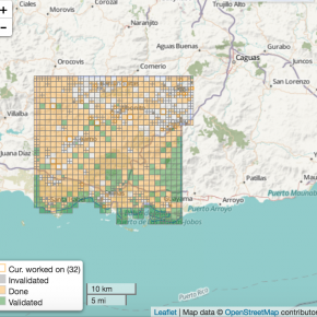
Mapping project #3661: Hurricane Maria | 2017 – Puerto Rico 5 (Cidra to Santa Isabel)
Following the recent hurricane, people around the world are using the OpenStreetMap platform to donate their time to hurricane relief efforts. The Red Cross in Puerto Rico has requested help with their relief efforts, and libraries (Columbia, Rutgers, Univ. of Miami, and more) are responding! (Thanks to @elotroalex for the idea!)
No mapping experience, knowledge of local geography, or software installation is required. Just bring yourself, lunch if you’d like, and a laptop (if you’d prefer to work on your own device rather than a classroom computer).
We’ll have a training session from 12-1 p.m., but will be available until 3 p.m. — drop in at any time to get started.
Learn more about the process through our guide, Humanitarian Mapping with OpenStreetMap.
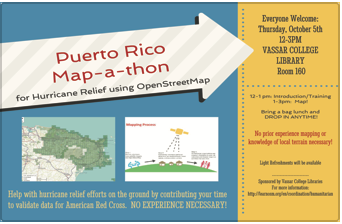 Download a copy of our flyer to distribute on campus.
Thank you for your interest in helping this effort! #prmapathon
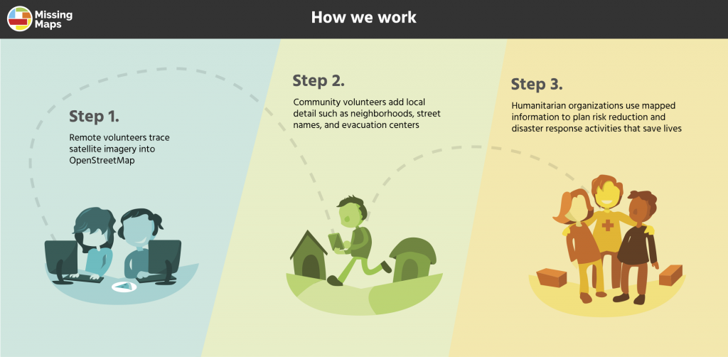
An overview of the mapping process (courtesy Missing Maps / Learn OSM)
Yeah!!!