
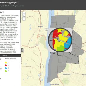
Investigating the Impacts of Redlining in Poughkeepsie, N.Y. by James Gibson on behalf of Hudson River Housing.
GEOG 228 (Web Mapping: Advanced Approaches to Publishing) is a half-unit course offered during the Spring semester, which introduces students to creating web maps, map apps, story maps, and other emerging applications on the ArcGIS Online. These applications offer new opportunities to publicize and share spatial data. Building on skills learned in GEOG 220 (Cartography) and GEOG 224 (GIS), students in GEOG 228 gain further experience with GIS, learn effective ways of communicating spatial data to an online audience, and have the opportunity to explore special topics.
Coordinating with the Office of Community Engaged Learning, students worked with Professor Mary Ann Cunningham and the following community partners to devise a question, locate data, and created an app or story map in ArcGIS Online.
- Scenic Hudson
- Dutchess Outreach
- The Environmental Cooperative at the Vassar Barns
- Family Services
- Hudson River Housing
- Mid-Hudson Heritage Center
- Rebuilding Together
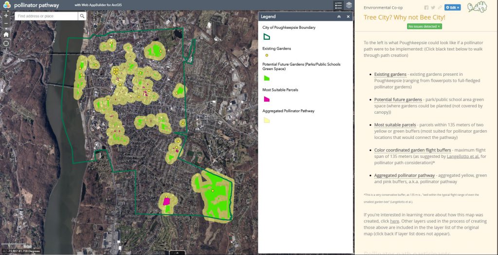
Tree City? Why not Bee City? Storymap created by Thomas Schindelman for the Environmental Co-op at Vassar Barns.
All student projects can be viewed on the course project site.