
The Geospatial Mapping at Vassar blog is proud to showcase alumni work when available. If you wish to share examples of your geospatial mapping and analysis work, please email necurri@vassar.edu.
In her first week at Michael Baker International, an Engineering firm headquartered in Pittsburgh, PA, Emily Webb (Geography-Anthropology, ’16) had already worked on two mapping projects in which she called upon the cartography skills she learned at Vassar. In her role for the company, Emily explained, “I work with ArcMap to research spatial statistics and to put together maps for project reports.” She also explained that she started using a vector graphics program for fine-tuning labels in her maps — something she picked up on-the-job.
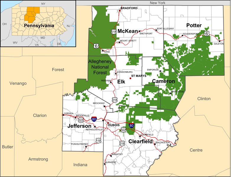
The map above was included in a long range transportation plan for a regional planning organization in north-central Pennsylvania. It illustrates the extent of national forest area across the six counties in the region – one the area’s major tourist attractions – as well as where transportation development is possible for connecting residential areas and municipalities. Note the use of different-sized labels for populated centers, larger cities, and counties — increasing in font size to indicate their relative importance in the basemap. Note also that only major roads are included. These features provide the necessary context for viewers to comprehend the extent of the protected forest area, which is shaded so it stands out from the lighter shades of the basemap. The inset map illustrates the location of the six counties relative to the state and bordering states.
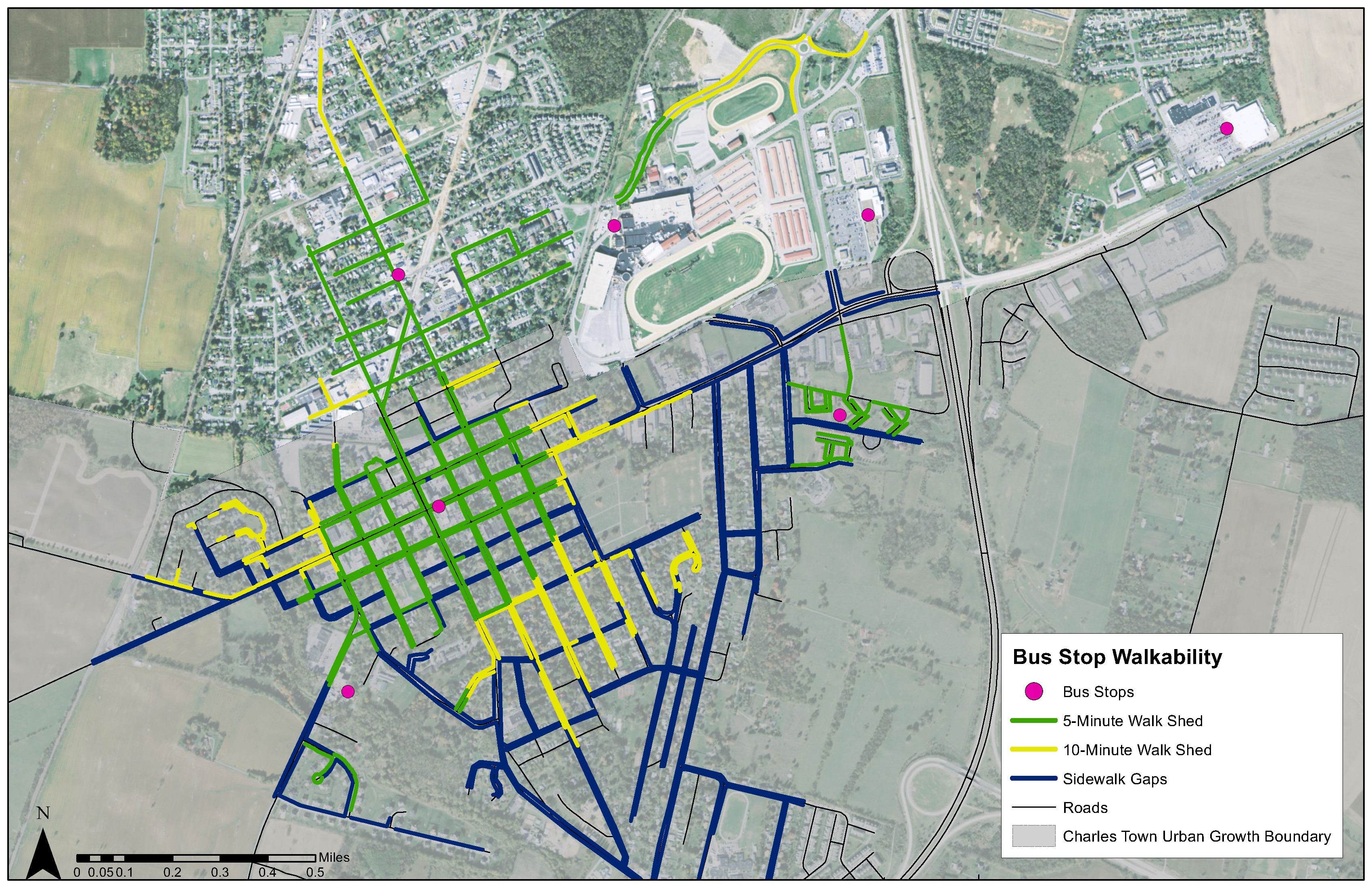
The map below illustrates walking routes and times to bus stops in Charles Town, West Virginia. The routes and distances are determined from social science research about how far and long most people are willing to walk to a destination.
Prior to Michael Baker International, Emily was working for the Pennsylvania State Historic Preservation Office. This was a great fit for Emily given her interest in historic architecture. In this role, she explained, “I used GeoMedia to map lat-long points and digitize features from aerial images—I seem to remember Prof. Cunningham saying after the digitizing lab [in GEOG/ESCI 224: GIS] that we wouldn’t need to do very much of it, so it was funny to have a job that was almost entirely digitizing!”
It is not unusual that Emily was required to use software other than ArcMap. While ArcMap is considered the industry-standard software for geospatial mapping and analysis, students who learn to use it in GEOG/ESCI 220 (Cartography) and/or GEOG/ESCI 221 (GIS) will find that these skills provide a foundation for quickly learning other geospatial mapping tools.
To view the database of historic and archaeological sites and surveys Emily helped curate, visit Pennsylvania’s Cultural Resources Geographic Information System.